Tag Archives: Whakatane

White Pine Bush, Awakeri – Taneatua

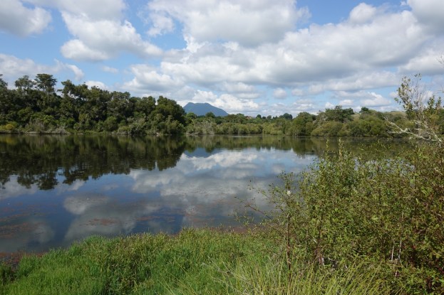
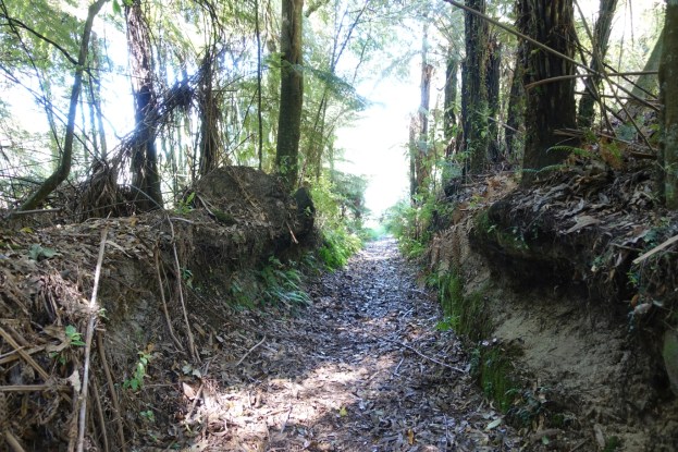
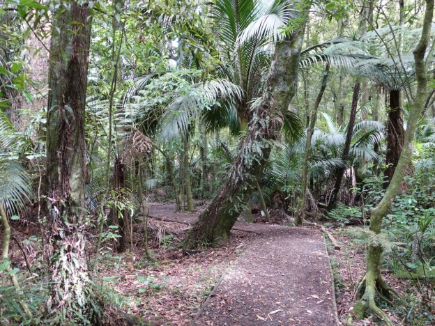
White Pine Bush, adjacent to SH2 between Awakeri and Taneatua, is a 4.5 hectare reserve containing one of the last stands of lowland kahikatea forest in the area. The trees in the forest area are mainly kahikatea, tawa, pukatea, and nikau. A bridge across Waioho Stream and a 250-metre long, level track suitable also for wheelchairs, has been formed as a loop through the forest. Information panels show details of the forest, the birds, and the predators.

A parking area is accessible directly from SH2, between Awakeri and Taneatua, and about 20km south of Whakatane. There are no toilets or other facilities at the site. A gumboot fence forms part of the boundary to the carpark. The walk can easily be done in 10 minutes, including time for reading the information panels. It would be suitable as a short break for travellers driving through SH2. Continue reading

Onepu Park

Onepu Park, also known as Onepu Community Park, Onepu Community Recreation Park, Onepu Mountain Bike Park, and Onepu MTB Park is located by State Highway 30, the main road between Whakatane and Rotorua, almost directly across from Braemar Road. The park is located on land owned by Norske Skog Tasman, and public access is permitted thanks to the generosity of that company. The largest part of the park consists of mountain bike trails, with two of these being dual use for bike riders as well as walkers or runners. A smaller area of the park consists of wetlands, with tracks and boardwalks restricted to pedestrian and wheelchair use.

There are 3 separate entrances to the park, each with its own small parking area. The entry to the bike park is almost directly across SH30 from Braemar Road, where extra parking is available, The entry to the wetlands is about 150 metres along the road, southeast of the bike park entrance. The entry and parking area by Lake Tamurenui is about 900 metres east of the bike park entrance, closer to Whakatane. There are no toilets in or near the park.

Continue reading

Rotoma Bridle Track

Rotoma Bridle Track is a 1km long, easy, almost completely level, walking track running parallel to SH30 between the junction of Manawahe Road and SH30, and SH30 by Lake Rotoma’s Whangaroa Bay. SH30 is the main road between Rotorua and Whakatane. The track is an old bridle track and runs through mature native forest with tall stands of trees, including rimu and tawa, in the Rotoma Scenic Reserve. Information about the track is available on the DoC web site.

There is no parking or any other facilities at or near the track. Parking is easiest on Manawahe Road, entering the north-western end of the track a few metres from the junction with SH30.

Continue reading

Latham’s Hill Track, Awakeri

Latham’s Hill Track, also called Lathams Track or Latham Track, is located by SH30 at Awakeri, about 17 km south of Whakatane, about 1.5 km west of the small township of Awakeri, and about 6 km south-east of Edgecumbe. One end of the track is accessible directly from SH30, where there is room to park 3 or 4 vehicles. It climbs through farmland and forest to Te Tiringa trig station at an elevation of 240 metres above sea level. It then continues along a ridgeline before descending steeply to end at the Awakeri Hot Springs. Walking along SH30 to the parking spot completes the loop in a clockwise direction. There is also parking available by the entrance to Awakeri Hot Springs, off SH30, so the walk can also be started and ended there.

Te Tiringa is the highest point of the Awakeri mountain range, and is of significance to local Maori as the landing place of Ngati Awa chief Tamarau.

Continue reading

Whakaari / White Island

Note – After the tragic events on December 9, 2019 with an eruption occurring while a tour group was on the island, resulting in multiple fatalities and serious injuries, tours to the island have been put on hold indefinitely.

Whakaari / White Island is a privately owned volcanic island in the Bay of Plenty, about 50 km from Whakatane. It is one of New Zealand’s most active volcanoes, and is in a more or less permanent state of activity, with occasional extra activity. The island is about 2 km in diameter, and the highest point, Mt Gisborne, is 321 m high. The acidic crater lake is only a few metres above sea level.

The island has been used for sulphur mining at various times, the last being in the 1930s. Some attempts have been terminated by eruptions, but the last attempt was terminated due to the insufficient accessible sulphur. Some remains of the sulphur mining are still present on the island. Continue reading

Karaponga Reserve and Dam

For an addition and an update to this post, see the later post Karaponga Reserve, Waterfall and Dam.

Karaponga Reserve is located at the end of Symond Rd, off Braemar Rd, between Matata and Kawerau. The reserve has one of the earliest hydro-electric power stations in New Zealand, with a dam on the Karaponga Stream supplying water to the power station.

The power station was first constructed in 1922 to supply power to Whakatane. It was expanded with a second generator in 1928, but closed down in 1939. Reconstruction and recommissioning started in 1996, and the power station is now operational. The light pumice soils in the area quickly filled up the dam, so it contains almost no water reserve, with the power station relying on the flow of the Karaponga Stream alone for its supply. About 800m of pipeline transports the water from the dam to the power station, with a fall from about 120m above sea level at the dam to about 40m at the power station. Continue reading

Nga Tapuwae o Toi – Burma Rd to Whakatane

The Nga Tapuwae o Toi (or Footsteps of Toi) track continues on from Burma Rd to Whakatane at the lower end of Mokorua Gorge. See this post for the part from Ohope to Burma Rd. Refer also to that post for pointers to DoC web site information about the track.

The Whakatane end of the track is not actually marked as the Toi track, but there is a sign on White Horse Drive calling it the Mokorua Walk. There are apparently no markers at the lower gorge end with the track name, or any other information about the track.

There is room for cars to park at the start on Burma Rd, and a car park at the Whakatane end, but no toilet facilities anywhere on or close to the track. Dogs and bicycles are not permitted on this track.

Continue reading

Nga Tapuwae o Toi – Ohope to Burma Rd

Nga Tapuwae o Toi, or The Footsteps of Toi, is a loop track between Whakatane and Ohope. This post covers the track between Ohope and Burma Rd, as well as the Fairbrother Loop Walk. Two previous posts cover the coastal part of the track, also known as the Kohi Point Walkway, and can be found here and here. There is a description of the various parts of Nga Tapuwae o Toi on the Doc web site.

Efforts are being made to maintain a population of kiwi in the forest area, and other threatened native birds have also been released in the reserve, including the NZ robin. To maintain and improve the birdlife requires a constant pest eradication program.

The walk starts at the Ohope end near the junction of Ohope Rd, West End Rd, and Pohutukawa Ave, as you enter Ohope on the main road from Whakatane (Ohope Rd). There is a parking area and toilet facilities a short distance down West End Rd.

Continue reading

Kohi Point Walkway – Ohope – Whakatane

After the walk on the Kohi Point Walkway from Whakatane to Ohope in drizzly weather with low cloud it was necessary to do the same walk on a fine day. But this time it was in the opposite direction, from Ohope to Whakatane. And this time with a detour to Otarawairere village. Since the original post described most of the features, this one will be mainly photos with short descriptions.

Continue reading

Kohi Point Walkway – Whakatane – Ohope


The Kohi Point Walkway connects Whakatane and Ohope, around the headland of Kohi Point, and Otarawairere Bay, passing several pa sites along the way. Total distance just over 7km, and a height difference from sea level to the Kohi Point lookout at 183m above sea level.

Unfortunately there was a gentle drizzle for most of the walk, with low cloud obscuring any views from heights above about 75m asl. But it was a good way to spend a few hours while waiting for a lawnmower to be serviced.

Continue reading