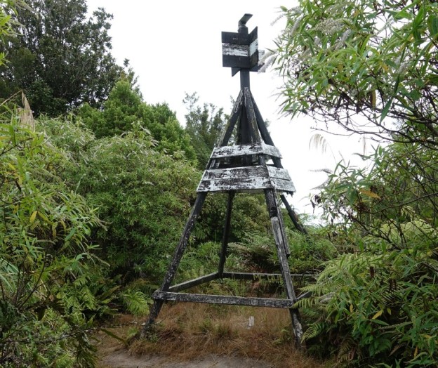
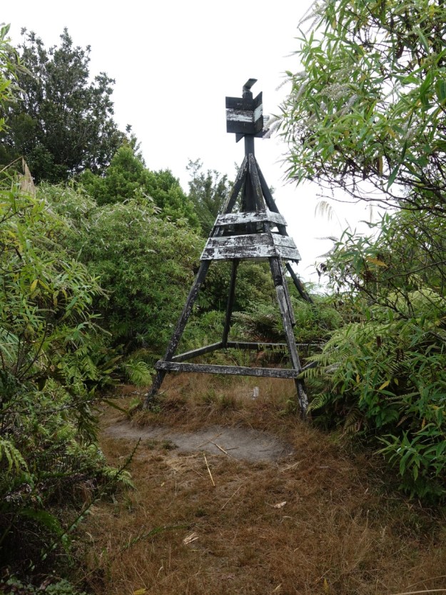
Otawa Scenic Reserve is an area of native forest south-east of Tauranga and south-west of Te Puke. Otawa trig, at an elevation of 565 metres, is the highest point within the reserve. The trig is accessible from several locations, including a track which starts at the end of Manoeka Road, climbing to meet up with the track from Demeter Road and Otanewainuku, with a short steeper section before reaching the trig station. There are no views from the trig station, or from the track which has vegetation cover for the entire length.
The Otawa Scenic Reserve is managed by DoC, and a short description of the reserve and some of the tracks is found on their web site. An alternative and easier route to the trig station is described in the post Otawa Trig from Te Puke Quarry Road on this site.
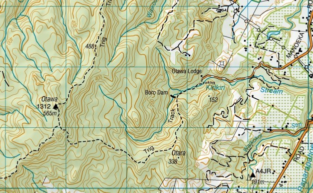
The track from Manoeka Road to Otawa trig is shown as being 4.5 km long, for a time of 2 hours 40 minutes. The track rises from an elevation of about 60 metres at the parking area, to the summit of Otawa at 565 metres. There are a few sections of downhill walking on the ascent, so the total climbed is slightly more than 500 metres. The track passes the location of an old dam, shown on the topographic map as Boro Dam, which once provided the water source for Te Puke.
There is a parking area at the end of the narrow, winding gravel section of Manoeka Road, adjacent to Otawa Lodge. There are no toilets or other facilities at the parking area. The road heading to the left above the vehicle is the driveway entry to Otawa Lodge, with the road on the right being Manoeka Road.

The sign at the start of the track to the trig. Unfortunately vandals apparently can’t resist destroying the signs.

The first part of the track, as far as the Boro Dam location, is a 4WD track with an easy gradient, although there are a few places strewn with rocks.

There are also 3 stream crossings on the track leading to the dam location. This walk was done after a long dry spell with little or no rain for more than a month. Presumably there is normally considerably more water in the streams.

At the dam location the track splits, with the track heading up to the trig branching off to the left, and access to the dam location and the stream on the right.

No dam remains were found except for a small concrete pad, seen on the lower left of the photo. Presumably all other remains have been washed away.

The track leading to the trig passes through native bush, with a mixture of different trees, including some fairly large rimu and tawa, and numerous nikau palms.

Some parts of the track are narrow and steep.

The junction of the tracks from Manoeka Road, Te Puke Quarry Road, and Demeter Road/ Otanewainuku. The track to Manoeka Road is on the right, over the fallen log; the track to the trig and Te Puke Quarry Road on the left, and the one to Demeter Road/Otanewainuku at the bottom.

The track to the trig is quite steep after a short section of fairly level and easy track. The trig is surrounded by vegetation, and unfortunately there are no views from the summit.
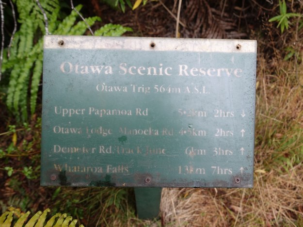
An old sign adjacent to the trig shows distances and times, including to Upper Papamoa Road, the old name for Te Puke Quarry Road. The elevation here is shown as 564 metres, where the topographic map shows it as 565 metres.
The track log shows the route followed. The walking pace was quite slow, taking a total of 2 hours 30 minutes for the uphill half, and 2 hours 15 minutes for the downhill. With 15 minutes for a quick lunch at the summit the total time was 5 hours. The uphill distance registered as 5.1 km on the GPS, with the downhill showing 4.7 km, despite following the same track.
From the car park to the dam site the distance was about 700 metres, with a time of 15 minutes. From the track junction to the trig was about 400 metres, with a time of 15 minutes on the uphill walk.
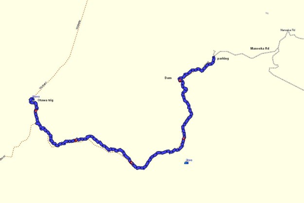
The aerial image, from Google Maps, shows a similar area to the track log.

The topographic map excerpt also shows a similar area.
The elevation profile shows the steepness of the various sections of the track, starting from the parking area at the left and ending at the trig station on the right. The elevation and the distance walked from the car park is shown in the axes.

The track was walked on February 15, 2020.
