Tag Archives: Nga Tapuwae o Toi

Nga Tapuwae o Toi – Burma Rd to Whakatane

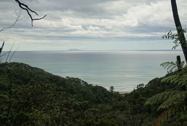
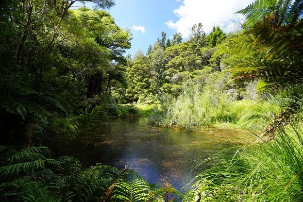
The Nga Tapuwae o Toi (or Footsteps of Toi) track continues on from Burma Rd to Whakatane at the lower end of Mokorua Gorge. See this post for the part from Ohope to Burma Rd. Refer also to that post for pointers to DoC web site information about the track.

The Whakatane end of the track is not actually marked as the Toi track, but there is a sign on White Horse Drive calling it the Mokorua Walk. There are apparently no markers at the lower gorge end with the track name, or any other information about the track.

There is room for cars to park at the start on Burma Rd, and a car park at the Whakatane end, but no toilet facilities anywhere on or close to the track. Dogs and bicycles are not permitted on this track.

Continue reading

Nga Tapuwae o Toi – Ohope to Burma Rd

Nga Tapuwae o Toi, or The Footsteps of Toi, is a loop track between Whakatane and Ohope. This post covers the track between Ohope and Burma Rd, as well as the Fairbrother Loop Walk. Two previous posts cover the coastal part of the track, also known as the Kohi Point Walkway, and can be found here and here. There is a description of the various parts of Nga Tapuwae o Toi on the Doc web site.

Efforts are being made to maintain a population of kiwi in the forest area, and other threatened native birds have also been released in the reserve, including the NZ robin. To maintain and improve the birdlife requires a constant pest eradication program.

The walk starts at the Ohope end near the junction of Ohope Rd, West End Rd, and Pohutukawa Ave, as you enter Ohope on the main road from Whakatane (Ohope Rd). There is a parking area and toilet facilities a short distance down West End Rd.

Continue reading