Tag Archives: Huntly

Lake Hakanoa, Huntly

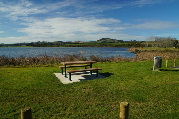
The walkway around Lake Hakanoa, on the eastern side of SH1 and Huntly, is a popular destination destination, and being almost level it is pram and wheelchair friendly. It is accessible from Huntly Domain at the end of Park Avenue, and also from Lakeview Terrace. When the lake level is high parts of the track may be flooded and inaccessible.

Several parking areas as well as toilets are available in the Domain. Information about the walkway is available on the Huntly i-Site web site. The walkway is about 3.8 km long and is split into 13 different zones, each with it’s own separate and different identity. Development is ongoing at some sites, such as the Japanese garden. Continue reading

Lake Puketirini, Huntly

Lake Puketirini at Huntly, on the western side of the Waikato River, is a man-made lake developed from a disused coal mine pit. It is part of Puketirini, a Waikato District Council owned park. Recreational boating is available on the lake, but access to the boat ramp requires a key from the council. A walkway /cycleway follows the lake edge, and several other tracks lead elsewhere through the park.

The park, lakeside track, and one of the boat ramps can be accessed off Rotowaro Road down a short, nameless access road at the eastern end of the lake. Another boat ramp at the western end of the lake is accessible off Weavers Crossing Road. Toilets are available near both boat ramps. Continue reading

Taupiri Mountain Summit

Taupiri Mountain (Taupiri Maunga), at the southern end of the Taupiri Range, is located adjacent to State Highway 1 between Huntly and Ngaruawahia. Taupiri Mountain is sacred to the Waikato people and its lower flanks are used as burial grounds. Amongst others Maori royalty are buried there. A loop track leads to the summit from an access road near Mangawara Stream.

The loop track was reopened in 1995 after work on the track was done by local residents and members of Taupiri Young Farmers Club. The summit of Taupiri Mountain has a trig station at an elevation of 288 metres.

Continue reading

Hakarimata Kauri Loop Walk

The Hakarimata mountain range runs from near Huntly to Ngaruawahia, to the west of the Waikato River. The tracks on the range are accessible from 3 different locations. Parker Rd for the northern end and the Kauri Loop Walk, and the track along the full length of the range. Brownlee Ave for the summit track. And Waingaro Rd for the Rail Trail and the southern section of the walkway.

This walk covers the Kauri Loop track and on to the Southern Lookout. Unfortunately the visibility was rather poor on the day. Continue reading