Tag Archives: Waihi

Waihi to Waikino loop – rail and walk/cycle

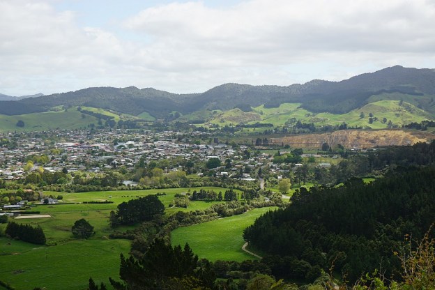
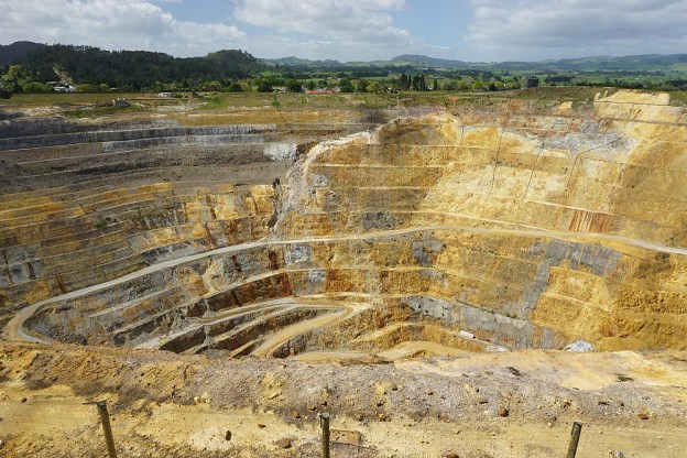
Until the original Martha gold mine in Waihi closed in the early 1950s the ore was transported by rail to Victoria Battery at Waikino in the Karangahake Gorge. This rail line ran alongside the left bank (southern side) of the Ohinemuri River. Part of the Hauraki Rail Trail now follows the route taken by this railway line. On the right bank of Ohinemuri River the New Zealand Rail railway line between Waihi and Paeroa followed alongside State Highway 2. The railway line was closed when the Kaimai Rail Tunnel was completed, but the line between Waihi and Waikino is now used by the Goldfields Historic Railway to carry passengers on the 30-minute journey between the two end points.

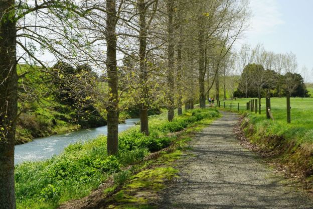
Goldfields Railway will also transport bicycles, so it is possible to take the train in one direction, and then walk or cycle in the other direction. Here the rail journey was taken from Waihi to Waikino and the walk done on the Hauraki Rail Trail cycleway/walkway from Waikino back to Waihi.

Continue reading

Waiorongomai Pylon Peak Track

The Pylon Peak Track in the Waiorongomai Valley was opened up in 2015 and currently does not appear on the DoC web site or signs in the area. The track branches off the Low Level Pack (or Low Level Drive) Track near the end of Waiorongomai Road, crosses the Waiorongomai River, climbs to a ridgeline which it follows before climbing quite steeply to the Pylon Peak and joining up with the Kaimai Ridgeway Track (formerly the North-South Track).

There are still a few remains of the steel power pylons which were used for the power line linking the Horahora hydro-electric power station with the Waihi gold mine and Victoria Battery in the Karangahake Gorge. The power station was the first large power station on the Waikato River and on the North Island, built in 1913 and commissioned in 1914. The power station was sold to the Government in 1920, expanded, supplying power to Paeroa and further afield to Cambridge, Hamilton and Auckland, before being submerged by Lake Karapiro after the Karapiro Dam was completed in 1948.

Continue reading

Golden Cross Mine to Maratoto Road

Gold was discovered at Golden Cross in 1892, and an underground mine operated there from 1895 to 1920, extracting over 2.5 tonnes of gold from about 160,000 tonnes of ore. The area reverted to farmland after the mine was closed, until the new Golden Cross Mine started operating in late 1991. The new mine operated as both an open-cast and an underground mine. The mine closed again in late 1997 – early 1998 after extracting 18 tonnes of gold and 52 tonnes of silver. Water from the mine site is still being treated, and the tailings dam is still present.

The mine site is about 12 km from SH2, and accessible at the northern end of Golden Cross Road, an extension of Waitekauri Road, off SH2 between Karangahake and Waihi. Old Waitekauri Rd and Campbell Rd also connect SH2 to Waitekauri Rd. There is a large parking area at the mine site, but no other facilities. The access gate near the end of Golden Cross Rd is opened at dawn and closed at dusk each day.

Continue reading

County Rd to Mt Karangahake Summit

There are several tracks leading to the summit of Mt Karangahake, a prominent peak visible from SH2 between Paeroa and Waihi. The post Mt Karangahake summit describes the most often used tracks, the Mountain Track and the unmarked and unnamed direct track which branches off the Mountain Track.

This walk was done on the County Rd track, part of which is also known as the Number 7 Level Track, with the Mountain Link Track joining County Rd to the Mountain Track and the summit. This route is somewhat longer than the other two tracks, but most of County Rd has an easy gradient and is a good, well-formed track. The Mountain Link Track is narrower and steeper, but not very long. The return from the summit was via the unmarked direct track and the Mountain Track.

Continue reading

Dickey Flat to Karangahake loop

The Dickey Flat campsite, administered by DoC, is located on the banks of the Waitawheta River in the Karangahake Gorge and the Kaimai Mamaku Forest Park. Located at the end of Dickey Flat Rd, off Kennedy Rd and Waitawheta Rd, it is a popular campsite in the summer, with swimming holes and trout fishing spots easily accessible.

Two walking tracks, which can be walked as a loop walk, connect Dickey Flat and Karangahake. The south-western track passes through regenerating native bush, with the north-eastern track following the Waitawheta River and the historic Waitawheta pipeline. The total loop has a length of just over 10km. It can be walked in either clockwise or anti-clockwise direction, and starting at either Dickey Flat campsite, or by SH2 at Karangahake.

Continue reading

Black Hill Walkway – Waihi

Black Hill in the Ngatikoi Domain (or Black Hill Reserve) is a 225m high hill on the outskirts of Waihi. The surrounding area contains mountain bike tracks as well as walking tracks. There is an easy, formed track around the base of the hill, and a steeper and rougher unformed track to the summit of Black Hill. Primary access to the area is from the end of Clarke Street, but it is also possible to access via walkways from Gilmour Reserve on Gilmour Street, Baker Street (off Clarke Street), and Morgan Park (off SH25/Barry Rd).

The walk can be done together with the Martha Mine Pit Rim Walkway, but in this case it was done starting at Gilmour Reserve and walking anti-clockwise around Black Hill. On the way back to the Gilmour Reserve the Mill Stream walkway to Barry Rd was also included.

Continue reading

Martha Mine Pit Rim Walkway – Waihi

The Martha Gold Mine in Waihi was originally an underground mine which closed in 1952. It was reopened as an open pit mine in 1988, in the centre of Waihi township. The extent of the mine is limited by the residential and commercial areas surrounding it. Currently the pit mine is closed, but underground mining is continuing in Waihi. When the pit mine finally closes the plan is to create a lake for recreational use.

As part of the mining consent the owners of the mine have to provide certain facilities, such as the Pit Rim Walkway which is a 4km long, easy walking track around the perimeter of the mine pit. There are various lookouts and historic remnants from the original mines in the area.

Continue reading

Bluff Stream Kauri Loop

Two of the largest Kauri trees in the Kaimai-Mamaku Forest Park can be seen alongside the Bluff Stream Kauri Loop Track. The track is accessible from the end of Franklin Rd, off Waitawheta Rd, between Waihi and Karangahake. The loop track passes around Maungawhio, a 366m high dome-shaped knoll. The large Kauri trees are on the south-eastern side of Maungawhio.

The most difficult part of the walk are the river crossings, especially during winter or after heavy rainfall. The track crosses the Waitawheta River twice, and Bluff Stream, a tributary to Waitawheta River, once. Both were about knee deep at all 3 crossing locations during this walk.

Continue reading

Karangahake Tunnel Loop to Owharoa Falls

There are several walking and mountain biking tracks in the Karangahake Gorge between Waihi and Paeroa. The Karangahake Gorge Historic Walkway mostly follows the route of the old railway running through the gorge. The railway was closed and the rails removed in the 1970s, but some of the rail bridges still exist, and the rail line between Waikino and Waihi has been reopened for passengers on the Goldfields Railway.

The walkway/cycleway is now open from Waihi to Karangahake Hall as the western end of the gorge. Parking is available by the Karangahake Reserve, accessible directly from SH2, and further west by the Western Portal Bridge, which crosses SH2. The lower level of the bridge is a one-lane road bridge.

Continue reading

Orokawa Bay and Homunga Bay

Sandy beaches at Orokawa Bay and Homunga Bay, north of Waihi Beach and within the Orokawa Scenic Reserve,, are only accessible from land by walking tracks. The shortest access to Orokawa Bay is from the northern end of Waihi Beach, and to Homunga Bay it is from the end of Ngatitangata Rd, east of Waihi. The track from Ngatitangata Rd is steep and passes through private farmland. There is also a coastal walking track between Orokawa Bay and Homunga Bay, which was reopened in early 2014 after being closed for some time due to slips.

This post covers the coastal walk from Waihi Beach to Orokawa Bay and Homunga Bay, returning the same way.

Continue reading