Tag Archives: Morrinsville

Morrinsville River Walk

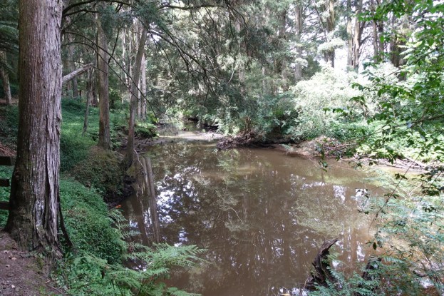
The Morrinsville River Walk is a walking track about 1.5 km long between the entry to the Morrinsville Recreation Ground on Avenue Road South and Studholme Street, running through a forested valley parallel to the Waitakaruru Stream for most of the way. Starting from Avenue Road South, where parking is available, the first 300 metres or so of the track is on open ground alongside Avenue Road South. It then enters the forested area, with two alternative tracks. One lower down alongside and close to the stream, and one higher up alongside the recreation reserve boundary. This walk was done in both directions, using the lower track on the way to Studholme Street and the upper track on the return. Continue reading

Pukemokemoke Reserve

Pukemokemoke (hill alone) with a height of 166m above sea level is a peak within the 40-hectare Pukemokemoke Reserve, which is now surrounded by farmland and a quarry, but which was once surrounded by forested wetland. The reserve, previously part of Orini Downs Station, was gifted to the nation by David Johnstone who was one of the major shareholders in the Station. The reserve, which has a conservation covenant placed on it, is now under the control of the David Johnstone Pukemokemoke Bush Trust. It was set up specifically to protect the bush and provide a recreational and educational asset for the community.

The reserveĀ is located about 15 km north-west of Morrinsville and about 18 km east of Huntly. It is accessible down a right-of-way at 1382 Tauhei Rd. There is a carpark at the end of the right-of-way, by the entrance to the reserve.

Continue reading

Te Tapui Loop Track – Maungakawa

The Te Tapui Scenic Reserve includes the two peaks of Te Tapui at 492m and Maungakawa at 495m. The Te Tapui Loop Track to the summit of Maungakawa starts at Piakonui Rd, west of Matamata, northeast of Cambridge and southeast of Morrinsville. It can be walked in a clockwise or anticlockwise direction, although the DoC description recommends the anticlockwise direction.

However, the times and distances on the DoC site do not entirely agree with my experience. The distance is close to 6.5km measured by GPS instead of 4km, and the time of 3 hours should be ample even with a long break at the summit.

Continue reading