Tag Archives: Ohope

Nukuhou Saltmarsh, Ohope – Ohiwa

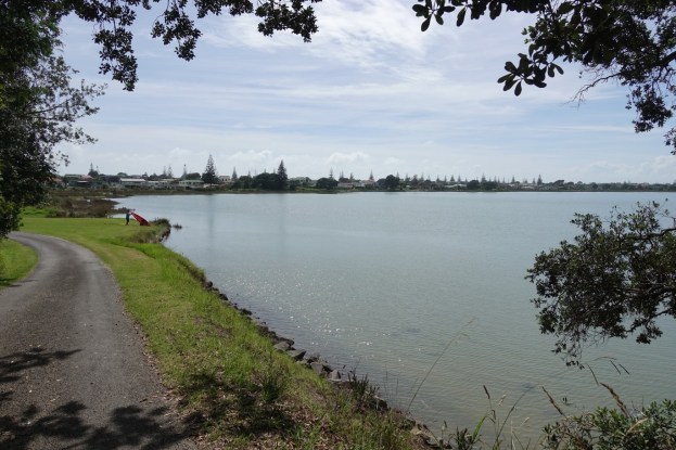
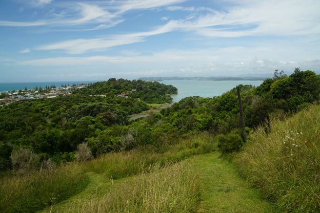
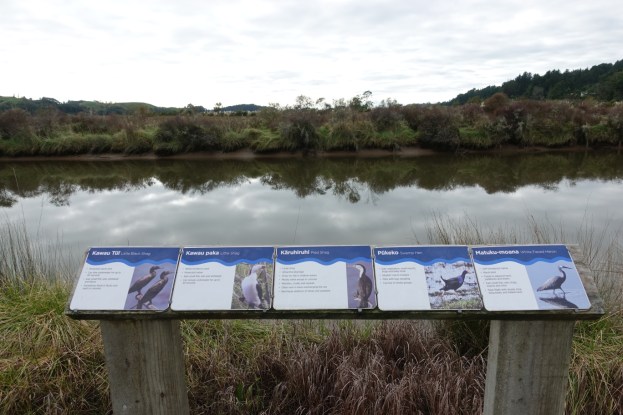
Nukuhou saltmarsh is a low-lying area located where the Nukuhou River enters Ohiwa Harbour. The tidal flow from Ohiwa Harbour brings in the salty water, going some way upstream at high tide, and forming a marshy area with a special flora and fauna. The saltmarsh is located adjacent to Wainui Road, between Ohope and Ohiwa, at Cheddar Valley. A lookout and a walkway alongside the road has been formed and is maintained by the Nukuhou Saltmarsh Care Group. Extensive predator control, mainly of rats and stoats, is also performed by the group, to allow other species to survive or flourish.

There is a small parking area by the junction of Wainui Road and Burke Road, providing easy access to the boardwalk leading to the lookout. The track directly off Wainui Road to the lookout is wheelchair-friendly, but the remainder of the walking tracks are not. There are no toilets near the track.

Continue reading

Ohope Harbourside Trail

The Ohope Harbourside Trail is currently a work in progress, as an initiative by the Whakatane Rotary Club. There is a walking and cycling trail between Waterways Drive at its western end, and Port Ohope Wharf at its eastern end. On the way it passes through grassed reserves, with gravel surfaces on the recently formed parts of the trail. As well as being accessible at both ends, it is also accessible from various locations along Harbour Road and Ohiwa Parade.

The trail is about 3.5 kms long, with no steps and only gentle slopes. Parking is available at both ends as well as some of the access points, with some grass areas also being used for parking. There are toilets at Otao South Reserve, close to Harbour Road near Phillip Street.

Continue reading

Tauwhare Pa, Ohope

The walk to Tauwhare Pa is a very short and easy walk on the outskirts of Ohope, accessible from Wainui Road. There are 3 pa on the site, but all were damaged in the 1950s when work was done on a potential residential subdivision. There are views from the pa sites to the eastern part of Ohope, and across Ohiwa Harbour to Ohiwa and Wainui.

There is a parking area off Wainui Rd with information panels and a carved waharoa, or entrance, to the site.

Continue reading

Onekawa Te Mawhai Regional Park, Ohiwa

Onekawa Te Mawhai Regional Park is a 26.8 hectare reserve on the headland east of the entrance to Ohiwa Harbour, between Ohiwa and Bryans Beach. The park was opened in 2010, and is managed collaboratively by Bay of Plenty Regional Council, Opotiki District Council, and Upokorehe. There are two pa sites in the park, Onekawa and Te Mawhai, at an elevation of about 100 metres, and walkways across the ridgeline between Ohiwa Harbour and Bryans Beach. Information about the park can be found on the Bay of Plenty Regional Council web site.

The walks can be done as a loop using the beach for one leg, or it can be done as in this case as a figure-8 crossing over the ridgeline twice, and accessing the beaches at either end. Parking is available off Ohiwa Harbour Road, and off Bryans Road, with toilets by the beach at Ohiwa. This walk was done starting and ending at Bryans Road.

Continue reading

Nga Tapuwae o Toi – Burma Rd to Whakatane

The Nga Tapuwae o Toi (or Footsteps of Toi) track continues on from Burma Rd to Whakatane at the lower end of Mokorua Gorge. See this post for the part from Ohope to Burma Rd. Refer also to that post for pointers to DoC web site information about the track.

The Whakatane end of the track is not actually marked as the Toi track, but there is a sign on White Horse Drive calling it the Mokorua Walk. There are apparently no markers at the lower gorge end with the track name, or any other information about the track.

There is room for cars to park at the start on Burma Rd, and a car park at the Whakatane end, but no toilet facilities anywhere on or close to the track. Dogs and bicycles are not permitted on this track.

Continue reading

Nga Tapuwae o Toi – Ohope to Burma Rd

Nga Tapuwae o Toi, or The Footsteps of Toi, is a loop track between Whakatane and Ohope. This post covers the track between Ohope and Burma Rd, as well as the Fairbrother Loop Walk. Two previous posts cover the coastal part of the track, also known as the Kohi Point Walkway, and can be found here and here. There is a description of the various parts of Nga Tapuwae o Toi on the Doc web site.

Efforts are being made to maintain a population of kiwi in the forest area, and other threatened native birds have also been released in the reserve, including the NZ robin. To maintain and improve the birdlife requires a constant pest eradication program.

The walk starts at the Ohope end near the junction of Ohope Rd, West End Rd, and Pohutukawa Ave, as you enter Ohope on the main road from Whakatane (Ohope Rd). There is a parking area and toilet facilities a short distance down West End Rd.

Continue reading

Kohi Point Walkway – Ohope – Whakatane

After the walk on the Kohi Point Walkway from Whakatane to Ohope in drizzly weather with low cloud it was necessary to do the same walk on a fine day. But this time it was in the opposite direction, from Ohope to Whakatane. And this time with a detour to Otarawairere village. Since the original post described most of the features, this one will be mainly photos with short descriptions.

Continue reading

Kohi Point Walkway – Whakatane – Ohope


The Kohi Point Walkway connects Whakatane and Ohope, around the headland of Kohi Point, and Otarawairere Bay, passing several pa sites along the way. Total distance just over 7km, and a height difference from sea level to the Kohi Point lookout at 183m above sea level.

Unfortunately there was a gentle drizzle for most of the walk, with low cloud obscuring any views from heights above about 75m asl. But it was a good way to spend a few hours while waiting for a lawnmower to be serviced.

Continue reading