The Nga Tapuwae o Toi (or Footsteps of Toi) track continues on from Burma Rd to Whakatane at the lower end of Mokorua Gorge. See this post for the part from Ohope to Burma Rd. Refer also to that post for pointers to DoC web site information about the track.
The Whakatane end of the track is not actually marked as the Toi track, but there is a sign on White Horse Drive calling it the Mokorua Walk. There are apparently no markers at the lower gorge end with the track name, or any other information about the track.
There is room for cars to park at the start on Burma Rd, and a car park at the Whakatane end, but no toilet facilities anywhere on or close to the track. Dogs and bicycles are not permitted on this track.
Today’s walk starts at the Whakatane end and continues to Burma Rd, before turning around and returning to the carpark at the Whakatane end, off Gorge Rd. A total distance of about 12km, and taking 4 hours for the return journey at walking pace, with time for a few breaks along the way. The track is popular with joggers and runners. There is a total height difference of about 175m between lowest and highest point, but the track goes up and down several times, so the total climb for both directions is about 550m. Most of this is in the direction from Gorge Rd to Burma Rd.
Most of the track is under tree cover, but near the Burma Rd end there is a short distance of open land next to a pine plantation.
The efforts to eradicate predators so kiwi and other native bird populations can be established seem to be having an effect. There was birdsong clearly audible for most of the walk, even drowning out the loud screeching of cicadas. Mainly tui, but also kereru wood pigeons and smaller birds. No fantails were seen, though.
Gorge Rd with the grassed area by the carpark, just off Valley Rd.

The car park area at the lower end of Gorge Rd, Whakatane.

The start of the track, off Gorge Rd, a few metres from the carpark. There are no signs indicating the name of the track, the distances, or the estimated times for walking the track.
From Gorge Rd the track climbs about 150m over the first kilometre or so of track. Much of this climb is on well-built stairs, with just enough room beside the steps for those who would rather avoid them. Looking down several flights of stairs near the start of the track.

There are only a few view shafts along the track. This one looking north-west, not far from the start of the track.

There’s a bench seat by the view shaft. The track is well formed all the way, but the steeper parts could be slippery when wet.

Another view shaft, this time looking across to some Hillcrest houses.
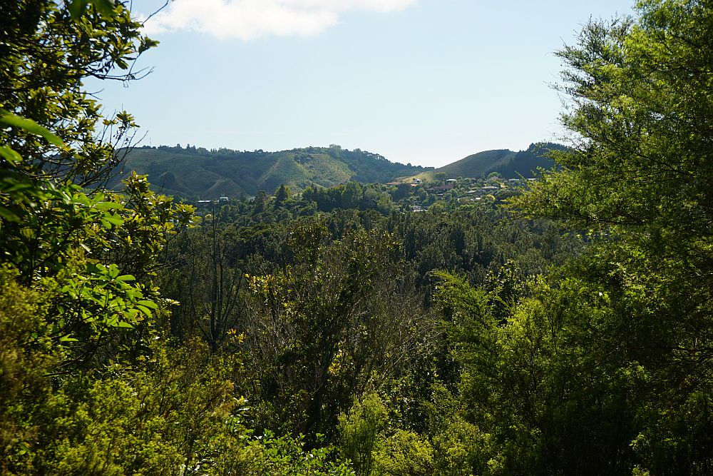
This one has views to the west.

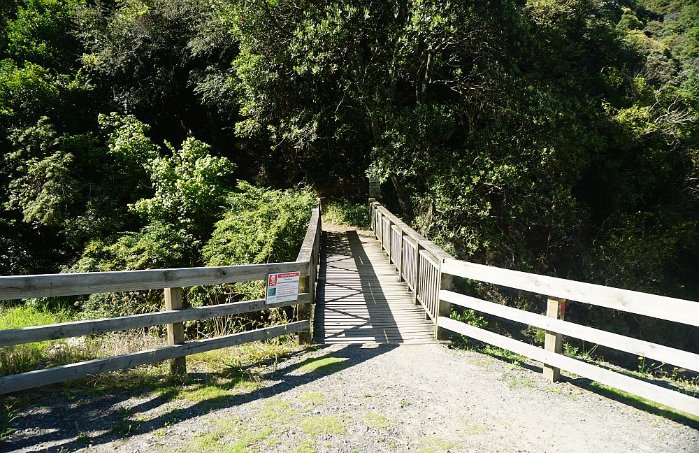
Bridges cross over the streams along the track, so there are no streams needing to be crossed at water level.

A short side track leads to White Horse Drive, off Gorge Rd. It seems this was originally one end of Nga Tapuwae o Toi Track. The track to the bottom of Gorge Rd is on the right, the one to Burma Rd on the left.

Looking from the Burma Rd track, the track to the right goes to White Horse Drive, and the one to the left goes to the lower end of Gorge Rd.

The start of the track on White Horse Drive. Here the track to the lower end of Gorge Rd is called Mokorua Walk, and there is no indication that this is also part of Nga Tapuwae o Toi.

This bench seat was a suitable spot for a short break, although there was no view from here.

Part of the track is across grassland, passing alongside a pine plantation, and crossing a couple of private roads or driveways.

In one location there were cattle grazing on the track. The gravel road continuing up the hill is a private driveway. The track turns to the left just past the stacks of firewood, where the cattle are grazing.

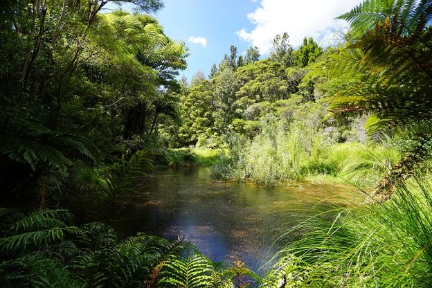
There is a small lake and a small area of wetland alongside the track.

A boardwalk through some of the more mature forest area, near the wetlands. For some reason running is not permitted on the boardwalk.


The track crosses over a private driveway, shortly before reaching Burma Rd.

The start/end of the track at Burma Rd. This section of the track is well marked.

The GPS track log shows the route taken, starting at Gorge Rd at the left-hand side, taking a detour to White Horse drive about mid-way, and ending at Burma Rd on the right. Total time in each direction was about 2 hours, and total distance about 6km each way.

The track was walked on February 28, 2015.
