
The Puketoromiro Pa site in the Kopurererua Valley has been cleared of the eucalyptus trees growing on it, and a set of steps crossing over the summit have been constructed, with a connecting walkway/cycleway from the existing path through the valley. Currently the site has not officially been opened, and there are currently no information panels by the site. But the gates have been opened and people are accessing the site.
The only information about the new walk across the pa site is apparently an article on the SunLive web site, which has some historical information and expects the completion with interpretation panels and replanted native vegetation in August 2020. This post will be updated after the track has been officially opened and information panels erected.
Access to the pa site track is only possible from the walkway/cycleway which runs through Kopurererua Valley between The Lakes at Tauriko and Tauranga central. The entry gate to the track is about 1.9 km from SH36 at The Lakes, near the roundabout at the intersection of SH29, SH29A and SH36. For more information about the valley and the walkways/cycleways see the post Kopurererua Valley, Tauranga on this site.
The entry to the short track leading to the Puketoromiro Pa site hill, from the walkway/cycleway through Kopurererua Valley. The stepped track crosses over the hill at picture centre.
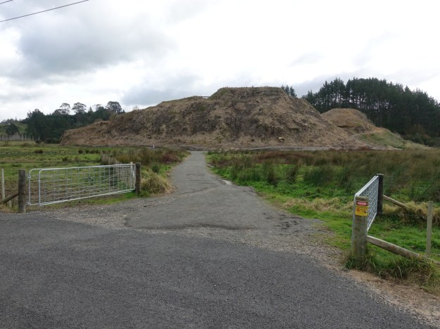
The short track to the left leads to the southern end of the stepped track across the pa site, the track to the right ascends to the northern end.

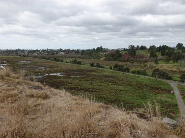
Looking back from the branch in the track towards the walkway/cycleway through Kopurererua Valley, about 120 metres away.

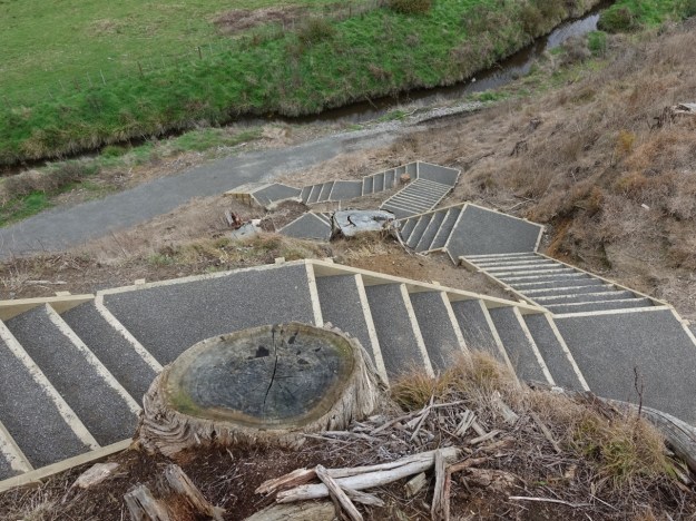
The northern end of the stepped walk across the pa site.

Looking from the northern end of the steps along SH29 to Whakapaewaka bridge across the toll road.

Looking towards the south along SH29 from the stepped path on the way from the northern end to the summit of the pa site.

Looking from the summit towards the south, with The Lakes and Tauriko in the distance. The walkway/cycleway through Kopurererua Valley can be clearly seen, with power poles alongside the path.

Looking along the walkway/cycleway towards Tauranga.
Looking back along the stepped path towards the summit of the pa site.

Looking down the stepped path towards the southern end of the path. Many of the steps are very narrow.
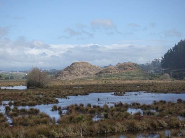
A sign with a pictorial representation of the Puketoromiro Pa site is located by the walkway/cycleway near Whakapaewaka Bridge. The pa site can be seen just to the right of the sign. The pa site was occupied by Ngai Tamarawaho until the land was confiscated by the government i 1864.

Zooming in for a closer look at the pa site hill from the sign by Whakapaewaka bridge.
The GPS tracklog shows the tracks from the existing walkway/cycleway to base of the pa site hill, and the stepped pathway across the hill. The total distance for the circuit from the entry gate and back is about 615 metres. The stepped path across the summit is about 190 metres long. The path from the entry gate to the base of the hill is about 120 metres long. The walkway/cycleway continues past the northern entry of the stepped track for a short distance towards SH29, as shown on the tracklog. The GPS indicates that the base of the hill is at about 5 metres above sea level with the summit at about 35 metres.

The aerial image from Google Maps shows the same area, but with the pa site still covered with eucalyptus trees.

The tracks were walked and cycled on August 9, 2020.
