Tag Archives: Lake Okataina

Eastern Okataina Walkway

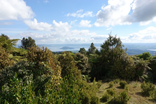
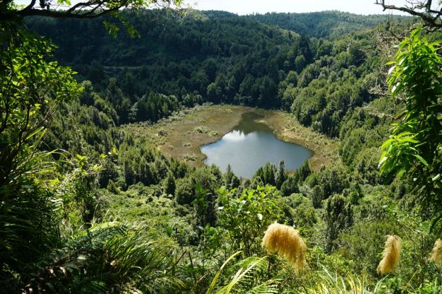
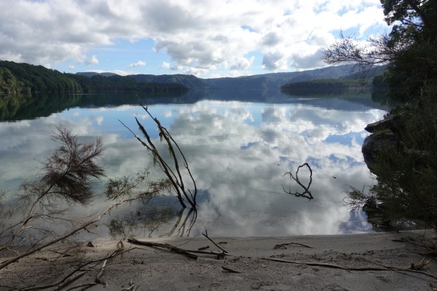
Eastern Okataina Walkway is a walkway through the Okataina Scenic Reserve connecting Lake Okataina at Tauranganui Bay at the southern end of Lake Okataina Road and Lake Tarawera at Humphries Bay (also known as Humphrey’s Bay). The walkway is about 10 km long, following the eastern shores of Lake Okataina for a large part of the way, crossing over a ridgeline with a climb of about 100 metres, and with a low saddle between Lake Okataina at Otangimoana Bay and Lake Tarawera at Humphries Bay. The walkway is mostly easy walking with no steps, but with a few short, steeper sections and some fallen trees requiring rougher, short detours.

There is access to the lake in several locations, and not far from the start at Tauranganui Bay there is a side track to Te Koutu Pa site. There is a short description of the walkway on the DoC web site. and in a brochure Walking and Hiking in Rotorua available for download from the Rotorua Lakes Council web site. There is a link to the brochure under the Brochures heading.

Continue reading

Lake Okataina to Mt Whakapoungakau

Mount Whakapoungakau is the highest point, at 758 metres, of the Whakapoungakau Range in the Lake Okataina Scenic Reserve. The summit is accessible as a side track off the Western Okataina Walkway, which is now a combined walkway and mountain bike trail. The walkway is accessible from the Lake Okataina and Lake Rotoiti end in several locations, and from the Lake Okareka end on Millar Road. This walk was done from Lake Okataina to the summit of Mt Whakapoungakau and return to Lake Okataina.

A short description of the Western Okataina Walkway can be found on the DoC web site, and all the tracks in the Lake Okataina region are described in a brochure available as a pdf file on the Rotorua Lakes Council web site. There is a link under the heading Brochures called Walking and hiking in Rotorua. Several of the tracks in the Okataina Scenic Reserve are also described in previous posts on this site, such as Lake Okataina Scenic Reserve – Ngahopua, Anaha and Kepa Tracks and Rongomai, Te Auheke and Tarawhai Tracks at Lake Okataina and Okataina Western Walkway – SH30 to Patotara.

Continue reading

Rongomai, Te Auheke and Tarawhai Tracks at Lake Okataina

Rongomai Track, Te Auheke (also known as Cascades) Track and Tarawhai Track are all located in the Lake Okataina Scenic Reserve, near the Okataina Outdoor Education Centre, off Lake Okataina Road. Rongomai Track is also part of the Western Okataina Walkway, and is a continuation of the track described in the post Okataina Western Walkway; SH30 to Patotara. Te Auheke Track (or Cascades Track) is a loop track, starting and ending near the education centre. Te Auheke means ‘tumbling water’. Tarawhai Track can also be walked as a loop track, with one end on the access road to the education centre, and the other joining with the Western Okataina Walkway just south of the education centre.

The walk was done starting from the access road to the education centre, along Lake Okataina Rd to Patotara and the northern end of Rongomai Track, Rongomai Track from Patotara to the education centre, Te Auheke Track in a clockwise direction, and Tarawhai Track in an anti-clockwise direction back to the education centre access road. All the tracks are a fairly easy walk, with very few steps and only short ascents and descents. Total walking distance was 7.1 km, for a total time of 2 hours. Continue reading

Lake Okataina Scenic Reserve – Ngahopua, Anaha and Kepa Tracks

There are several short walking tracks in the Lake Okataina Scenic Reserve. Three of these, all to the east of Lake Okataina Road, are accessible directly from Lake Okataina Road. The northernmost, Ngahopua Track, is a loop track with views to two crater lakes, Lake Rotongata and Lake Rotoatua, that traverses a few gentle slopes and climbs. The other two tracks, Anaha and Kepa, are on almost flat terrain and are mostly old vehicle tracks.

Lake Okataina Road branches off State Highway 30 at Ruato by Lake Rotoiti, north-east of Rotorua. Information about the walks can be found on the DoC web site, and a brochure with walks and hikes in the Rotorua area, including a map of tracks in the Lake Okataina area, can be downloaded from the DoC site. Parking is available where the tracks connect to Lake Okataina Road, or by the road leading to the Outdoor Education Centre. Toilets are available at Lake Okataina.

Continue reading