Tag Archives: Kawerau

Hansen, Stoneham, Ruruanga Walks, Kawerau

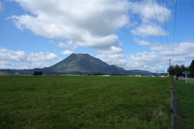
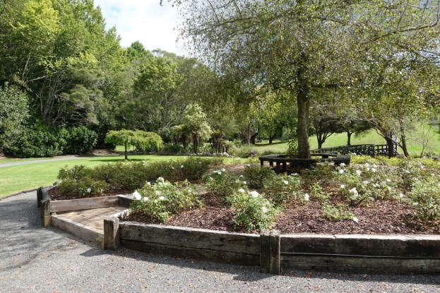
Stoneham Walk, Hansen Walk, Prideaux Park, and Keith McKenzie Park are a contiguous set of recreation reserves in Kawerau with the Ruruanga Stream running through them between Valley Road, past Bell Street, to Tamarangi Drive (SH34). The Stoneham Walk reserve is quite separate from Stoneham Park, which is a reserve on Peter Lippa Drive. A walkway follows the Ruruanga Stream through the reserves, with bridges for the stream crossings.

There are several options for starting and ending a walk through the reserves, but the one recommended on the Kawerau Information web site starts on Plunket Street, across the road from the information centre. A brochure with a map can be downloaded from that web page. Parking is available off Plunket Street by the information centre, and toilets are available at the centre.

Continue reading

Onepu Park

Onepu Park, also known as Onepu Community Park, Onepu Community Recreation Park, Onepu Mountain Bike Park, and Onepu MTB Park is located by State Highway 30, the main road between Whakatane and Rotorua, almost directly across from Braemar Road. The park is located on land owned by Norske Skog Tasman, and public access is permitted thanks to the generosity of that company. The largest part of the park consists of mountain bike trails, with two of these being dual use for bike riders as well as walkers or runners. A smaller area of the park consists of wetlands, with tracks and boardwalks restricted to pedestrian and wheelchair use.

There are 3 separate entrances to the park, each with its own small parking area. The entry to the bike park is almost directly across SH30 from Braemar Road, where extra parking is available, The entry to the wetlands is about 150 metres along the road, southeast of the bike park entrance. The entry and parking area by Lake Tamurenui is about 900 metres east of the bike park entrance, closer to Whakatane. There are no toilets in or near the park.

Continue reading

Tarawera River Walks, Kawerau

There are walking tracks, also used as cycle tracks, on both sides of the Tarawera River where it runs through Kawerau, with bridges over the river on SH34 at the northern end, by the golf course (pedestrian only) at the southern end, and on Waterhouse Street about halfway between the two ends. The tracks on the western (town) side of the river mainly pass through reserves and parks with no fixed marked tracks, with the ones on the eastern side the tracks rougher, also unmarked, and partly overgrown. Total track length is about 4.7km on the west side and 5.3km on the east.

There is parking available by Waterhouse Street and Firmin Field, on Porritt Drive, and in Tarawera Park. Toilets can be found at the entry off Waterhouse Street to Firmin Field. Continue reading

Tarawera Falls to Tarawera Outlet

Tarawera Falls is an impressive group of waterfalls in Lake Tarawera Scenic Reserve, with the river emerging from various locations on a sheer rock face. After heavy rain there may also be water cascading down from the top of the rock face. A walking track about 5 km long links the Tarawera Outlet where water from the eastern end of Lake Tarawera at Tapahoro Bay forms the beginnings of the Tarawera River, to the Tarawera Falls lookout, and further on to a carpark on Waterfall Road. The only road access to the outlet and to the falls is from Kawerau, along gravel forest roads which require a permit to enter.

There is a DoC campground by the outlet, at the end of Tarawera Road, with parking and toilet facilities. There is also a parking area at the end of Waterfall Road, near the base of the Tarawera Falls, with a basic DoC toilet. Information about the waterfall, campgrounds, and walking tracks can be found on the DoC web site. This also includes information about obtaining a permit to access the locations by road from Kawerau.

Continue reading

Karaponga Reserve, Waterfall and Dam

A bridge has recently been built across the Karaponga Stream, and a track to a waterfall below the Karaponga Dam has been opened up. This post is an addition and update to the Karaponga Reserve and Dam post, over three years after that walk.

Karaponga Reserve is located at the end of Symond Road, off Braemar Road, between SH30 and SH2, near Kawerau and Matata. There is a small parking area by the reserve, and a locked gate to climb across to access the reserve. There are no toilet or other facilities nearby.

Continue reading

Putauaki (Mt Edgecumbe), Kawerau King of the Mountain race

Putauaki (Mt Edgecumbe) towers 820 metres above the township of Kawerau at the southern end of the Rangitaiki Plains. The town was built in the early 1950s for to support the new pulp and paper mill being constructed at the same time. The Kawerau King of the Mountain race, a race from the town to near the summit of Putauaki and back, has been held every year since 1955. Information about the race, with entry forms and race results can be found on the Kawerau King of the Mountain web site.

Access to the mountain is now controlled, and a permit is required to climb the mountain. Due to safety concerns it is necessary to climb in groups of at least 4 people, and the office issuing the permits is only open on weekdays. See the Kawerau Online web site for more details of the mountain and the procedure required to obtain a permit.

Note: According to an article in The Beacon on July 15, 2022, permits to climb the mountain will not be issued until a safety review has been done and any required work completed.

Continue reading