Tag Archives: Kaimai Range

Waiorongomai to Dog Kennel Flat, Mt Te Aroha

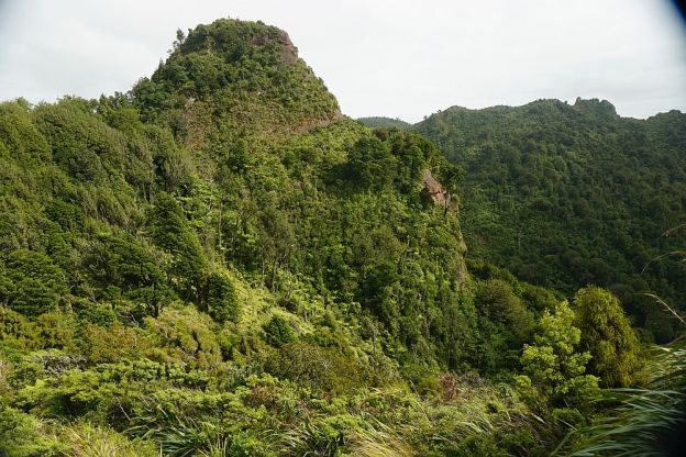
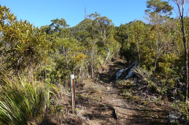
A link track connects the upper end of the Piako County Tramway track to Dog Kennel Flat junction adjacent to Mountain Road on Mount Te Aroha. From Dog Kennel Flat the road continues up to the summit of Mount Te Aroha and down to Tui Road by the Tui mines. From the junction it is also possible to take the steeper climb up the eastern side of Mt Te Aroha, or the Tui Saddle Track and Tui Track down to the Tui mines. Various other walking tracks also branch off nearby.

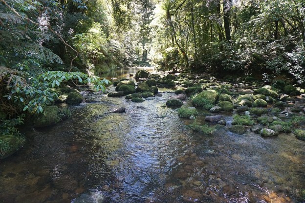
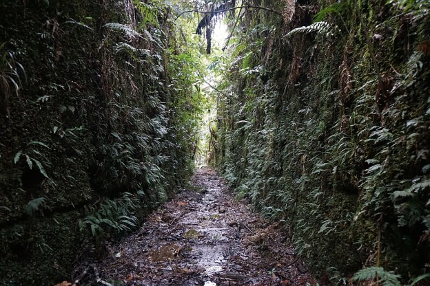
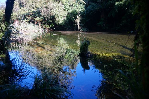
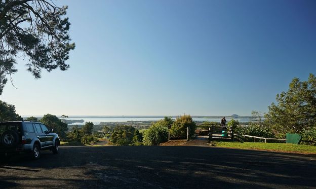
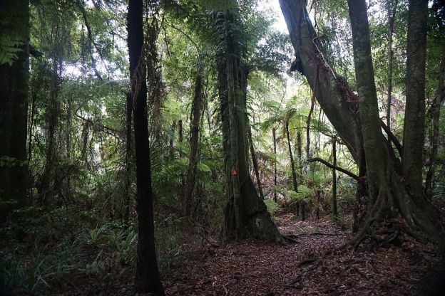
The link track, known as Te Aroha Link Track or Waiorongomai Link Track, also connects to Waipapa Track and Mangakino Pack Track. It is about 1.9 km long, and steep in places, mainly near the tramway end of the track. This walk was done starting and ending at Waiorongomai, turning around at Dog Kennel Flat. Continue reading

Rapurapu Kauri Track

The Rapurapu Kauri Track in the Kaimai Mamaku Forest Park is accessible directly from SH29 the Waikato side of the Kaimai Range. The track leads to 3 large Kauri trees near the southern limit of their natural occurrence. On the way the track crosses the Rapurapu Stream 8 times. The stream crossings may not be possible after heavy rain.

The first 750 m or so of the track goes through recently cleared pine forest, before entering the regenerating native bush area in the Forest Park. The same track is used in both directions, for a total of about 6 kms, but with only about 30 m in height difference between highest and lowest points.
Continue reading

Leyland O’Brien Tramway Track

The Leyland O’Brien Tramway (or Tramline) Track follows the route taken by a tramway last used many years ago to extract logs from the forest in the Kaimai Range. The northern end of the track is at the end of Whakamarama Road, and the southern end is at a junction with the North / South Track which runs along the length of the northern end of the Kaimai Mamaku Forest Park. On the way it joins up with the Ngamuwahine Track.

The DoC web site has information about the track. However, the expected time of 2 hours in each direction does not agree with the DoC panels along the track, and the actual walking time was about 2 hours 15 minutes without any breaks. One of the few tracks where the actual walking time was longer than the DoC posted time. Continue reading

Mount Eliza Mine and Summit

The Mt Eliza Mine Track connects the North South Track in the Kaimai Range to Thompsons Track, south-west of Katikati. Thompsons Track consists of two major parts: a road from SH2 south of Katikati to the boundary of the Kaimai Mamaku Forest Park, an impassable 4WD track crossing over the Kaimai Range to Thompsons Road, off Te Aroha – Gordon Rd on the western side of the Kaimai Range. The Mt Eliza Mine Track passes the old, abandoned Mt Eliza gold mine, with part of the track consisting of the pack track used to transport supplies to the mine. Continue reading

North South Track – SH29 to North Henderson Tramline

The North South Track in the Kaimai Range is a total of 82 km long, with the northern end in the Karangahake Gorge, and the southern end near the summit of SH29 across the Kaimai Range. Accessible directly from SH29 is also a short Kaimai Summit Loop Track, about 700m long, with two stream crossings and numerous steps.

This post covers the Summit Loop Track and the North South Track between SH29 and the North Henderson Tramline Track. For more details of the Henderson Tramline Tracks see the Henderson Tramline Loop post. This also includes the North South Track between the two tramline track branches.

There is a parking area by the northern side of SH29 near the summit. The Summit Loop track forms the first part of the North South track, with both starting at the parking area. Directly across the road from the parking area is a small spring where people often stop and collect drinking water. Continue reading

Aongatete Walking Tracks

There are several walking tracks starting near Aongatete Lodge, on a short access road near the end of Wright Rd south of Katikati. The tracks are in the Kaimai Mamaku Forest Park. One of the tracks provides access to the North South Track, which runs along almost the whole length of the Kaimai Range. The other tracks provide walks through regenerating native forest, and access to a popular swimming hole in a local stream.

There is a parking area on the lodge access road, and a toilet nearby. Access to the lodge itself, and the road from the parking area to the lodge, is for users of the lodge only, and should not be used for access to the tracks. Continue reading

Mt Te Aroha summit

Mount Te Aroha in the Kaimai Range at the edge of the Hauraki Plains towers above the town of Te Aroha. At a height of 953m it is the highest mountain in the area, with the summit being used for a transmission and communication tower. Previously the mountain has seen mining (gold, silver, tin, etc) and forestry activity.

There is a road leading from Tui Rd to the summit, but this is not open to the public. Several walking and tramping tracks also lead to the summit, with the shortest and most direct being the track from the Te Aroha Domain. This is the most frequently used track. With the Domain only being about 35 metres above sea level, there is a more or less direct climb of about 920 metres to reach the summit. Continue reading

Lindemann Loop Track and Wairoa Shelter

The Lindemann Loop Track, accessible from the end of Lindemann Rd just north of Katikati, consists of two parts: the southern Ridge Track, and the northern Pack Track. These rejoin at a junction a short distance from the Wairoa Shelter. The track continues on past the Wairoa Shelter, joining up with the Upper Waitawheta Track and Cashmores Clearing Track. The Wairoa Stream Track also joins up with the Lindemann Loop Pack Track.

The Pack Track is more than twice as long as the Ridge Track, but has a gentle gradient except where crossing streams where the original track has been washed away. The Ridge Track has some steep sections as it follows a ridgeline from Lindemann Rd to the junction with the Pack Track.

Continue reading

Tuahu Kauri and Sentinel Rock

Although it is now considered too dangerous to climb Sentinel Rock, a large rocky outcrop in the Kaimai Mamaku Forest Park, it is still possible to view the rock and surrounding valley from a nearby lookout. There are also views to the Pacific Ocean and parts of the Bay of Plenty.

The track to the lookout starts at the end of Hot Springs Rd, just south of Katikati. The Tuahu Track and Tuahu Kauri Loop Track lead past two of the largest kauri trees in the Western Bay of Plenty, to the start of the Sentinel Rock Track.

Continue reading

Ngamuwahine and Ngamuwahine Loop Tracks

The Ngamuwahine and Ngamuwahine Loop Tracks on the northern slopes of the Kaimai Ranges in the Kaimai Mamaku Forest Park are accessible from the end of Ngamuwahine Road, off SH29, about 25km south of Tauranga. Ngamuwahine Road, about 3km long, is gravel, winding, and only about 1 vehicle width most of the way. So meeting with other traffic usually means one of them reverses to the nearest suitable passing spot.

Tauranga Intermediate School administers an outdoor education facility, the Ngamuwahine Outdoor Education Lodge, at the end of Ngamuwahine Road. There is a large grass parking area and picnic area at the end of the road, by the entrance to the lodge and the start of the track. But there are no toilet facilities on or near the track.

The tracks pass through regenerating native forest, with a number of pine trees in between. All the tracks are under tree cover, so will stay moist for most of the year.

Continue reading