Onepu Park, also known as Onepu Community Park, Onepu Community Recreation Park, Onepu Mountain Bike Park, and Onepu MTB Park is located by State Highway 30, the main road between Whakatane and Rotorua, almost directly across from Braemar Road. The park is located on land owned by Norske Skog Tasman, and public access is permitted thanks to the generosity of that company. The largest part of the park consists of mountain bike trails, with two of these being dual use for bike riders as well as walkers or runners. A smaller area of the park consists of wetlands, with tracks and boardwalks restricted to pedestrian and wheelchair use.
There are 3 separate entrances to the park, each with its own small parking area. The entry to the bike park is almost directly across SH30 from Braemar Road, where extra parking is available, The entry to the wetlands is about 150 metres along the road, southeast of the bike park entrance. The entry and parking area by Lake Tamurenui is about 900 metres east of the bike park entrance, closer to Whakatane. There are no toilets in or near the park.
The mountain bike trails appear to be well used. There are trails from grade 2 (easy) to grade 5 (expert) with new trails having been added since the park was opened. Information about the park can be found on the Kawerau Information web site and on the Whakatane Information web site. The latter also has a short introductory video by one of the driving forces behind the establishment of the park, Bill Clark. New trails have been added since the maps on those pages were made.
Establishment and maintenance of the park has all been done by volunteers. At some junctions there are signs showing the track and trail names and directions, but in several places these have been damaged or destroyed, so bringing along a diagram or map could be practical for new visitors.
The map posted on the base shelter shows the tracks and trails with names, grades, and some of them with distances. The Ridge and Oh Mai-Mai are shared use for cyclists and walkers, the wetland walks are for walkers only, and the remainder are for mountain bike riders, although there are also some link tracks that are dual use. Since this was a walk only The Ridge, Oh Mai-Mai and the wetland tracks were used. Starting at the bike entry point The Ridge was walked in an anti-clockwise direction, and Oh Mai-Mai in a clockwise direction, so that any cyclists on that trail would be oncoming.
Total length of The Ridge is about 3 km and Oh Mai-Mai 2.2 km. A walking track with numerous steps not shown on the map is about 200m long, and passes through a planted kauri grove. Between Oh Mai-Mai and the wetlands there is a well formed walking track with some steps and a few steeper sections. Otherwise the walking tracks and joint use tracks all have an easy gradient.
Note that north is more or less the bottom of the map and south is at the top with east on the left and west on the right.

The mountain bike entrance to Onepu Community Park, with a small parking area, on SH30 almost directly opposite Braemar Road.

Not far from the entry gate a short unmarked track branches off to the left, down to the wetlands tracks.

The base is a small shelter with the map shown above on the side, and a picnic table in front. It is about 180 metres from the entry gate, and only a few metres from The Ridge track. The wetlands is also accessible by a partly overgrown track just behind the pampas grass growing behind the shelter.

With signs damaged or missing it’s not always obvious which tracks go in the different directions. The Ridge track comes from the entry gate off to the right, and does a sharp right turn into the trees at centre left. The track continuing at lower left is the short track to the base.

The Ridge track follows the boundary of neighbouring farmland before entering the forest area again and heading uphill.

The Ridge track continues straight ahead with The Sandpit off to the left. From here the track rises from about 25 metres above sea level to the highest point about 65 metres asl.

The pine forest is bordered on the south and south-western side by a few rows of eucalyptus trees. The Ridge track heads off to the left, with one of the MTB trails on the right.
Putauaki/Mt Edgecumbe is visible from a few places along The Ridge track. Parts of Lake Rotoroa can also be seen through the trees in another location.

The end of The Ridge track, with Oh Mai Mai heading off to the right and straight ahead. Pai’s Pathway trail exits from the left. To walk Oh Mai-Mai in a clockwise direction (opposite the MTB direction) or to go directly to the wetlands continue straight ahead.

About 200 metres on from this junction the track to the wetlands branches off to the left (behind the pine tree) and Oh Mai-Mai continues on the far bottom right.
Several of the new plantings alongside Oh Mai-Mai have signs with their common names and latin names.

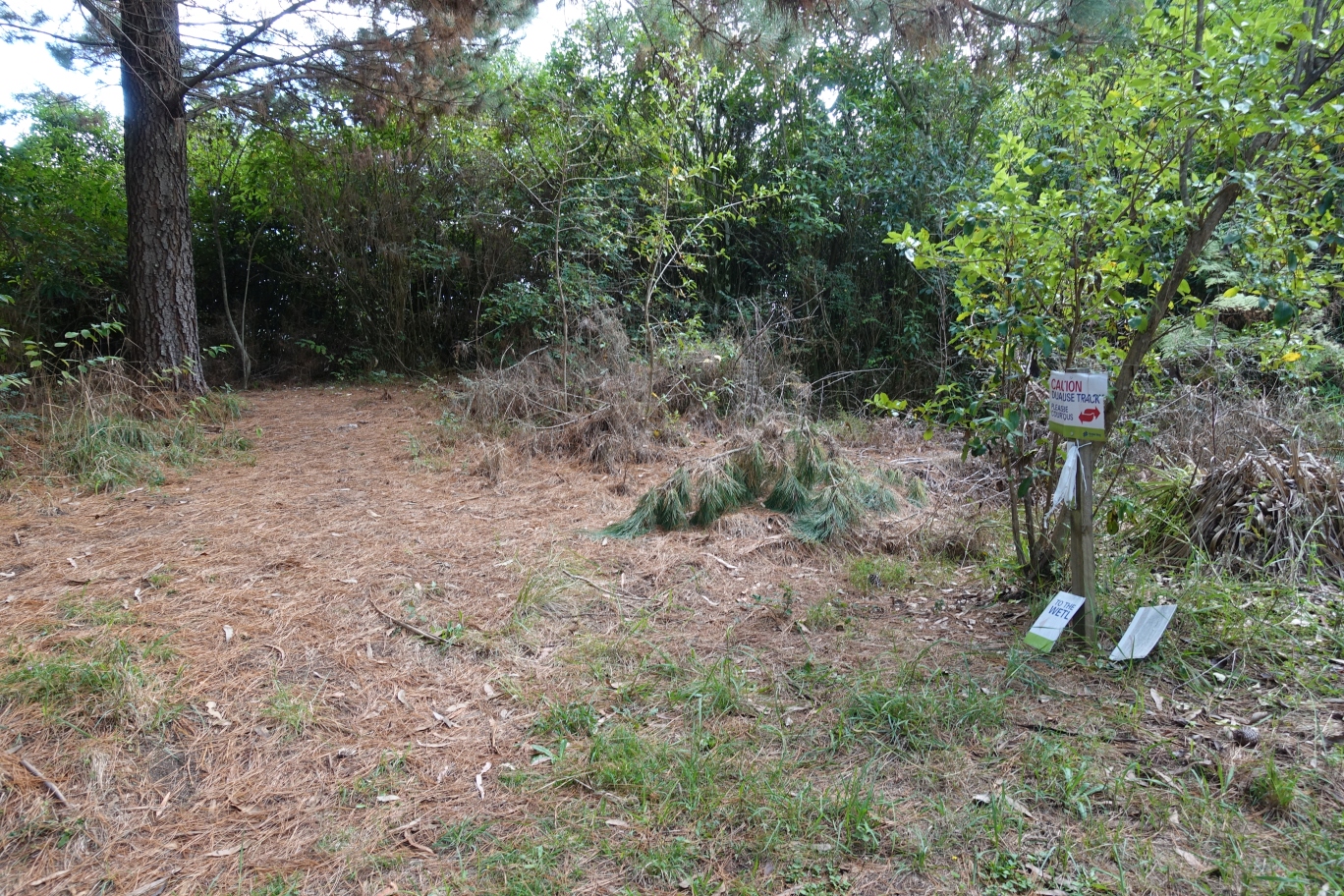
After running close to SH30 and then going gently uphill Oh Mai-Mai takes a sharp turn to the left and an unmarked track continues straight ahead. The track straight ahead leads through the kauri grove and down some steps to the Lake Tamurenui entry point to the park.

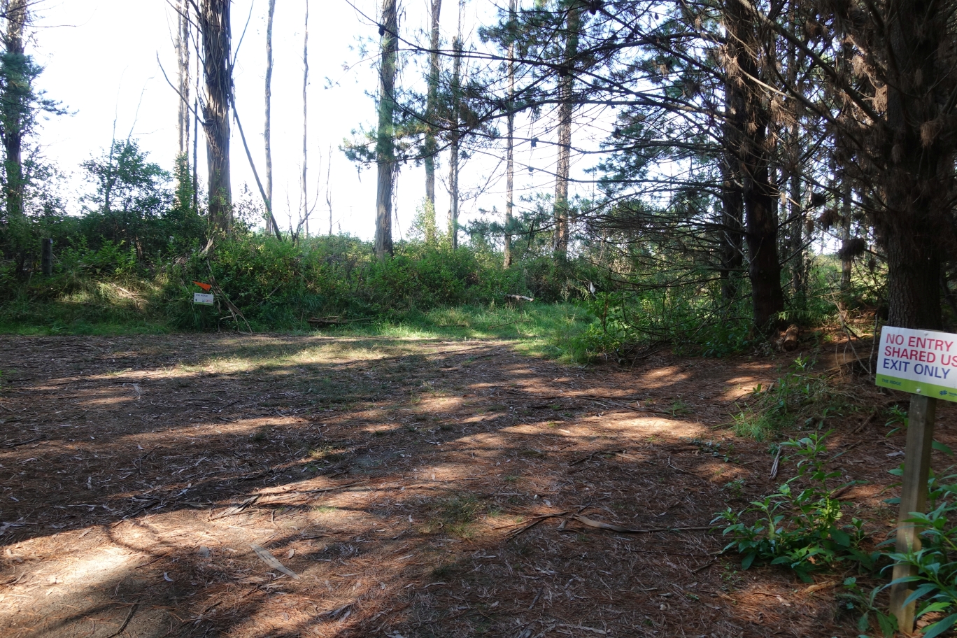
The parking area and entry to the park by Lake Tamurenui. Oh Mai-Mai is behind the sign on the right, and follows the vehicle track before joining it at the edge of the lake. The track up to the kauri grove is behind the post to the left of the sign.

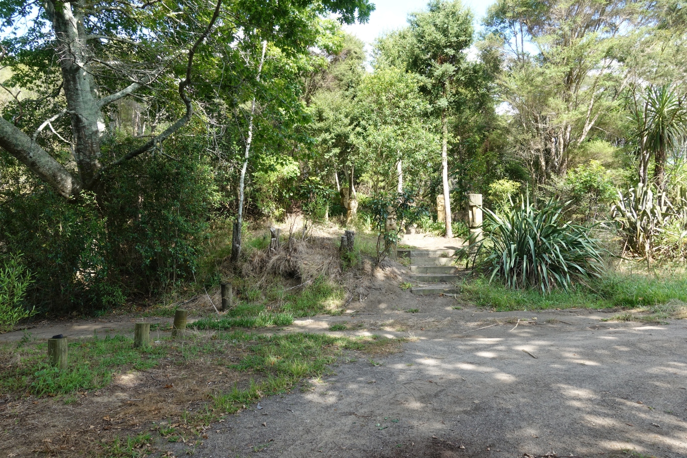
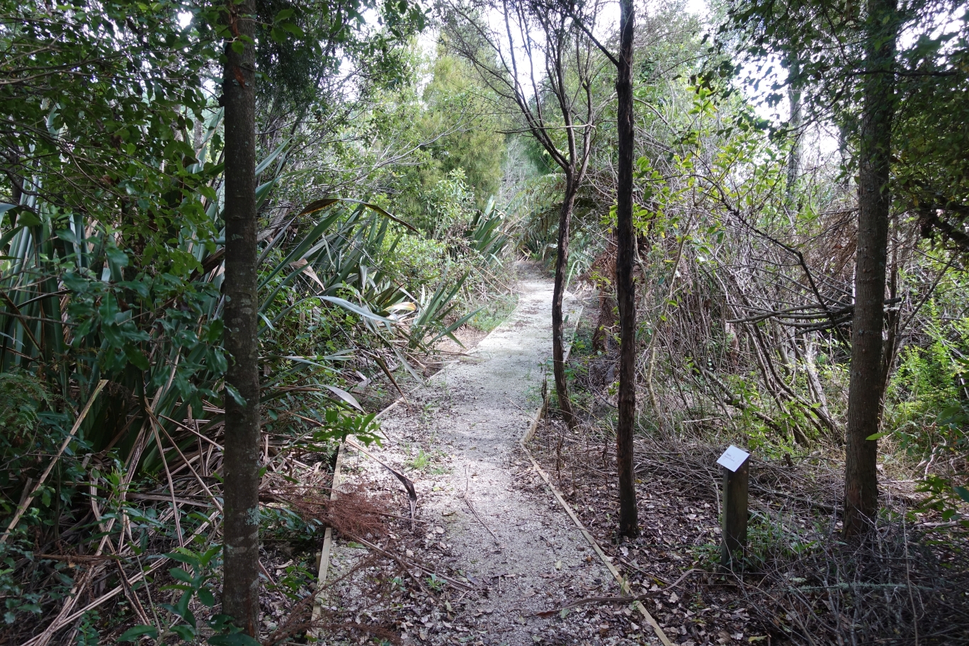
The steps and tracks, with wood carvings alongside, leading to the kauri grove from the entry by Lake Tamurenui.
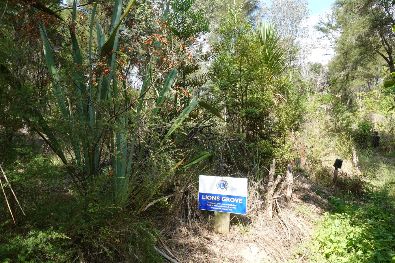
The Lions kauri grove, established with the help of Edgecumbe Lions Club in 2014.
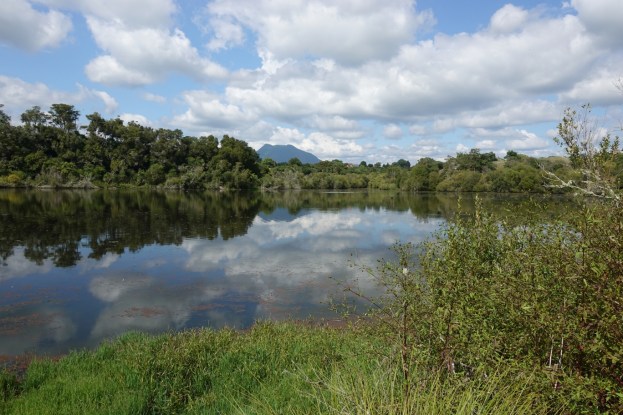
A maimai partly hidden by dead vegetation at the edge of Lake Tamurenui.

View across the lake from a maimai (duck shooting hide) further along the lakeside track.

From the lake edge Oh Mai-Mai heads uphill through recently planted pine forest towards The Ridge. The track is narrower here, and mountain bikers have the right of way, so some care is required while walking.

From the track leading from Oh Mai-Mai down to the wetlands there is a view of SH30 at the intersection with Braemar Road, and the parking area and entrance to the bike park.

Near the bottom of the hill the track branches off to both the left and the right. The branch to the right gos to a Rongoa Rakau area, planted with medicinal or edible plants. Sensible sampling of these plants is allowed.

Some of the many tracks through the wetlands are well formed, and could be traversed by wheelchair, but others are rougher and overgrown and would not be suitable for wheelchair use.
The small parking area and entry point to Onepu Wetlands on SH30. This is the only park entry which would be suitable for wheelchairs.

The GPS tracklog is shown both as an overview of the whole park, and then as a more detailed view of the wetlands, Oh Mai-Mai track, kauri grove, and park entrances.
Some of the tracks were walked twice in order to cover all the walking tracks, such as the one past the kauri grove, and the Oh Mai-Mai track part from The Ridge and down to the Wetlands track exit. Total distance walked was about 7.4 km, in a total time of 2 hours 10 minutes. Of this about 3 km is The Ridge track and 2.2 km for Oh Mai-Mail once through.


The aerial image, from Google Maps, shows the same area as the first GPS tracklog map.

The tracks were walked on March 17, 2019.
Update:
According to an article on SunLive, dated January 19, 2022, the Wetland and Mountain Bike Park has become more accessible to people with powered wheelchairs, prams/pushchairs and the elderly.
“The Onepū Wetland and Mountain Bike Park is now accessible to powered wheelchair users and the mobility challenged thanks to Bay of Plenty Regional Council funding.
The Edgecumbe Lions Club made a successful application to the Regional Council’s Environmental Enhancement Fund in June and have since constructed several paths to improve public access to the Onepū Wetlands and some sections of the Mountain Bike Park.”
