
The 757 m high summit of Mt Ngongotaha, near Rotorua, is accessible by the Jubilee Track, a walking track starting by Paradise Valley Rd, or by walking or biking up the last 5 km or so of Mountain Rd from the carpark and locked gate. The lower part of Jubilee Track is shared with the Nature Loop, an easy 3.7 km long loop with numerous information signs and panels. Unfortunately there are no longer any views of the surrounding area from the summit, due to the regrowth of native bush in the Mt Ngongotaha Reserve.
There is a small car parking area on Paradise Valley Rd next to the Violet Bonnington Reserve and the start of the Nature Loop and Jubilee Track. Basic DoC toilets are located about 100 m from the carpark, next to the track.
Information is available on the DoC web site for the Jubilee Track and the Nature Loop Track. Mountain bikes are not permitted on the tracks, and this is clearly signposted at both ends of the track. Despite this, there were tyre tracks from mountain bikes on the Jubilee Track. According to the DoC site “the original Jubilee Track was cut on Jubilee Day, January 29 1890, marking 50 years since Captain Hobson arrived at Waitangi” [for the signing of the Treaty of Waitangi on February 6].
This blog entry covers the Nature Loop walked in a clockwise direction, followed by the Jubilee Track walked in both directions, and including the short walk on Mountain Rd from the top of Jubilee Track to the summit of Mt Ngongotaha. The trig station near the carpark has an elevation of 369 metres, and the summit of Mt Ngongotaha is 757 metres, so there’s a total climb of about 400 metres from the carpark to the summit. There are only a few steps on the Jubilee Track, which has a few sections that are steeper and rougher than the gentle and well formed Nature Loop.
The parking area on Paradise Valley Rd, with the start of the track heading into the vegetation on the right.

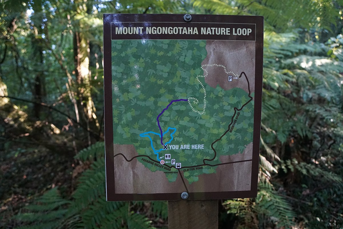
The information sign by the carpark, with a map of the area and the location of the tracks.

Looking down Paradise Valley Rd towards Rotorua and the steam from the Whakarewarewa thermal area, with the carpark on the left.
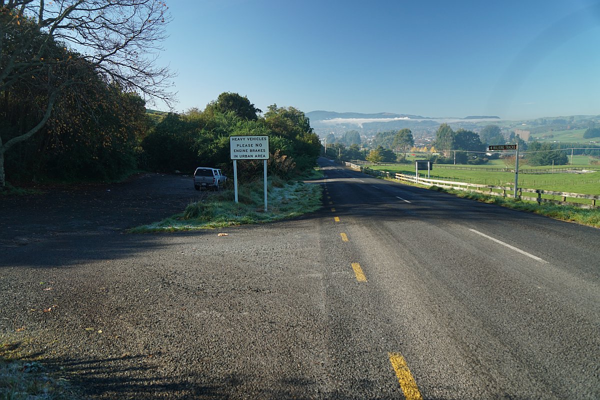
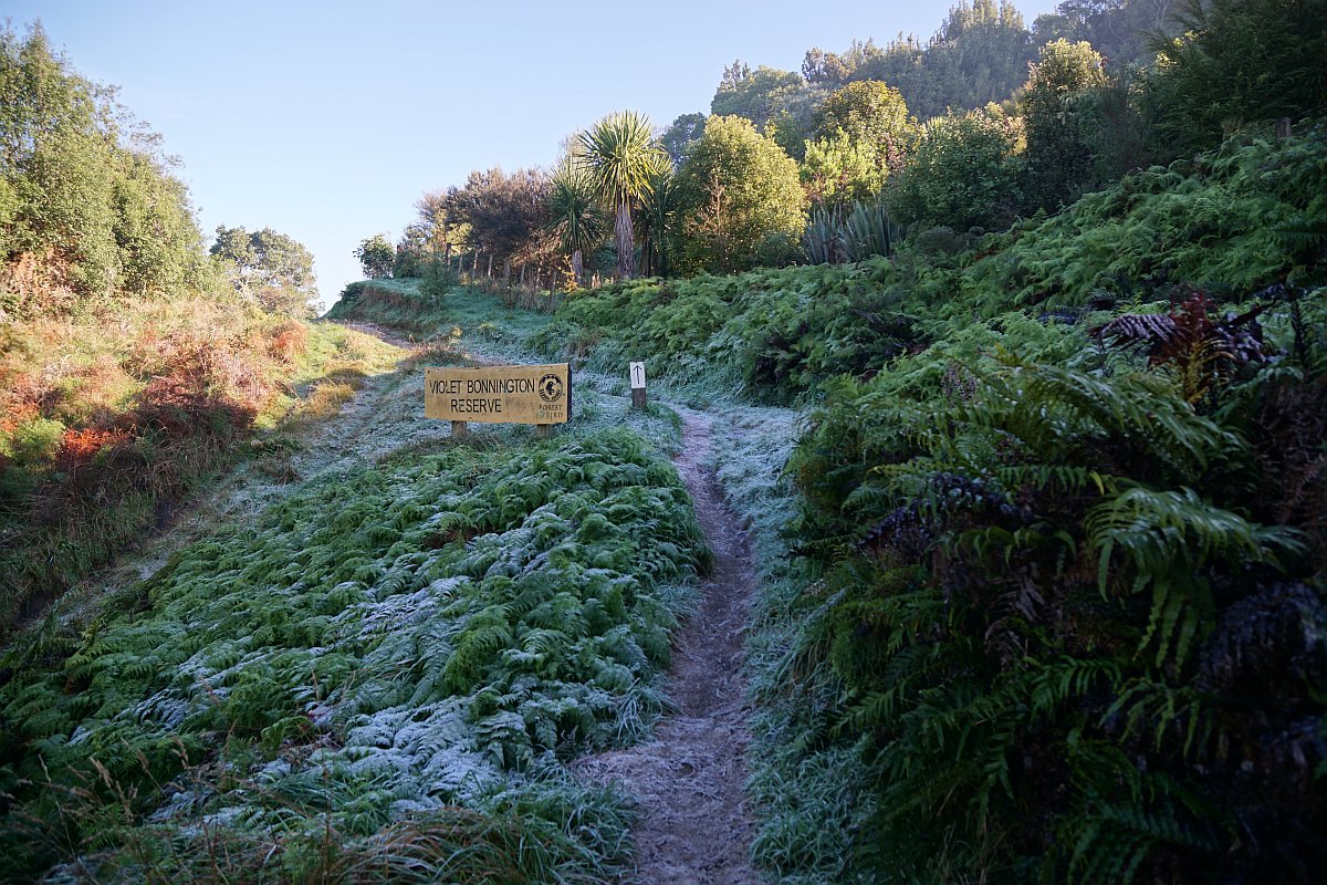
The start of the track by the carpark, on a cold and crisp morning.
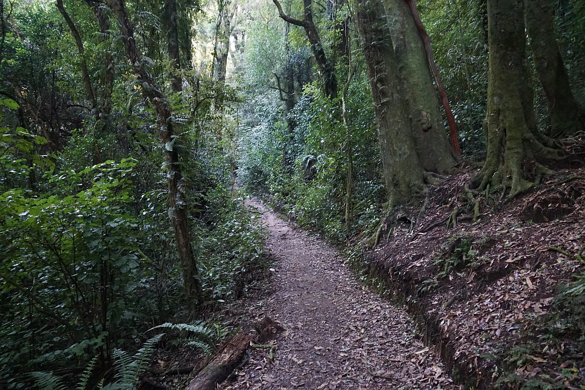
The start of the track through the forest area. The Jubilee Track branches off from the Nature Loop after about a 20 minute walk.

Information panels are found along the Nature Loop, with a large 3-panel sign at the start of the track.

The Nature Loop is almost entirely a well formed and benched track, with easy gradients.
One of the largest surviving Northern Rata trees has a viewing platform by the Nature Loop track.

The information panel on the viewing platform.
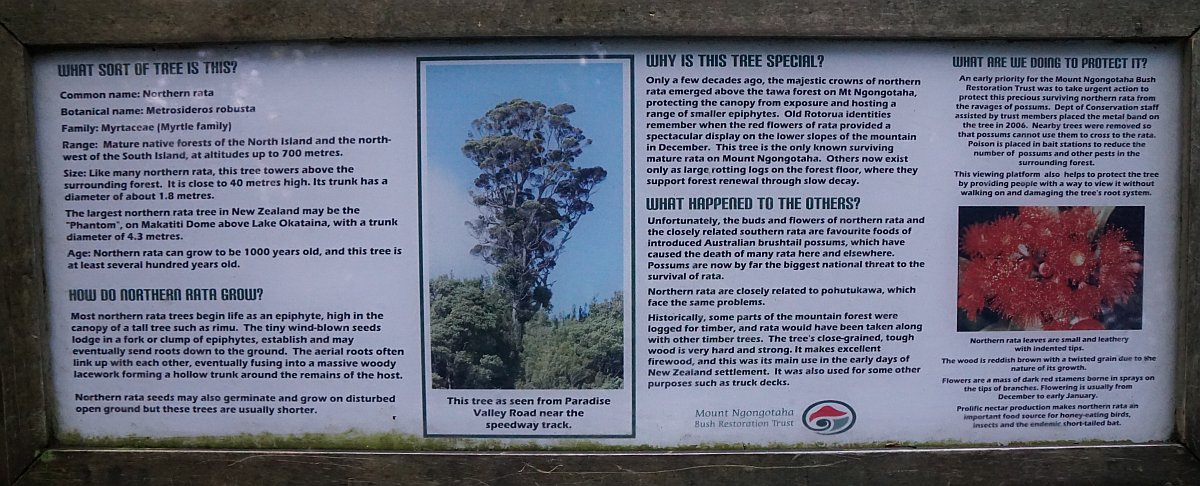
The top of the tree is protected from possum damage by a wide steel band around the trunk near the first visible large branch. The band is not clearly visible, as it has been painted to match the trunk.

Looking down from the track across the Ngongotaha Raceway.

At the fork the Nature Loop continues to the left for walking in a clockwise direction, and to the right for access to the Jubilee Track or walking the loop in an anti-clockwise direction.
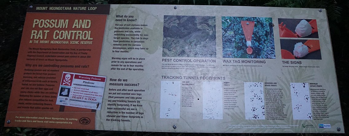
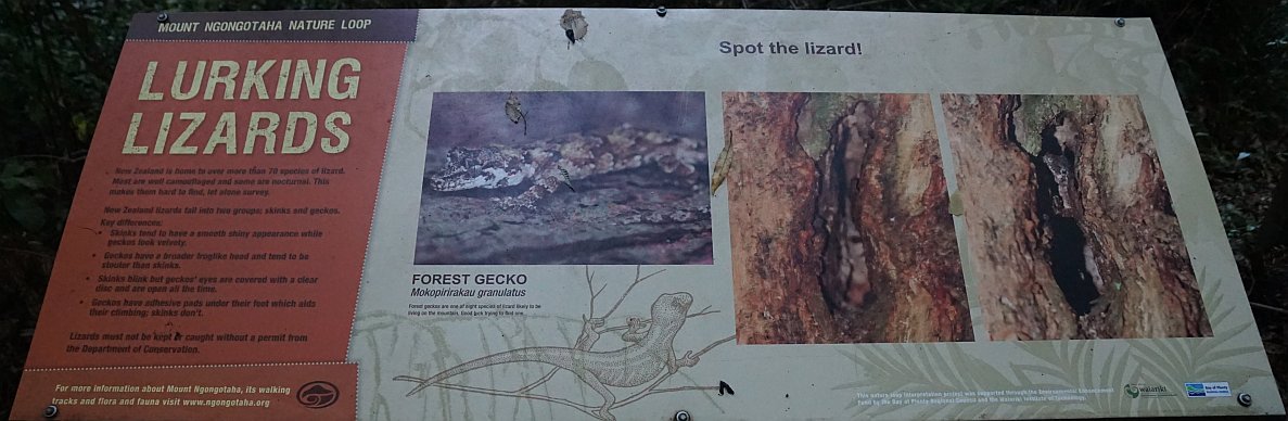
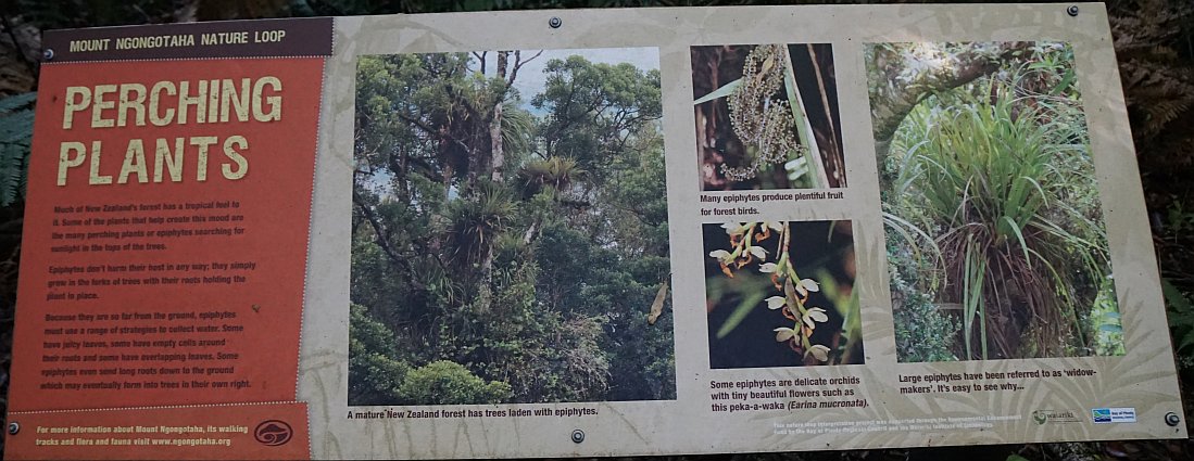
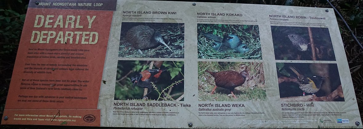
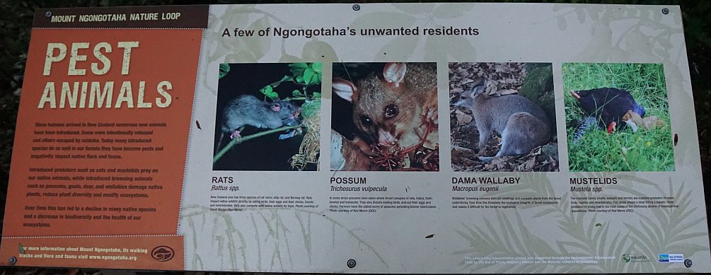
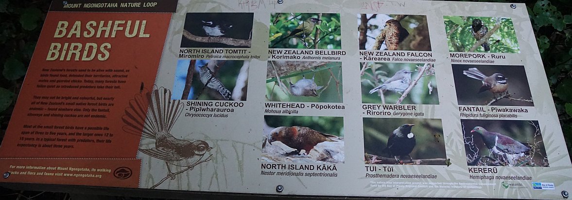
As well as small signs with names and information about various plants and trees, there are larger information panels along the Nature Loop. Here a selection of some of the panels.


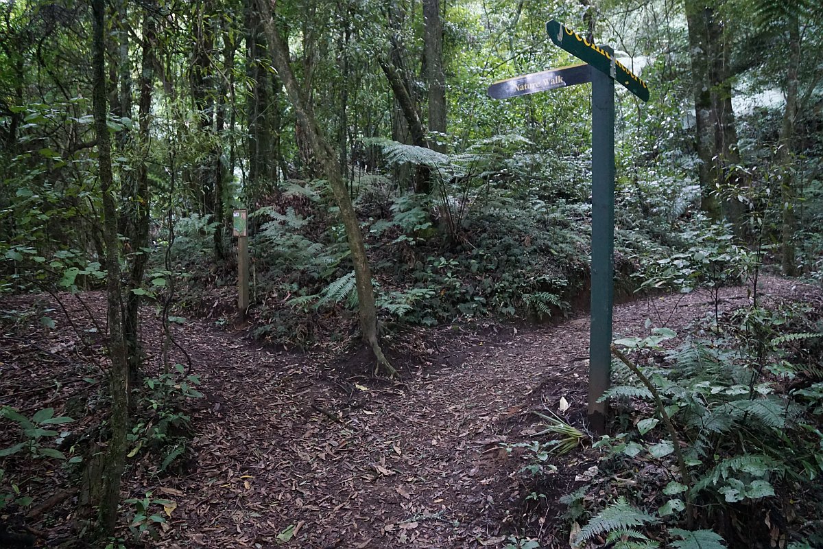
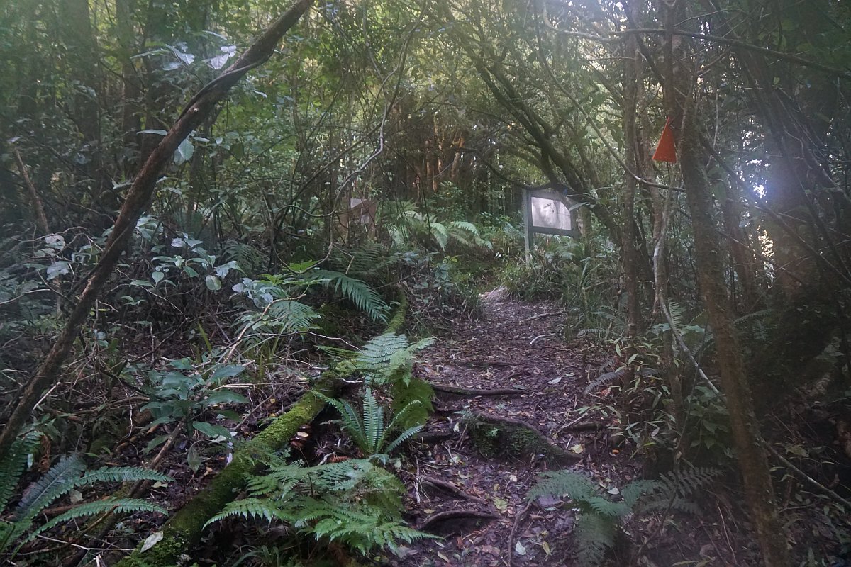
Looking back along the Nature Loop where it intersects with the Jubilee Track. The Jubilee Track continues across the tree roots up the hill to the right.

The location where the Jubilee Track branches off from the lower section of the Nature Loop. A few metres from here, along a short unmarked track on the far left, there are views across farmland to Rotorua and Whakarewarewa.

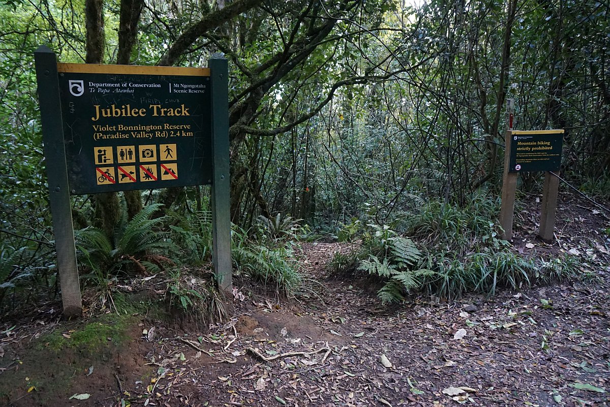
A sign at the start of the Jubilee Track where it leaves the lower section of the Nature Loop.
There are benches and an information panel at the nearby lookout.

The steam from the geothermal vents at Whakarewarewa is clearly visible, draped along the hillsides, on a cold morning. Mt Tarawera is just visible in the distance on the far left.

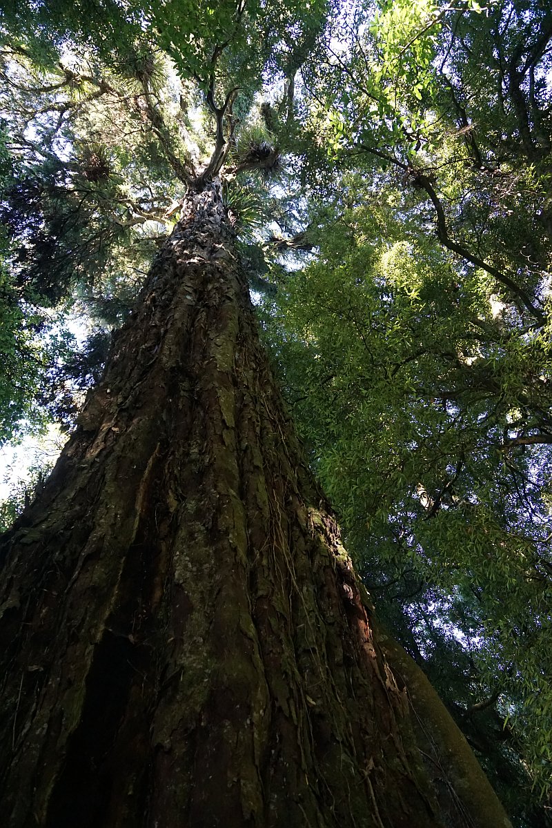
A large rimu tree by the Nature Loop. An even larger, but unmarked, rimu can be seen next to the Jubilee Track.

Steps on the Jubilee Track between the two junctions with the Nature Loop.

Approaching the top junction with the Nature Loop.

A large rimu tree by the Jubilee Track.
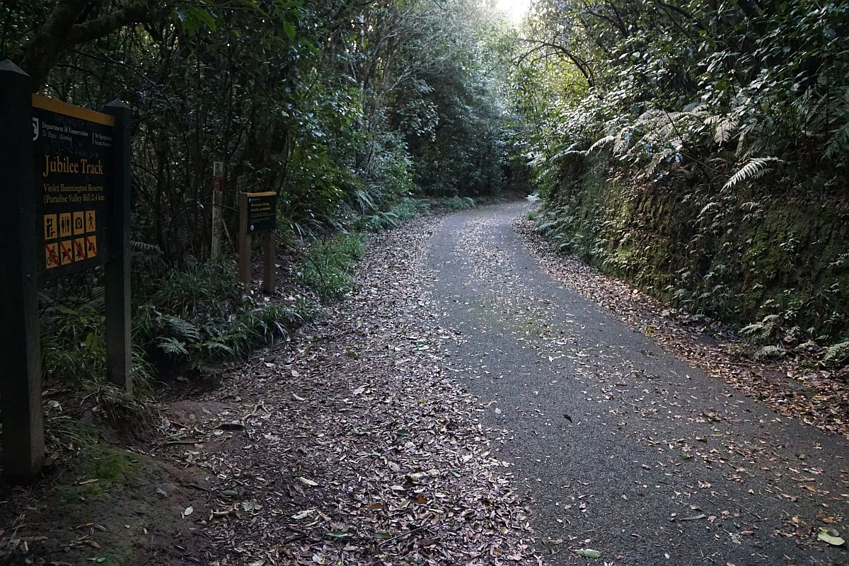
The Jubilee Track at the exit onto Mountain Rd.
Looking down Jubilee Track from Mountain Rd.
Mountain Rd heading up to the summit of Mt Karangahake, with the Jubilee Track on the left.
Transmission towers on the summit. The trig station at the summit has been removed, but the geodetic marker is still there.

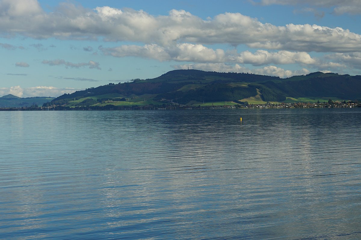
Mt Ngongotaha seen from the other side of Lake Rotorua, at Hamurana.
The GPS tracklog shows the tracks walked. The Jubilee Track branches off the Nature Loop at the marked lookout, and crosses the loop on the way to the junction with Mountain Rd near the summit.
The Nature Loop from carpark and back was about 3.7 km, and took about 1 hour 15 minutes. The Jubilee Track was about 5.6 km in total, or 2.8 km in each direction, starting and ending at the carpark. The climb to the summit took about 1 hour 5 minutes, and the descent about 50 minutes.
To shorten the total distance and time it would be possible to walk from the upper junction of the Nature Loop and Jubilee Tracks to the summit and back, and then continue on the remainder of the Nature Loop back to the carpark. This would bypass the Jubilee Track between the two juctions, which is very similar to the remainder of the Jubilee Track.

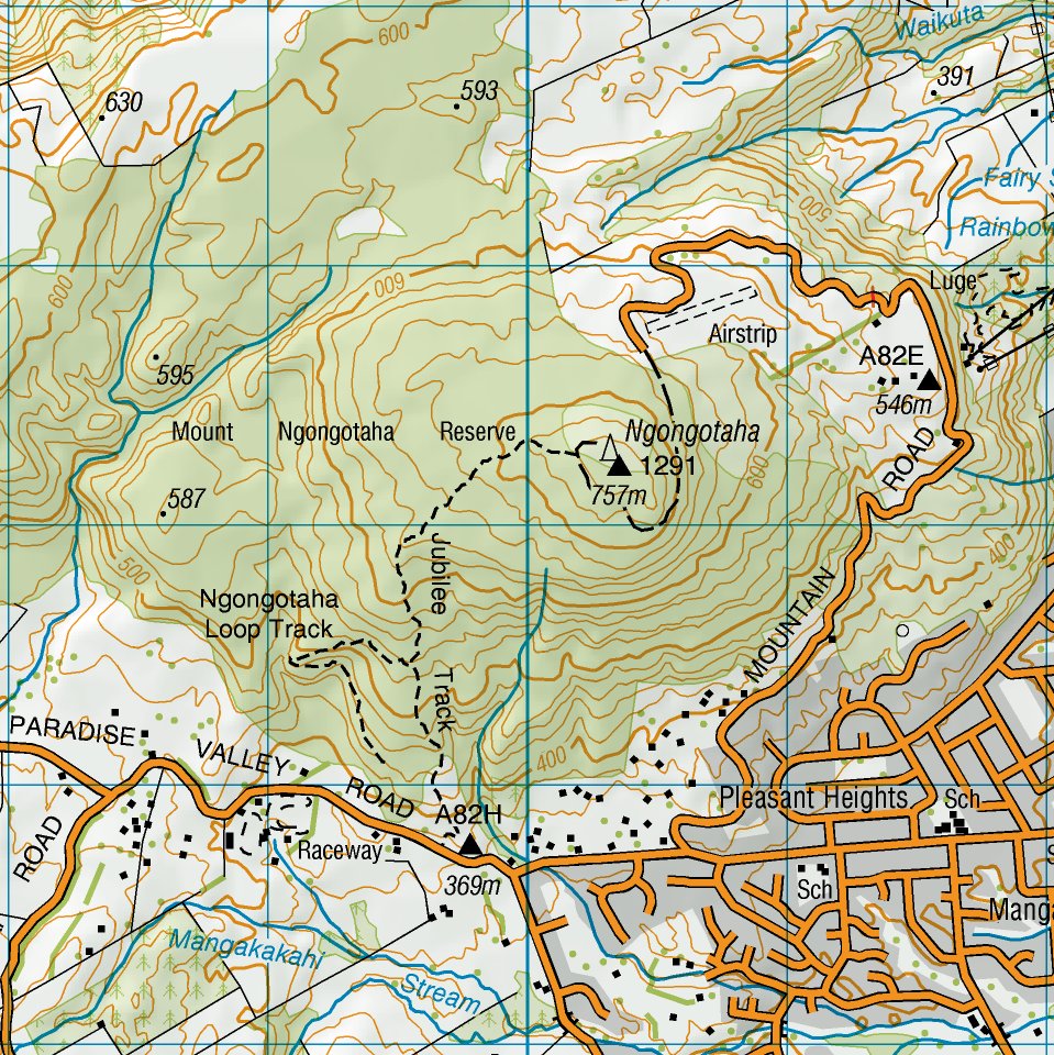
A topographic map excerpt showing the area, but with only part of the Nature Loop shown.
A satellite image of the area, taken from Google Maps.

The tracks were walked on June 4, 2016
