White Pine Bush, adjacent to SH2 between Awakeri and Taneatua, is a 4.5 hectare reserve containing one of the last stands of lowland kahikatea forest in the area. The trees in the forest area are mainly kahikatea, tawa, pukatea, and nikau. A bridge across Waioho Stream and a 250-metre long, level track suitable also for wheelchairs, has been formed as a loop through the forest. Information panels show details of the forest, the birds, and the predators.
A parking area is accessible directly from SH2, between Awakeri and Taneatua, and about 20km south of Whakatane. There are no toilets or other facilities at the site. A gumboot fence forms part of the boundary to the carpark. The walk can easily be done in 10 minutes, including time for reading the information panels. It would be suitable as a short break for travellers driving through SH2.
The parking area off SH2, the gumboot fence, the bridge across Waioho Stream, and the entry to the loop walk through White Pine Bush reserve.

The fence has a request for more gumboot donors.

Waioho Stream seen from the bridge.

The start of the loop walk after crossing the bridge.

The information panel at the start of the loop walk.

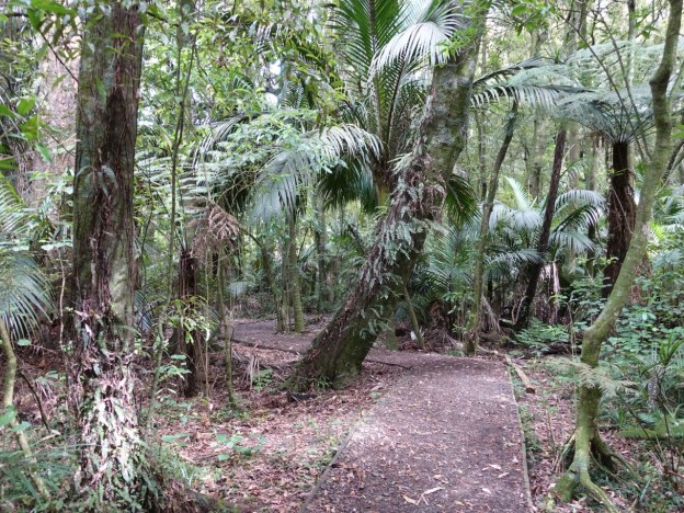
The well-maintained level track winds its way amongst the trees in the bush reserve.

A panel with information about kahikatea and the predators which can do serious damage to both plant and animal life in the forest. Timber from kahikatea, commonly known as white pine, was extensively used to make butter boxes for exporting dairy produce to England as it did not affect the taste of the butter. Kahikatea is New Zealand’s tallest native tree.

Some of the tallest kahikatea in White Pine Bush can be seen behind the information panels.

The bush also has various varieties of native birds, although only the fantail (piwakawaka) were seen on this occasion.

A few of the plant varieties also have signs with data about them. Here one of the largest kahikatea.

Although one of the largest it is not the tallest, as it has a forked trunk.

Almost back at the start of the loop the track now runs alongside Waioho Stream, and the bridge and parking area are visible.

Back at the start of the loop walk, looking across to the parking area.

The GPS tracklog shows the route taken, although due to the dense vegetation cover the GPS signal is not too reliable. The total distance walked was about 310 metres, including the bridge crossing in both directions. Total time was less than 10 minutes.

The aerial image, from Google Maps, shows the same area, with the forest clearly visible.

The track was walked on October 4, 2020.
