Author Archives: nzartig

Kauri Point – Ongare Point

Note: The Kauri Point bush walks were closed in early June 2017 due to slips along the waterfront cliffs after heavy rain. More details on Bay of Plenty Times web site.

Kauri Point, Ongare Point, and Tuapiro Point are all located on the same peninsula in the Tauranga Harbour, north of Katikati. A walkway along the coastal reserve joins Kauri Point and Ongare Point, and continues along the full length of both small settlements. The walk can, of course, be started at either end.

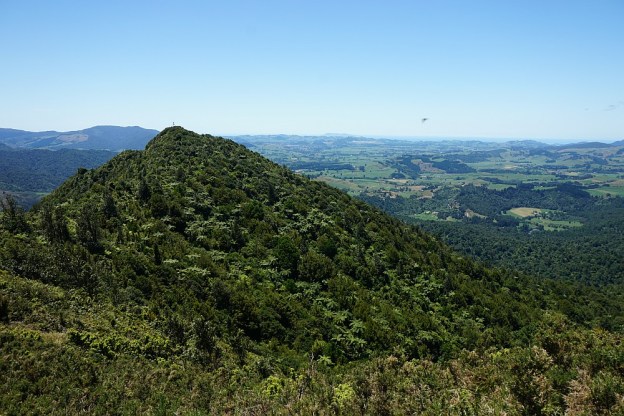
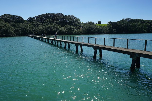
Most of the track is on open land, with easy contour and little vegetation for shade. Only the southern end along the coastline at Kauri Point is steep in places and mostly under tree cover. At Kauri Point there is a 200-metre long wooden jetty which is a popular location for fishing.

Continue reading

Tuapiro Point

Tuapiro Point is a small, sandy spit in the Tauranga Harbour, across a channel from Tanners Point. A small pine plantation at the end of the spit has walking tracks through it, and horses can be ridden around the perimeter of the spit by the plantation. Recent developments have included a larger carpark and toilets next to the plantation. Some of the parking area is available for freedom campers.

The tracks through the plantation are short, and all level. A longer walk can be achieved by walking along the grass reserve on the waterfront. Continue reading

Tanners Point

The coastal walkway at Tanners Point, north of Katikati, follows the Tauranga Harbour coastline around the Tanners Point peninsula. It starts at the Tanners Point Reserve, and ends by the estuary at the western end of Tanners Point. The track rises and falls, with steps on some of the steeper parts. On the way it passes through a small area of private farmland, before descending to sea level through recently planted native vegetation. Old pohutukawa trees are present in several places along the track.

The track has a total length of about 1.6 km, making it 3.2 km and about 1 hour for walking in both directions. There is a parking area, including an area for freedom camping, at the end of Tanners Point Rd, by Tanners Point Reserve. Toilets are available nearby. Continue reading

Athenree Village

A short walkway along the foreshore of Tauranga Harbour runs the length of Athenree Village. It starts at the children’s playground on Waione Ave, a continuation of Athenree Rd, and runs along a grassy foreshore under large pohutukawa trees. There are views across the harbour to the Bowentown peninsula. Except around high tide the water views will mostly be across mudflats.

Parking is available by the playground and on the grass verge along Waione Ave. There are toilets across the road from the playground. Continue reading

Horseman’s and Lipsey Tracks, Te Aroha

The lower end of Horseman’s Track, on the western flanks of Mt Te Aroha, is near the Mokena Geyser behind the spa building in the Te Aroha Domain, at an elevation of about 50 metres above sea level. The upper end is at a junction with Mt Te Aroha Summit Track at an elevation of about 360 metres. The track can be used as an alternative to the lower end of the summit track. The lower end of Lipsey Track is next to the Te Aroha Water Treatment Plant, next to the Tui – Domain Track and accessible from Miro Street.

Both of these tracks are narrow, and mostly quite steep, with steps on many of the steepest parts. Continue reading

Tui – Domain Track, Te Aroha

The Tui – Domain Track, also signposted as Tui Domain Track and on some old signs as Tui Mine Track, connects Tui Road and the Te Aroha Domain. Various side tracks lead to viewing points or other points of interest. The track is also accessible from Hamilton Street and Miro Street.

Most of the track is narrow, but with a gentle contour. Only the short track between Hamilton St Track and the Water Race Track is steep and rough. Some of the side tracks are also steep and rough. Continue reading

The Redwoods – Treewalk

The treewalk mentioned and shown in previous posts from The Redwoods in Whakarewarewa Forest opened to the public in late 2015. The access point to the treewalk is next to the information centre on Long Mile Road, off Tarawera Road. The walkway consists of a fixed starting/ending platform and 22 platforms suspended between 6 and 12 metres above ground in large redwood trees, joined by a series of suspension bridges. The total length of the walkway is just over 550 metres.

Details of the walkway can be found on the official treewalks web site, including the cost of access, the rules for the walk, and requirements such as age and weight limits. Almost anyone who can walk unaided can do the treewalk.

Continue reading

Ananui Falls from Woodland Rd

Note: Please see the comments and the DoC web site, which state that the track has been closed to prevent the spread of kauri dieback disease.

Ananui Falls, in the Kaimai-Mamaku Forest Park, is a 106m high waterfall accessible from Woodland Rd, a few kms north of Katikati. Woodland Rd, previously known as Woodlands Rd since it was originally intended to be joined up with Woodlands Rd off Old Tauranga Rd south of Waihi, joins up with SH2 about 4 km north of Katikati. The parking area is at the end of Woodland Rd, with the last kilometre of the road being a narrow gravel road.

There are numerous stream crossings along the track, some of which may be difficult after heavy rainfall. Unfortunately there appear to be no good lookout points for viewing the falls, but the top of the falls are easily accessible from the track.

There are no facilities at the parking area, which is a large grassed area next to the junction of the Wairoa/Waitengaue Stream and Tamaki Stream. Information about the track is also available on the DoC web site.

Continue reading

Ancient Maori Trail at Wairere Falls

There are two alternative tracks from the carpark on Goodwin Road to the top of the Wairere Falls, In the Kaimai-Mamaku Forest Park, east of Matamata. The main track passes by the lower falls lookout on the way to the top. The alternative route, which is only signposted where it joins up with the main track near the top of the falls, is signposted as “Ancient Maori Trail (Very Steep and Not Maintained)”.

The sign is not wrong. The track is steep and not very well marked, although there are occasional orange triangular DoC markers to show the way. Otherwise it is more or less necessary to follow a visual trail showing previous use. The lower junction with the main track is unfortunately not signposted, and can be difficult to locate. Since the track is steep, rough, and slippery in places it is easier to walk uphill than downhill. Continue reading

County Rd to Mt Karangahake Summit

There are several tracks leading to the summit of Mt Karangahake, a prominent peak visible from SH2 between Paeroa and Waihi. The post Mt Karangahake summit describes the most often used tracks, the Mountain Track and the unmarked and unnamed direct track which branches off the Mountain Track.

This walk was done on the County Rd track, part of which is also known as the Number 7 Level Track, with the Mountain Link Track joining County Rd to the Mountain Track and the summit. This route is somewhat longer than the other two tracks, but most of County Rd has an easy gradient and is a good, well-formed track. The Mountain Link Track is narrower and steeper, but not very long. The return from the summit was via the unmarked direct track and the Mountain Track.

Continue reading