
The Tui – Domain Track, also signposted as Tui Domain Track and on some old signs as Tui Mine Track, connects Tui Road and the Te Aroha Domain. Various side tracks lead to viewing points or other points of interest. The track is also accessible from Hamilton Street and Miro Street.
Most of the track is narrow, but with a gentle contour. Only the short track between Hamilton St Track and the Water Race Track is steep and rough. Some of the side tracks are also steep and rough.
The information panel at the small geyser in the Domain reads:
“Tui-Domain Track
Waterfall lookout: 30 minutes
Miro Street: 45 minutes
Hamilton Street carpark: 1 hour 30 minutes
Tui Road: 2 hours 15 minutes
Most of this walk from Te Aroha is fairly level with some short detours to old reservoirs and scenic waterfalls. There are a few shallow, unbridged streams and the mountain bike trails intersect with the walking track in places. At the Hamilton Street track junction you can exit to the Hamilton Street carpark or continue to Tui Road – a steeper section which passes an historic mine and two reservoirs. A number of Department of Conservation tracks, including another route to the summit of Mt Te Aroha, can be accessed from this track or from Tui Road.”
Another sign by the Spa building indicates that the track is 5.5 km long.
There is a small parking area on Tui Road, but no other facilities. Parking is available in and around the Te Aroha Domain, and there are toilets by the information centre on Whitaker St by the entrance to the Domain.
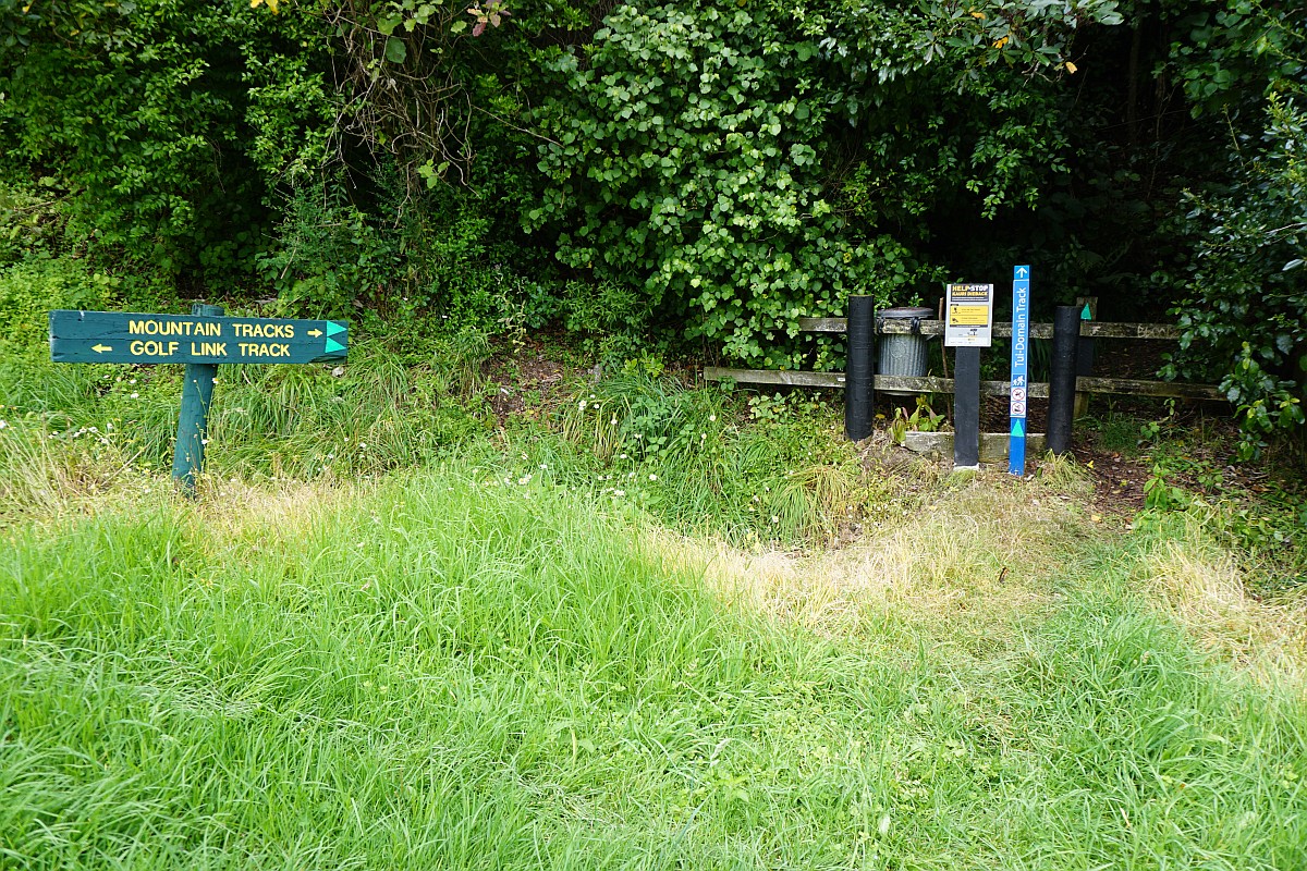
The Te Aroha Domain. The Tui – Domain track starts to the left behind the Spa building behind the playground.

The sign by the Spa building.

The information panel by the small geyser behind the Spa building.

The geyser, next to the start of the walking tracks. The shelter with the large information panel is on the left.

The Tui – Domain Track starts on the left. The Mt Te Aroha Summit track continues on straight ahead.

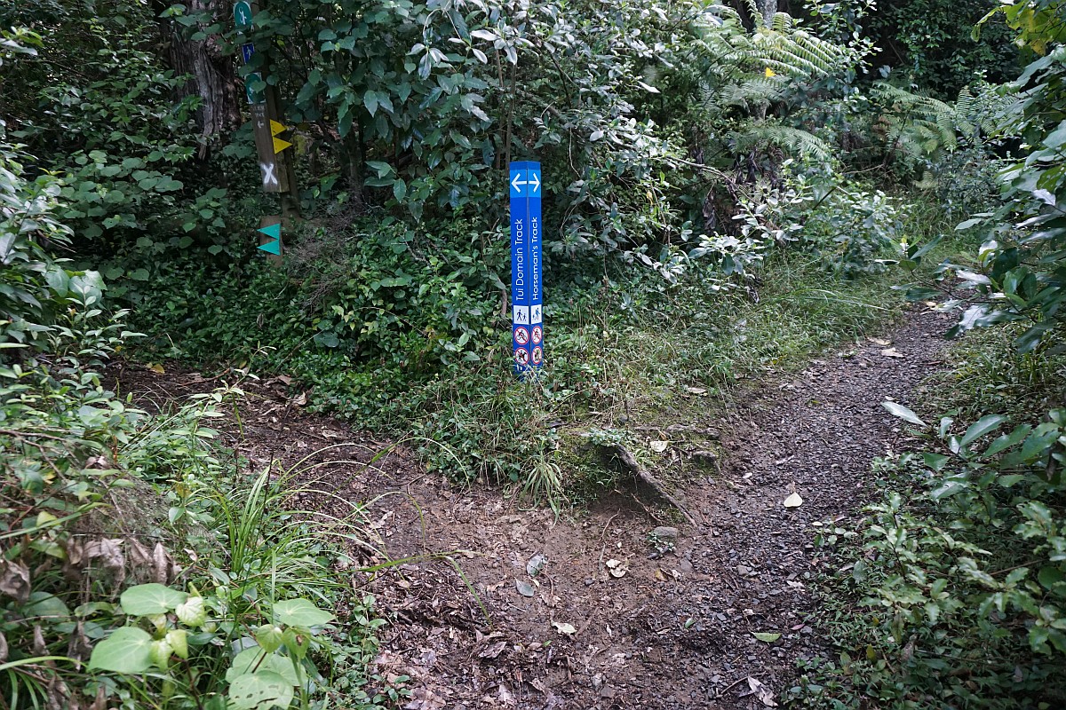
A few metres further on and Horseman’s Track, an alternative track leading up to the summit track, branches off to the right from Tui – Domain Track.
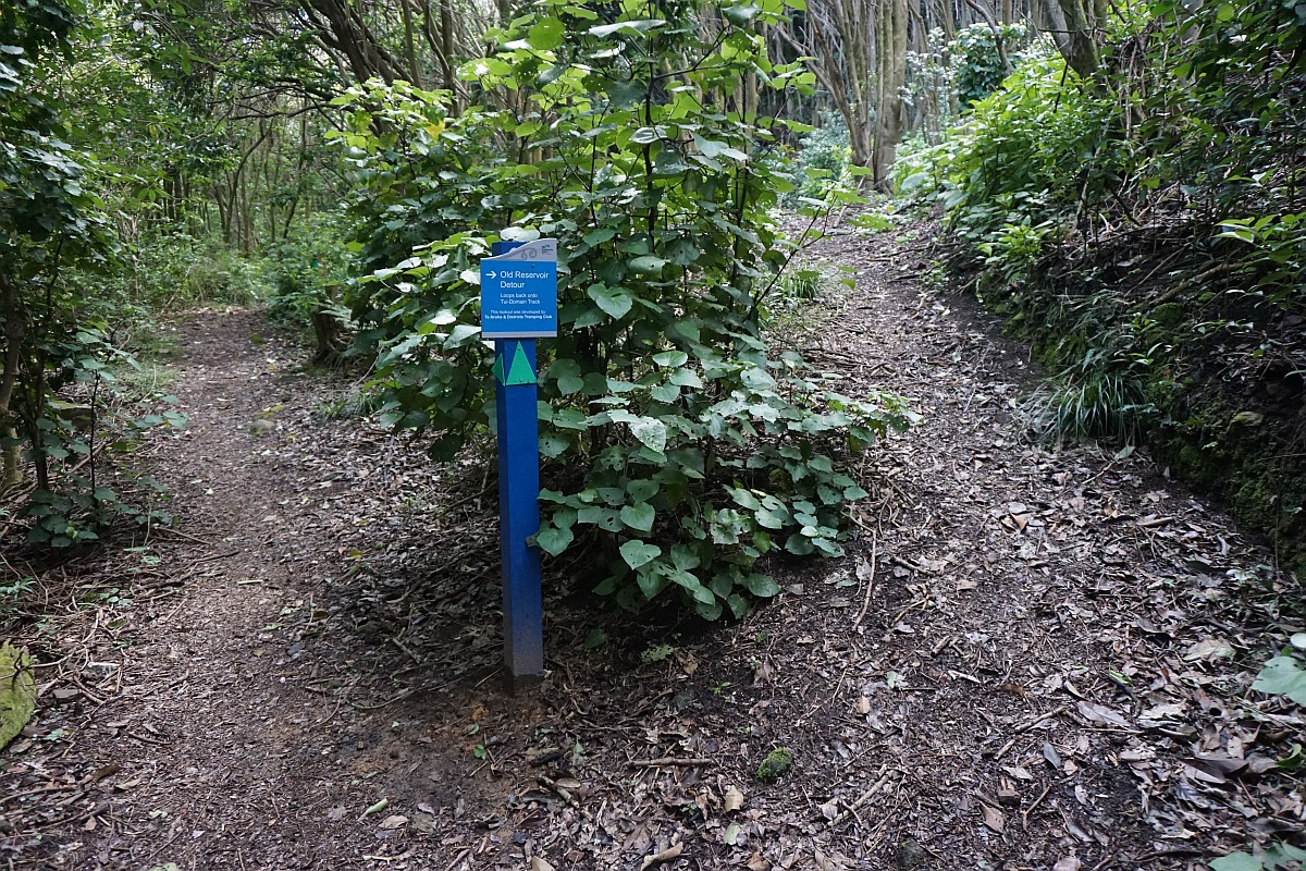
A short side track leads to an old reservoir, with a few remains. The track returns to the main track.
Remains from an old reservoir.

The other end of the old reservoir detour.

There are several side tracks to the main Tui – Domain Track. Some of these return to the main track further on. Others have to be walked in both directions. This one off the reservoir detour follows an old pipeline and leads to the base of the Tutumangao Falls, and possibly also to a falls lookout before returning to the main track.

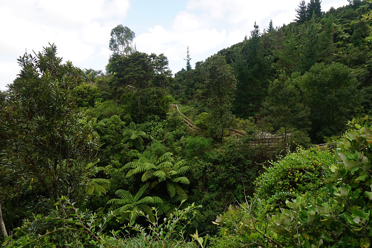
Looking across from the pipeline track to the Tutumangao Falls lookout and Noels Lookout.
The Tutumangao Falls.

There is a track crossing over Tutumangao Stream, along a rocky ridge and across a short bridge, to the lookout. However the bridge, seen in the foreground, is not very stable and is marked as No Entry. It is possible to cross over alongside the bridge. The alternative is to return to the main track and then take another side track to the lookout. The stairs lead up to Noels Lookout.

Looking down from Noels Lookout over the water treatment plant and water reservoirs to Te Aroha and the Hauraki Plains.

Tutumangao Falls seen from Noels Lookout.

Other tracks lead to smaller waterfalls and streams. The track on the far right leads to a small weir on Tutumangao Stream, the stairway leads to the falls lookout and Noels lookout, the one to the left on the far end of the bridge leads to a small waterfall. The water treatment plant and water reservoirs are also accessible from this junction.

The Tutumangao Stream at the end of the short, far right track shown above.

The waterfall by the track to the left shown above.

The water treatment plant and water tanks. The lower end of Lipseys Track is near the tank on the right.

An alternative track back to the main track passes by the remains of a rock crusher.

The junction of the Tui – Domain Track and the tracks to the lookouts and waterfalls. These tracks are not maintained by the district council.

Crossing the road from Miro Street to the water treatment plant. The Tui – Domain Track continues on the far side of the sealed road.

The information panel which can be seen by the fork in the road above.

A short side track off Tui – Domain Track with an unofficial-looking sign leads through a small grove of redwood trees to a lookout.

Looking across the Hauraki Plains from the lookout.

An information panel with information about the Waihou Valley Scheme at the lookout.

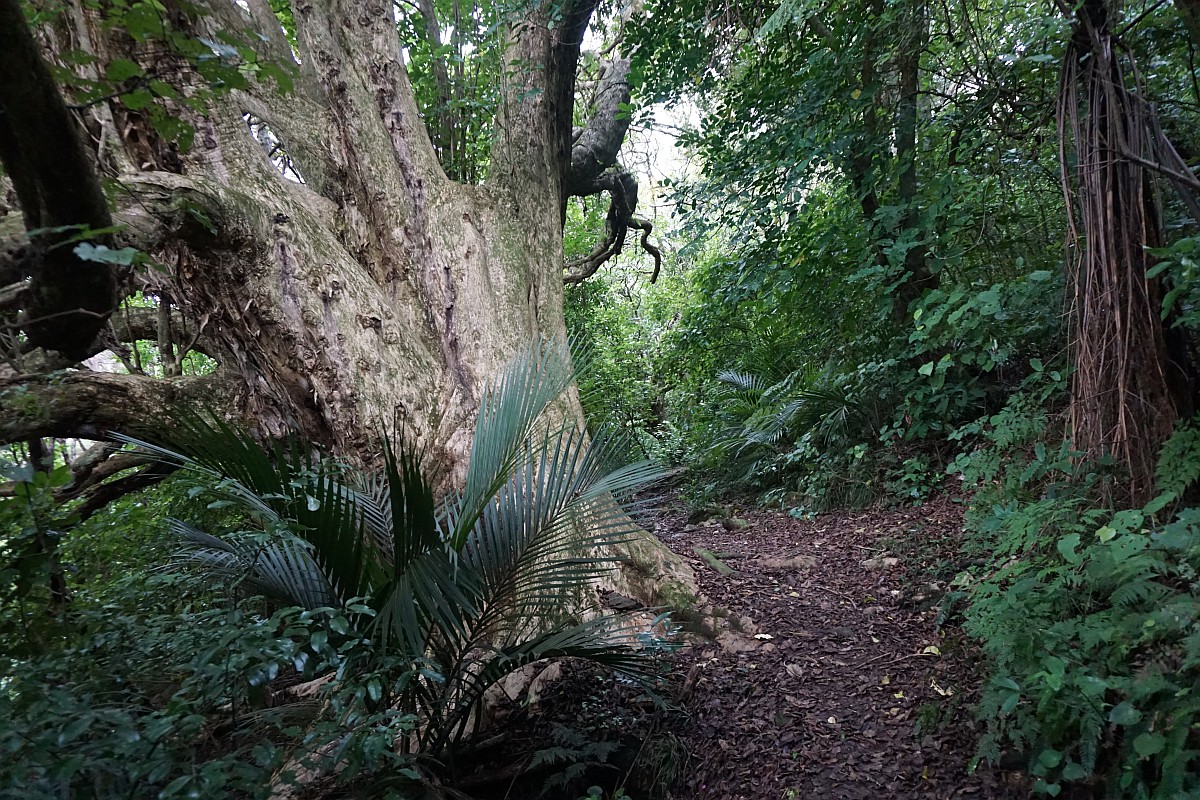
A large puriri tree by the Tui – Domain Track.
Small stone pyramids alongside the track, by a small stream.

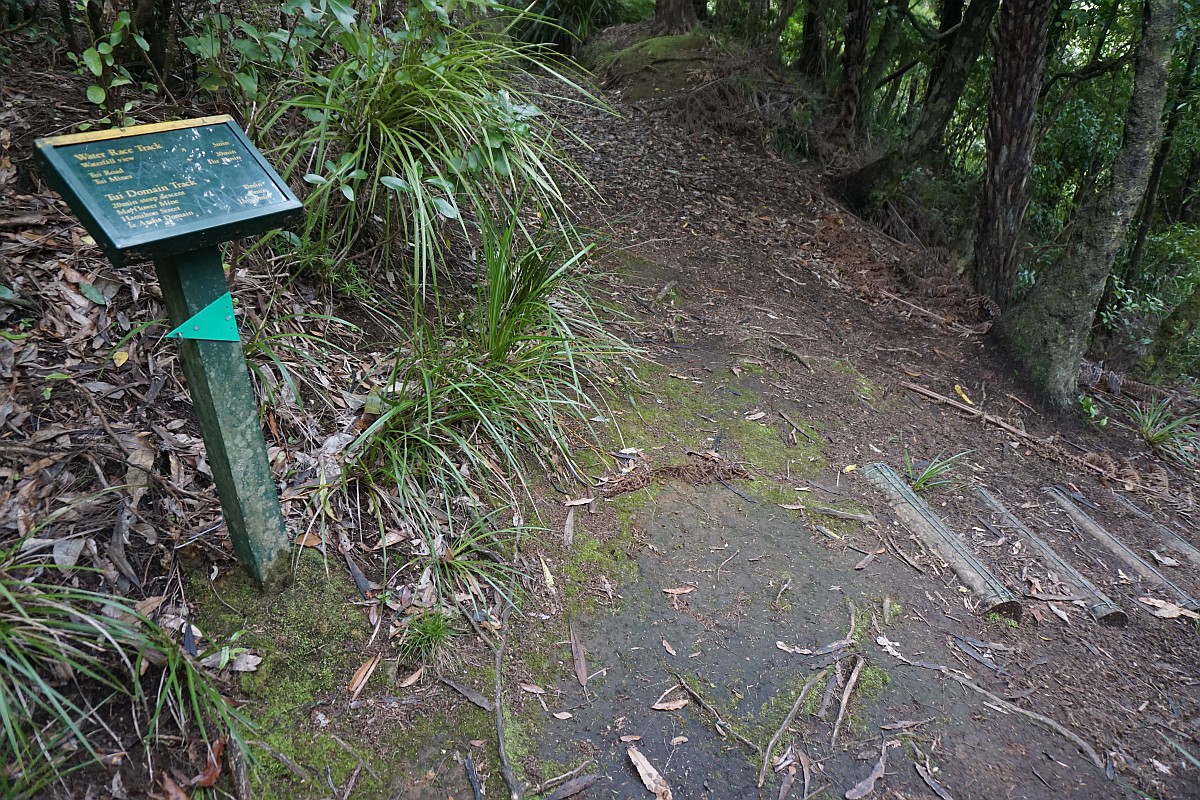
The sign at the junction of Hamilton Street Track and Tui – Domain Track.

The Hamilton St Track is about 600 metres long and runs alongside and over the Tunakohoia Stream. This is the stream crossing near Hamilton St.

An old generator is located by the carpark on Hamilton St, by the start of the Hamilton St Track. It was used to provide hydro-electric power to Te Aroha starting in April 1906. It used water from the Tunakohoia and Tui Streams, stored in reservoirs alongside the Tui – Domain Track to turn the generator. The interesting information panel on the right provides details about the power scheme and later changes.

Continuing on the Tui – Domain Track this crosses over the Tunakohoia Stream before a steep climb to the reservoirs and the water race track.
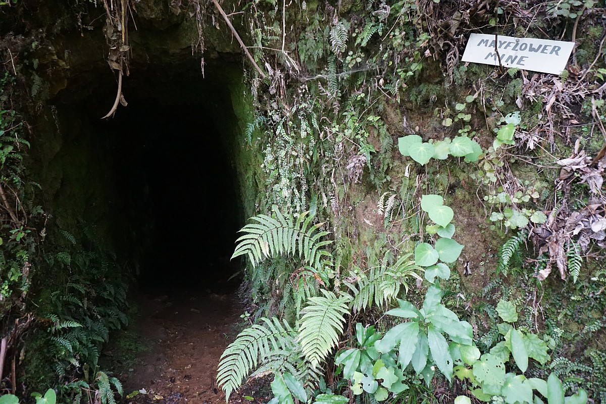
The mine entrance to the old, disused Mayflower Mine, presumably a gold mine, by the steep section of Tui – Domain Track.
The trunk of an old puriri tree provides a suitable seat for a short lunch break.

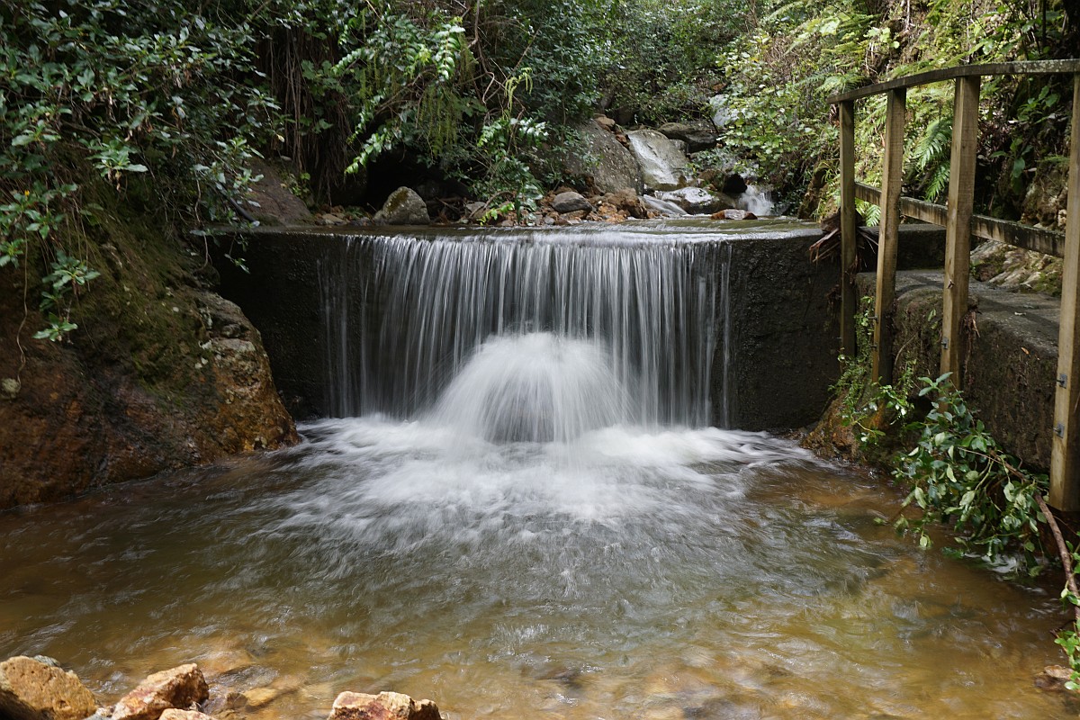
The steep section of track (steps on the right) ends at the Water Race Track (bottom of photo), with a short track to a waterfall lookout straight ahead.
Unfortunately vegetation obscures the lookout to the waterfall at the end of the short side track. The track is only about 200 m long.

Bridges cross some of the deeper and steeper stream gullies along the Tui – Domain Track. This one on the Water Race Track.

The water races were used to send water from Tunakohoia and Tui Streams to the water reservoirs providing water for the hydro-electric power station on Hamilton Street. The water was piped in wooden pipelines, a part of which can be seen crossing a gully.

The water race also cut through some ridgelines.

The track, straight ahead, to the old Tui Mine and the summit of Mt Te Aroha branches off from the Tui – Domain Track near the old reservoirs.

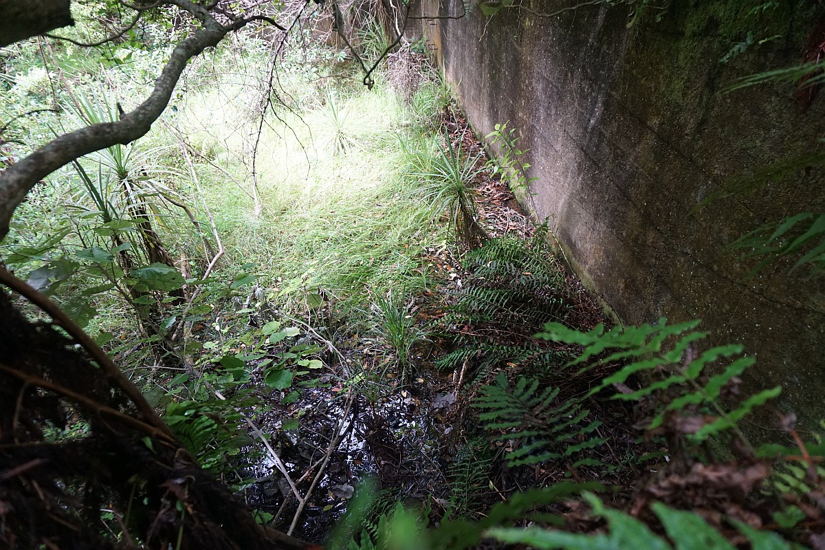
Concrete walls from the two reservoirs built in 1906 and 1907 for the power station are visible alongside the Tui – Domain Track.
The entry to Tui – Domain Track on Tui Road.
Looking down Tui Road, with the car parking area on the right, and the entry to Tui – Domain Track on the left.

The GPS tracklog shows the route followed and some points of interest. All the side tracks were taken on the walk from the Domain to Tui Road. The return was along the Tui – Domain Track with no detours or side tracks.
The times and distances were as follows:
Total, including 10 minutes for a lunch break: 10.9 km, 4 hours.
Domain to Tui Road including side tracks and lunch: 6.8 km, 2 hours 50 minutes.
Tui Road to Domain on main track: 1 hour 10 minutes.
Total height difference from lowest to highest point about 230 metres.

The topographic map shows the contours of the track. The track between the water treatment plant and the domain is not shown, and a large part of the track is shown in an incorrect location, as can also be seen on the GPS tracklog map.

The track was walked on February 20, 2016.

Pingback: Horseman’s and Lipsey Tracks, Te Aroha | motowalknz
Hello Motowalknz
This is a lovely record of your Tui domain track walk with some beautiful waterfall shots and clear instructions. Would you mind if we put a link to this on our Facebook page? http://www.facebook.com/tearohaisite? Also, these are the best photos I have ever seen of the Tutumangao Falls and the water intake. Would it be possible to use them on our new website that we are developing? Thanks, Michele – Te Aroha I-SITE Visitor centre manager
LikeLike
Thanks, Michele. You’re welcome to do that. There’s a Facebook button at the bottom of each blog post just waiting to be used 🙂 For photos on your new web site, see the email I sent.
LikeLike
Hello,
My name is Jessica and I’m an editor from Epoch Times NZ Branch. We are going to publish an article about Hamilton and the towns around. We need some pictures about the Tui track, and I found your pictures are really good.
So my question is if you could give us permission to use your pictures on our publication? We will write credit.
Looking forward to hearing from you.
Jessica
LikeLike
Email sent, Jessica.
LikeLike
Hi, Just wanted to say huge thank you for sharing the photos, maps and info regarding difficulty of tracks I find it a great help when choosing walks for a group. Regards Molly
LikeLike
Many thanks for your kind words, Molly. It’s good to know that the posts can be of some benefit. Unfortunately I don’t have the time or resources for regular revisits of all the tracks to check for any changes, so I’m reliant on readers to provide news of any significant updates. All helpful comments are appreciated.
LikeLike
Thanks for your excellent presentation. The photos are just wonderful, and makes me enjoying the the tracks around Te Aroha even more.
LikeLike
Many thanks for that. It’s always heartening to hear when someone finds the track descriptions useful. The tracks around Te Aroha, including Waiorongomai Valley, are some of my favourites.
LikeLike