Author Archives: nzartig

Golden Cross Mine to Maratoto Road

Gold was discovered at Golden Cross in 1892, and an underground mine operated there from 1895 to 1920, extracting over 2.5 tonnes of gold from about 160,000 tonnes of ore. The area reverted to farmland after the mine was closed, until the new Golden Cross Mine started operating in late 1991. The new mine operated as both an open-cast and an underground mine. The mine closed again in late 1997 – early 1998 after extracting 18 tonnes of gold and 52 tonnes of silver. Water from the mine site is still being treated, and the tailings dam is still present.

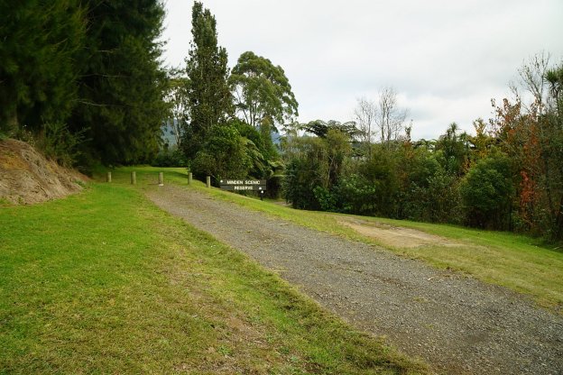
The mine site is about 12 km from SH2, and accessible at the northern end of Golden Cross Road, an extension of Waitekauri Road, off SH2 between Karangahake and Waihi. Old Waitekauri Rd and Campbell Rd also connect SH2 to Waitekauri Rd. There is a large parking area at the mine site, but no other facilities. The access gate near the end of Golden Cross Rd is opened at dawn and closed at dusk each day.

Continue reading

Katikati – Haiku Pathway, Uretara/Yeoman Walkway

The Haiku Pathway in Katikati was constructed as a unique and lasting Millennium Project. Haiku poetry is carved into river stones along the pathway, in an area alongside the Uretara Stream. The project also included the Millennium Bridge, a footbridge linking the Highfields suburb with the town centre. At its construction it was the only Haiku Pathway in the Southern Hemisphere, and the largest display of boulder haiku outside Japan.

The pathway can be accessed from Highfields Drive, from the town centre, and from SH2 by the bridge over the Uretara Stream. From the Uretara Stream bridge a walkway continues northwards past the Uretara (or Katikati) Landing along the estuary and the waterfront to the Park Road Reserve at the northern end of Park Road. The walkway is known as the Uretara or Yeoman Walkway, and part of it as a Bird Walk, with sculptures of birds beside the walkway.

Continue reading

Minden Scenic Reserve

The Minden Scenic Reserve is accessible from Ainsworth Road, off SH2 on the northern outskirts of Te Puna, near Tauranga. The Reserve has a short, 15-minute loop walk described in a brochure published by the Western Bay of Plenty District Council, and available online. The WBOP District Council brochure does not mention that there is an unmarked track continuing on uphill from the turning point of the loop walk and ending on Minden Road near the intersection with Dawn View Place.

There are no markers on the loop walk except at each end, and no indication of the extent of the reserve. The unmarked track continuing up the hill does not cross any fences, and since the bush area continues all the way to Minden Rd, the track presumably remains entirely within the reserve. The track does get used, both by walkers and by mountain bikers.

Continue reading

Mt Ngongotaha – Nature Loop and Jubilee Track

The 757 m high summit of Mt Ngongotaha, near Rotorua, is accessible by the Jubilee Track, a walking track starting by Paradise Valley Rd, or by walking or biking up the last 5 km or so of Mountain Rd from the carpark and locked gate. The lower part of Jubilee Track is shared with the Nature Loop, an easy 3.7 km long loop with numerous information signs and panels. Unfortunately there are no longer any views of the surrounding area from the summit, due to the regrowth of native bush in the Mt Ngongotaha Reserve.

There is a small car parking area on Paradise Valley Rd next to the Violet Bonnington Reserve and the start of the Nature Loop and Jubilee Track. Basic DoC toilets are located about 100 m from the carpark, next to the track.

Continue reading

Lake Tikitapu/Blue Lake

Lake Tikitapu or Blue Lake is situated in the Lake Tikitapu Scenic Reserve, alongside Tarawera Road and the Whakarewarewa Forest, a few kilometres south of Rotorua. The lake is used for various watersports and together with the area around it for competitions such as triathlons. A walkway of close to 6 kilometres in length runs all the way around the lake. The walkway is well formed, and has no steep sections and only a few steps. Alternative tracks are available to bypass the steps.

Parking is available directly off Tarawera Road across from the holiday park, near the Okareka Loop Road intersection. Another parking area is also available near the water ski clubhouse, at the northern end of the lake. Toilet facilities are available nearby, but some of them are closed during winter months.

Continue reading

Tui Tracks to Mt Te Aroha Summit

Several tracks lead to the summit of Mt Te Aroha, the highest peak in the Kaimai Range. The most direct track leads directly from the Te Aroha Domain to the summit. A formed road, sometimes called Mountain Rd but on Google Maps shown as being part of Tui Rd, runs from the parking area by Tui Rd on the outskirts of Te Aroha to the summit. A series of walking tracks also lead from Tui Rd to the summit. This walk was done using the Tui tracks from the parking area on Tui Rd to the summit, returning back down on Mountain Rd.

The walking tracks from Tui Rd to the summit of Mt Te Aroha consist of a short part of Tui-Domain Track, Tui Link Track, the continuation of Tui Link Track (Tui Mine Track?) to the Tui Saddle, the Ridge Track to Dog Kennel Flat, and then an unnamed track (perhaps Dog Kennel Flat Track?) from Dog Kennel Flat to the summit.

Continue reading

Waitawheta Tramway Track – Franklin Rd to Waitawheta Hut

The Waitawheta Tramway Track follows a tramline used in the early 20th century to extract wood from the Waitawheta Valley, first for gold mining operations, and then Kauri logs and timber. The tramway runs for almost 10 km from Franklin Rd (off Waitawheta Rd) to a sawmill site and the Waitawheta Hut. There are 8 crossings of the Waitawheta River, with all except one of them now spanned by bridges. There is a detour track available which bypasses the unbridged crossing.

The tramway has a gentle slope, rising from about 160 m above sea level at Franklin Rd, to about 380 m at the Waitawheta Hut. Most of the track is easy to walk, with only a few short washed out sections. Several remains from the tramway and milling can be seen along the way.

Continue reading

Pukemokemoke Reserve

Pukemokemoke (hill alone) with a height of 166m above sea level is a peak within the 40-hectare Pukemokemoke Reserve, which is now surrounded by farmland and a quarry, but which was once surrounded by forested wetland. The reserve, previously part of Orini Downs Station, was gifted to the nation by David Johnstone who was one of the major shareholders in the Station. The reserve, which has a conservation covenant placed on it, is now under the control of the David Johnstone Pukemokemoke Bush Trust. It was set up specifically to protect the bush and provide a recreational and educational asset for the community.

The reserve is located about 15 km north-west of Morrinsville and about 18 km east of Huntly. It is accessible down a right-of-way at 1382 Tauhei Rd. There is a carpark at the end of the right-of-way, by the entrance to the reserve.

Continue reading

Sanctuary Mountain Maungatautari Summit Northern Loop

Note, January 2022: Access from Hicks Rd was removed in 2018 due to the access privilege across private land being abused. Access has now been reinstated (see comment at end of post) so PLEASE do not abuse the privilege so that it gets to be closed permanently. Thank you. Also see the comments at the end for updates to the parking and facilities at Hicks Rd.

Sanctuary Mountain Maungatautari is a mainland ecological island surrounded by the world’s longest pest-proof fence. It provides a sanctuary for populations of many of New Zealand’s most endangered species – from birds to bats, frogs to reptiles, tuatara to giant weta. There is an information centre at the southern entry, on Tari Rd, off Arapuni Rd. The northern entry is accessible from Hicks Rd, off Maungatautari Rd.

Tracks lead across the mountain, with access from these to the summit of Maungatautari at 797 m asl and Pukeatua at 753 m asl. There are views of the surrounding area from Pukeatua summit and the nearby rocky outcrop, but none from Maungatautari summit. An earlier post covers the walk from the southern entry to the summit of Pukeatua and the rocky outcrop.

The easiest access to the summit of Maungatautari is from the northern entry, accessible from Hicks Rd. There are no facilities other than a carpark area on Hicks Rd.

Continue reading

Dickey Flat – Mangakino Pack Track Loop

Dickey Flat Campsite in the Karangahake Gorge is the starting point of various walks in the Kaimai Mamaku Forest Park. The Mangakino Pack Track Loop is one of the longer and most difficult of the loop walks starting and ending at the campsite. The tracks making up this loop have various names depending on the source, which can be confusing. For example the Mangakino Pack Track is also known as Mangakino Track and Mangakino Stream Track. Dickey Flat is also called Dickey’s Flat on older DoC signs.

The campsite, with parking area and basic toilet facilities, is located at the end of Dickey Flat Road, off Kennedy Rd and Waitawheta Rd. The last part of Dickey Flat Rd is a narrow, gravel road.

Continue reading