Mount Tarawera is a volcano in the Rotorua area, part of a chain of volcanoes stretching from Whakaari/White Island in the north, to Ruapehu in the south. It was the site of the largest and most deadly eruption in New Zealand in at least the last 250 years. It erupted in the early hours of June 10, 1886, causing the death of about 120 people and leaving a layer of ash and mud over a large area. Details of the eruption can be found on the New Zealand History web site, and on Wikipedia.
One of the tribes or iwi displaced from the area by the eruption, Ngati Rangitihi, are now guardians or kaitiaki of the mountain, and access to the summit is restricted. Ngati Rangitihi marae is located at Matata, and there are Ngati Rangitihi farmlands at Rerewhakaaitu, near the base of Mt Tarawera.
There is a very rough single-track road leading up to the crater rim, but a locked gate prevents access by unauthorised vehicles. Airstrips near the summit are no longer usable, and there are no walking tracks accessible to the public. The company Kaitiaki Adventures runs bus trips to the mountain, and the helicopter company Volcanic Air fly to and land near the summit. The access fees charged by both of these companies contribute to the conservation of the mountain.
The Kaitiaki Adventures trips start and end in Rotorua, travelling by a 4WD bus to the edge of the crater. The trips include a walk of about 3 km length, taking up to about 2 hours, up to the summit and back to the bus parking area at the crater rim. Including the time driving to the mountain and back to Rotorua the total trip time can be about 5 hours. The road up the mountain is very rough, so people prone to motion sickness should consider taking appropriate medication beforehand.
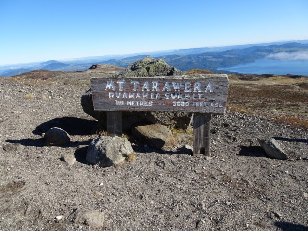
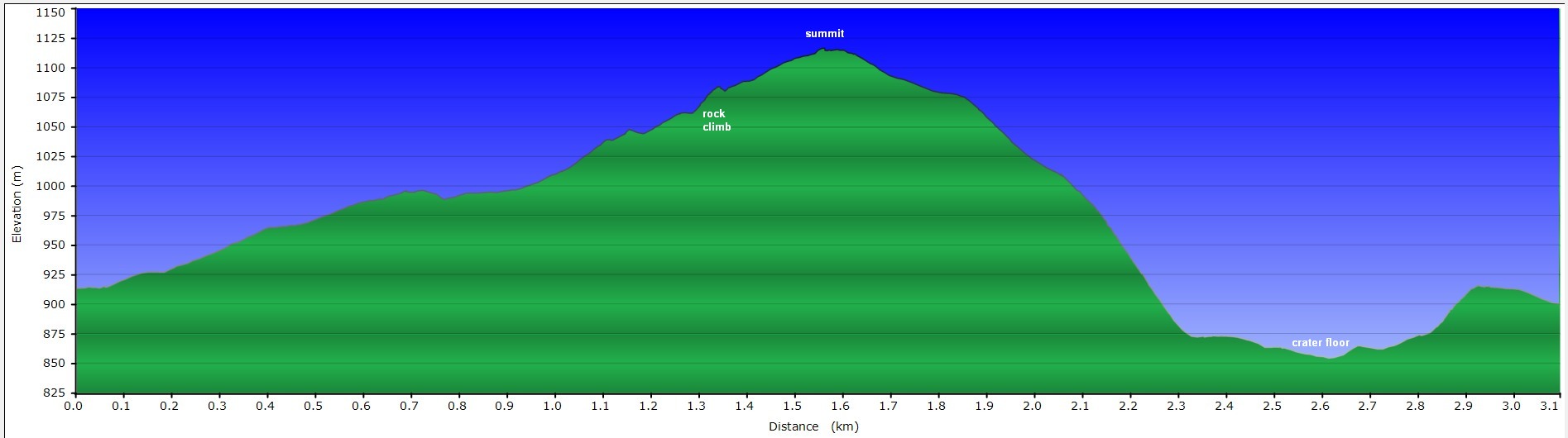
The summit of Mt Tarawera is 1111 metres above sea level, and the bus parking area is about 900 metres a.s.l, so there is a mostly gentle climb of about 200 metres to reach the summit. One short climb near the summit, known as the rock climb, is the most difficult part of the walk. Anyone not able to complete the walk is asked to turn around before the rock climb and return along the crater rim to the bus park. The rock climb is the point of no return.
Since all volcanoes are unpredictable passengers are required to sign a disclaimer form on the bus on the way to the mountain. Each trip includes two guides, including the bus driver, and participants are accompanied at all times.
The bus makes a short stop at a location near the end of the drive up the mountain, where there is a very basic toilet and drinking water is available.

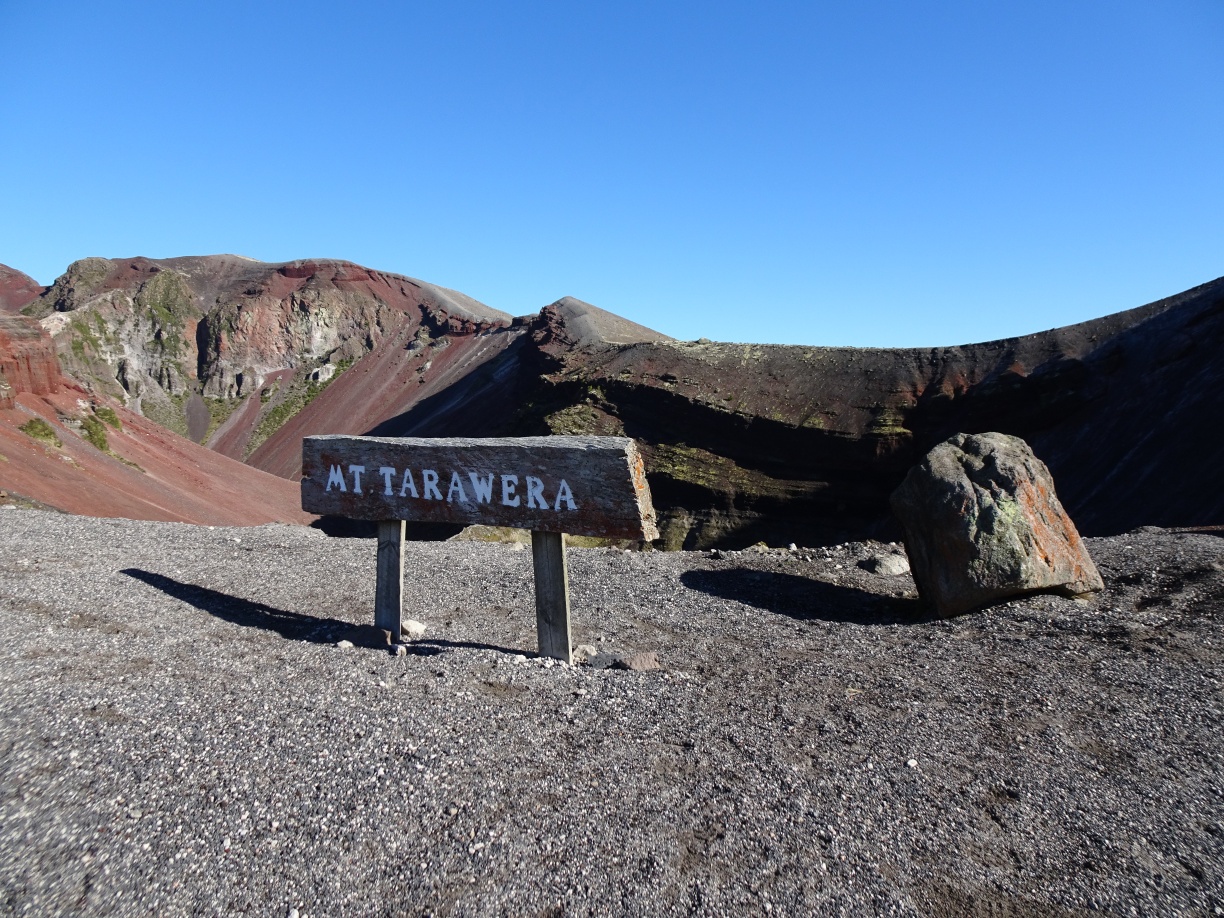
The bus parks only a few metres from the crater rim. The summit is the highest visible point near the upper left, and the rock climb is the right-hand edge of the dip to the far left. The steep downhill slope is below and to the right of the summit, behind the left-hand end of the sign. The walk starts and ends by this sign.
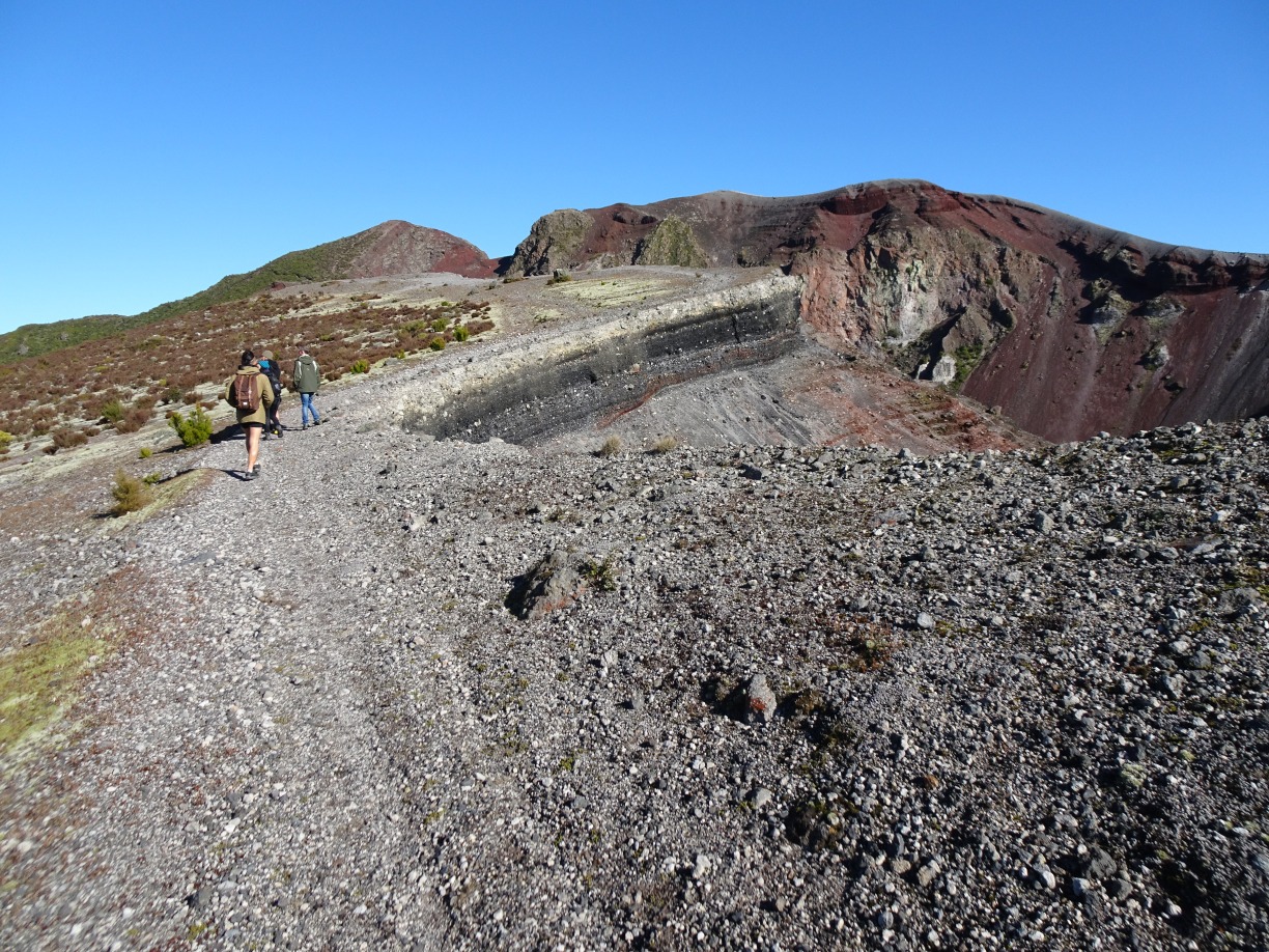
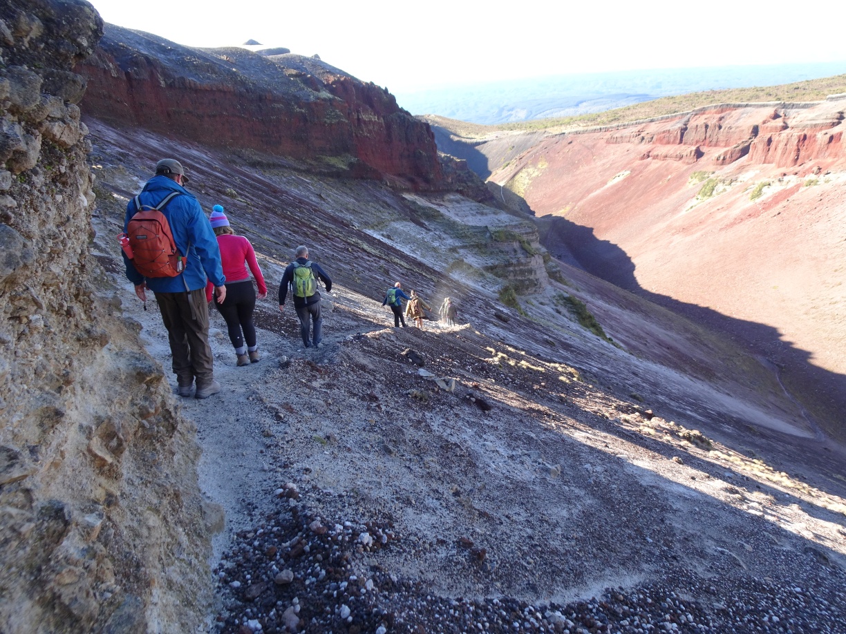
Starting out on the walk the gradient alongside the crater rim is quite gentle. Benches are placed at several locations, providing suitable places for a short rest and for information from the tour guides.
One of the benches on the far left, looking down into the crater and across to the steep descent, off picture to the right.

Looking back down the track along the crater rim.

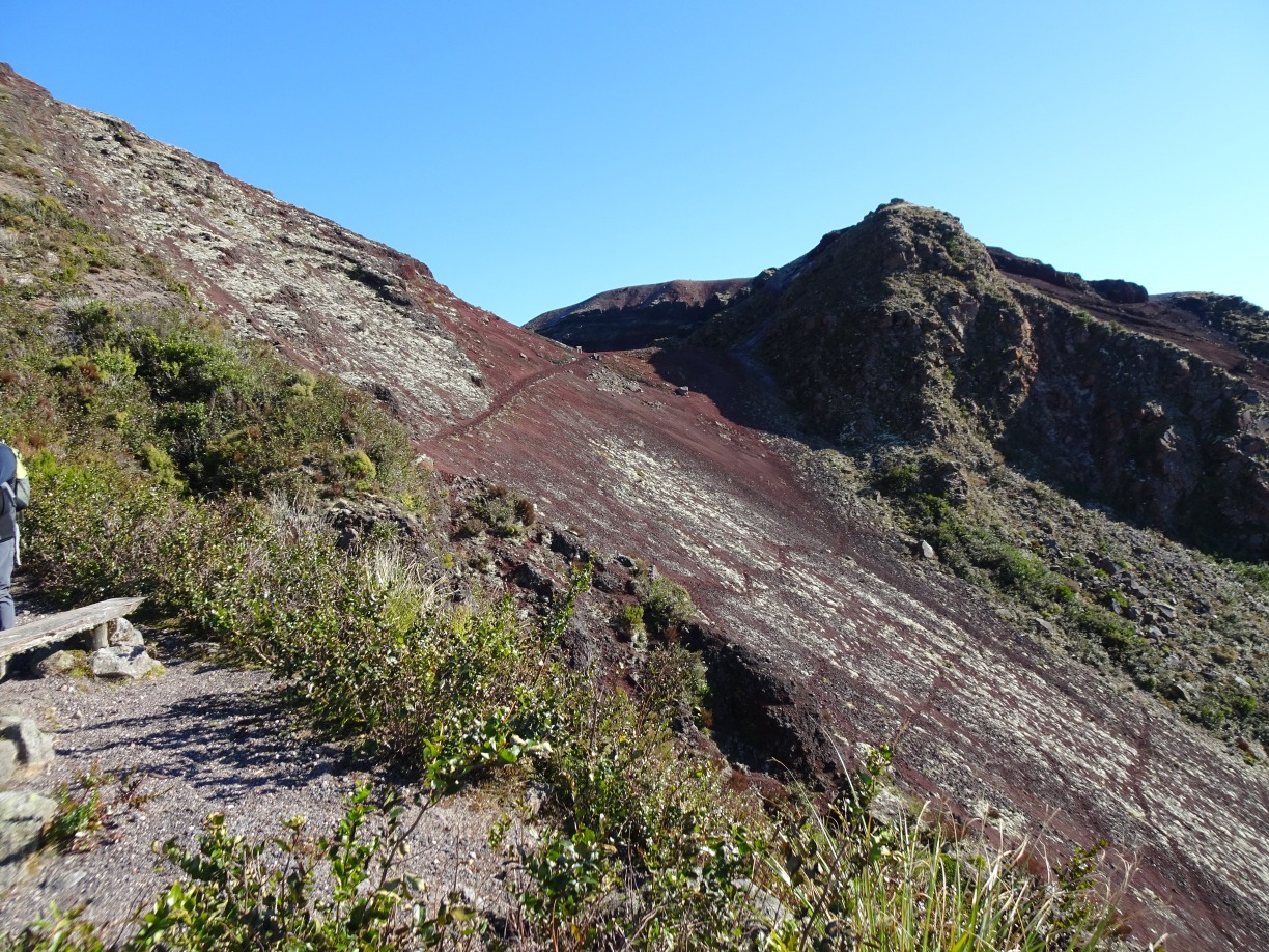
Another bench seat and a short break before traversing the track across the slope to the rock climb. Anyone not able or willing to complete the walk can return back to the bus from this point, accompanied by one of the guides.
Ascending the rock climb. The climb is quite short but also quite steep.

At the top of the rock climb, looking back at the track traversing the slope, with part of the Kaingaroa Forest in the distance.

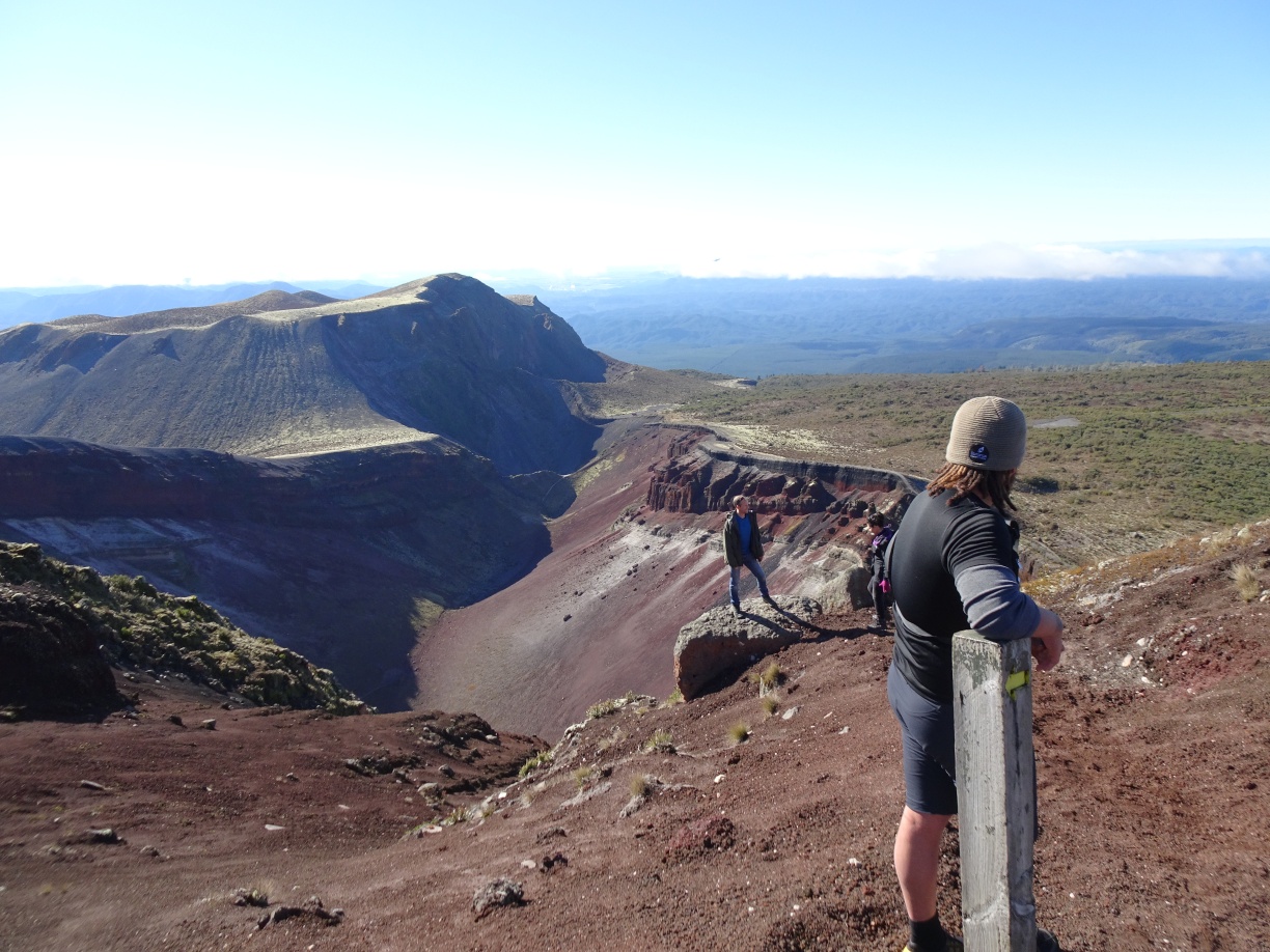
A rock platform on the crater edge is a popular spot for photos. Our Kaitiaki Adventures guide is taking a rest by the marker post.
The sign at the summit of Mt Tarawera. The GPS showed 1114 metres elevation at the geodetic marker nearby. Lake Tarawera can be seen to the right and above the sign.

On a clear day Mount Ruapehu, here with its snow cover, is visible from the summit. It was not clear enough to see Mt Taranaki on the day.

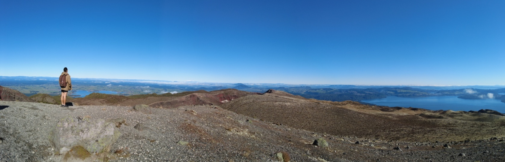
Lake Tarawera seen from the summit of Mt Tarawera.

A couple of panoramic photos from the summit. In the second panorama Putauaki/Mt Edgecumbe is mostly hidden by cloud, just to the left of centre.

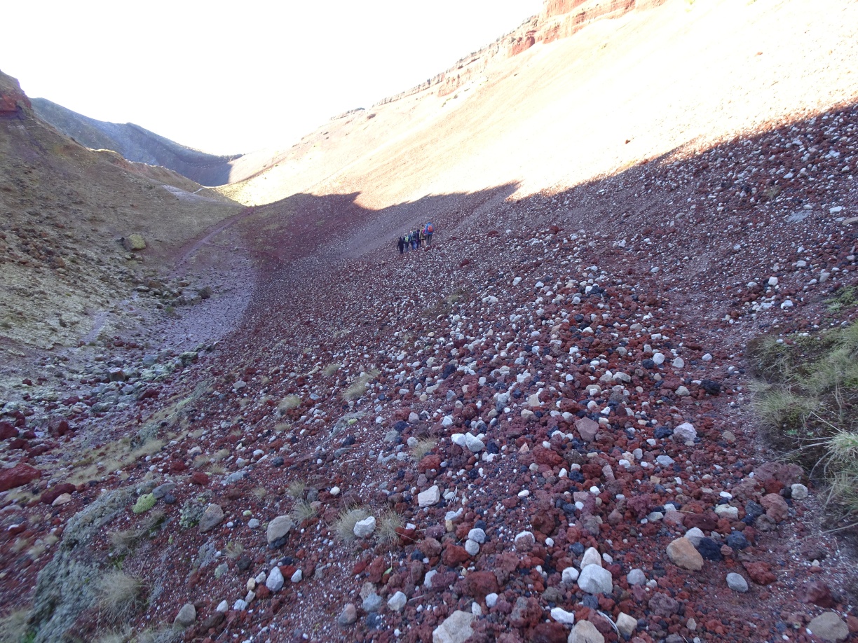
Heading down from the summit towards the steep descent, which can be seen leading down to a track at the crater floor at the lower far right.
Heading down the steepest part of the descent. Some of the group including a guide had already reached the crater floor, jumping and flying down the slope.

Our bus driver/guide demonstrates how it can be done.
Another tour guide does a longer run down the scree slope.
Our bus driver/guide showing some of the rocks of various types found in the crater.

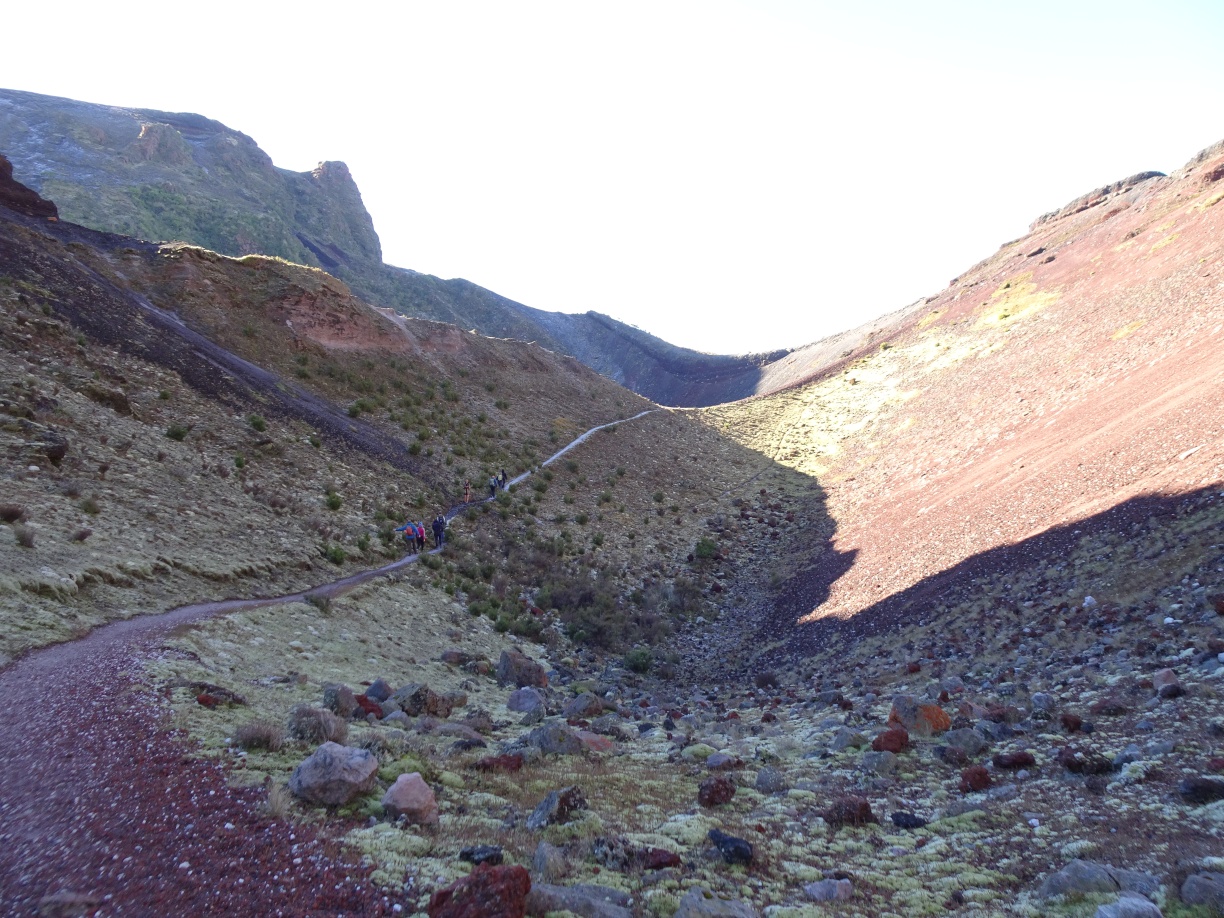
Walking along the crater floor track towards the ascent and return to the bus.
The track crosses over to the other side of the crater floor, before the final ascent visible heading up the crater wall to the right.
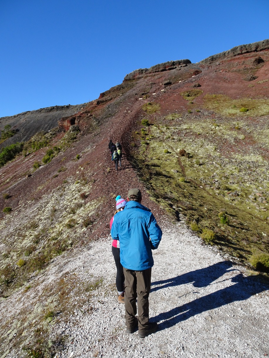
The final ascent back up to the crater rim, not far from the bus parking area. A challenge to run up the track as far as possible was met by one member reaching the fourth step seen near the top before sliding and coming to a stop.
On the return trip in the bus the clouds had cleared around Putauaki/Mt Edgecumbe. During the walk Whakaari/White Island was just visible in the distance.

The GPS tracklog shows the route followed, walking around the loop in a clockwise direction. Total time for the walk was exactly 2 hours, with a total distance of 3.1 km. Total time for the whole trip was about 5 hours, with pickup and dropoff at the Te Puia South car park. The bus route follows SH5, SH38, Rerewhakaaitu Rd, Brett Rd, and Ash Pit Rd to the mountain track entry adjacent to Crater Rd.
On other trips the walk may start at the end of the airstrip shown, and head up to the first of the benches at the edge of the crater. The bus will then be driven down to the start/end point shown, where the walk then ends. This gives a total walking distance of about 2.8 km.

The elevation graph shows the elevation changes during the walk, starting and ending at about 900 metres above sea level, and reaching the summit at 1111 metres.
The aerial image from Google Maps shows a larger area than the GPS tracklog, and includes the location of the stop on the way up the mountain. The airstrips, no longer used, are also clearly visible.

The trip with Kaitiaki Adventures was done on July 4, 2021, and again on July 11, 2021.
