Old Reservoir Road off SH2 about 1.5 km east of Paeroa is a short road, partly tarsealed, and partly a narrow gravel road. At the north-eastern end of the formed road an old ‘paper road’ continues on from a locked gate and past the old water reservoir dam. The road has once been drivable as far as the dam, but from there it continues on as an unmarked tramping track. The track does not entirely follow the paper road, which apparently continues all the way to Waitekauri Road, and there are no indications that it has ever been formed as a road.
This walk only covers about 2.5 km of the track, starting at the current formed end of Old Reservoir Road, past the old reservoir dam and a small lake to an old tin shed or hut before returning. Being unmarked the track was difficult to find in places, although there were signs that it is still being used as a tramping track. From the dam the track rises quite steeply with an initial elevation about 40 metres above sea level and with the highest points about 315 metres a.s.l.
There appears to be very little information available about the track. It has also been referred to as the Strawberry Tree Track. One of the best descriptions, although apparently quite old, is found on the Ohinemuri web site. The page also has track logs which can be downloaded, and some historical information. One map showing the actual track is Open Street Map, including a short distance past the old shed.
The last 450 metres or so of Old Reservoir Road are very narrow and unsealed, with almost no suitable places to park a vehicle. There is room for a couple of vehicles at the end of the tarseal, and the gravel part of the road is an easy walk.
The end of the tarsealed part of Old Reservoir Rd, looking back down the road towards SH2.

The gravel part of the road is narrow with no real options for parking.

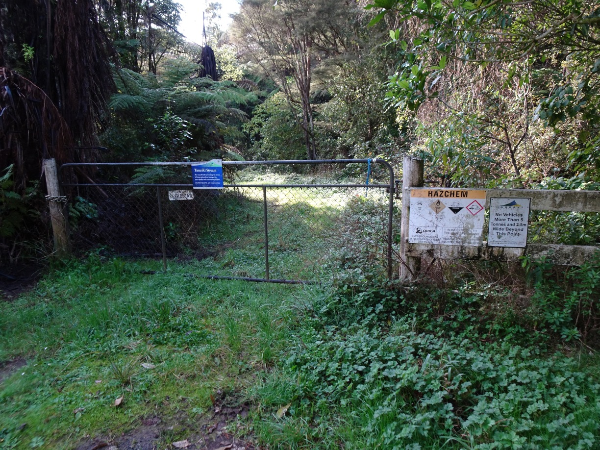
A locked gate marks the end of the formed road. A sign on the gate states that the council land surrounding the stream is being replanted for water management and conservation purposes. There’s room to walk past the left-hand gate post.
There is a ford or bridge at the first stream crossing, shortly after passing the gate.

The road as far as the dam has once been used as a road, as there are still road barriers and warning signs alongside it.


The water supply dam and reservoir.

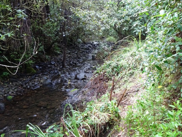
The track continuing on from the dam is very narrow in places, and close to the edge of the stream.

The second stream crossing requires some rock hopping. There had been rain about a week before the walk, but the crossing was easy.

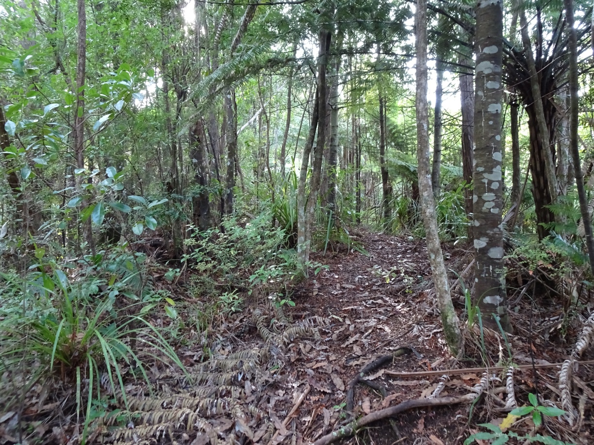
The track passes through regenerating forest all the way from the dam to the hut, and also continuing on from the hut.

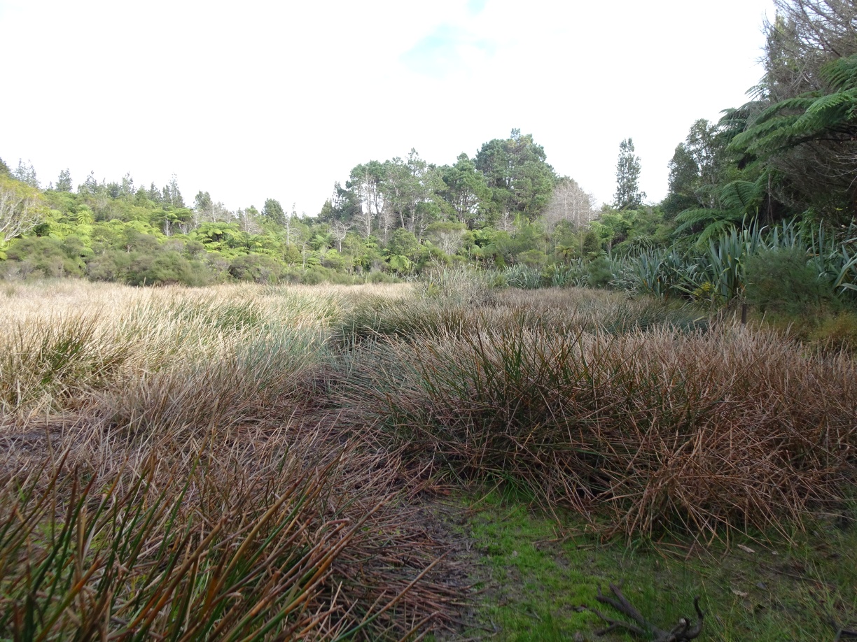
A small lake is located alongside the track. Since the tracks are unmarked, with some tracks apparently used for pest control, it can be easy to take a wrong turn and follow a wrong route. On the way to the shed the easiest track to find passed to the south side of the lake, with the lake not visible from the track. However the tracks south and north of the lake connect again shortly before arriving at the old shed.
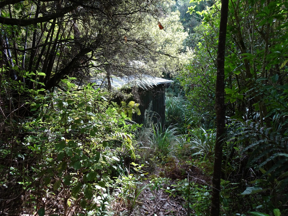
An old stove, plates and cutlery indicated that the shed had been used as a hut some time in the past.


The inside of the shed, which could provide shelter on a cold, wet day.

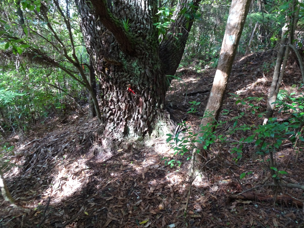
The track to the north of the lake was easy to find on the return walk, next to the large, multi-trunk pine tree.
The lake looked more like a bog than a lake.
The maimai showed no signs of having been used recently.

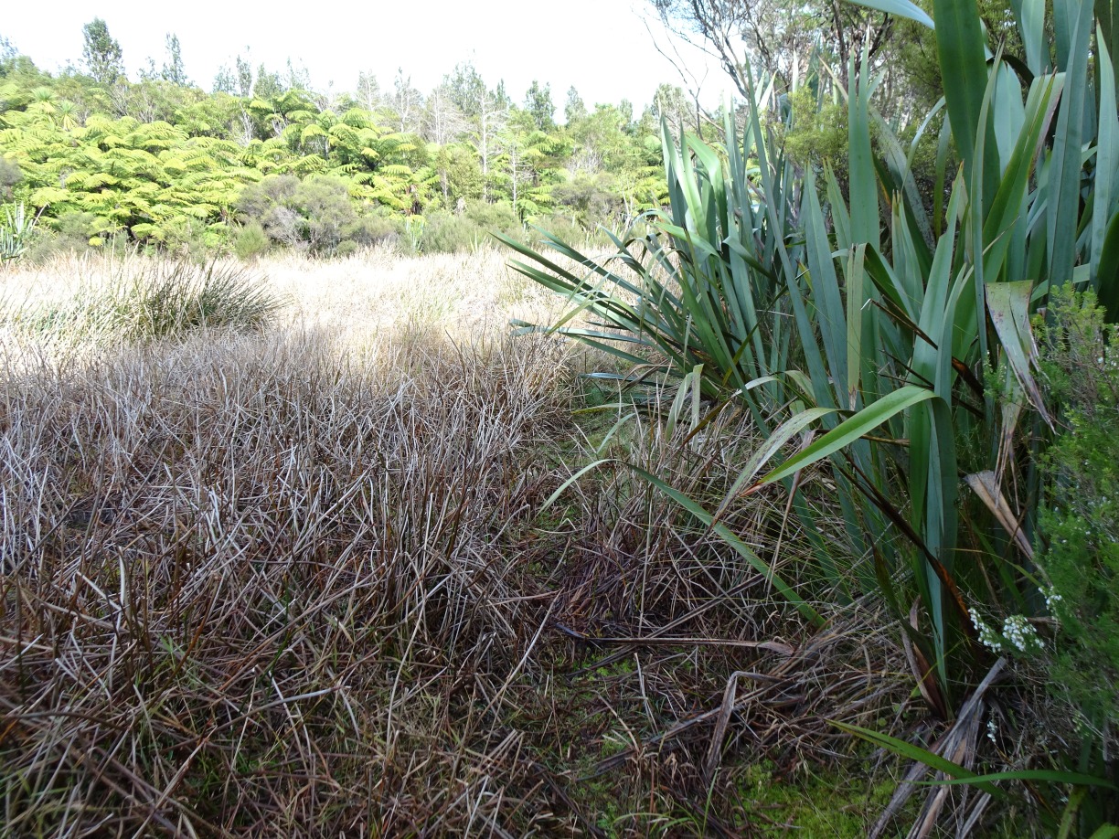
The track continues alongside the lake and the flax bushes, and shortly afterwards joins up with the track passing to the south of the lake, along the ridgeline to the left.
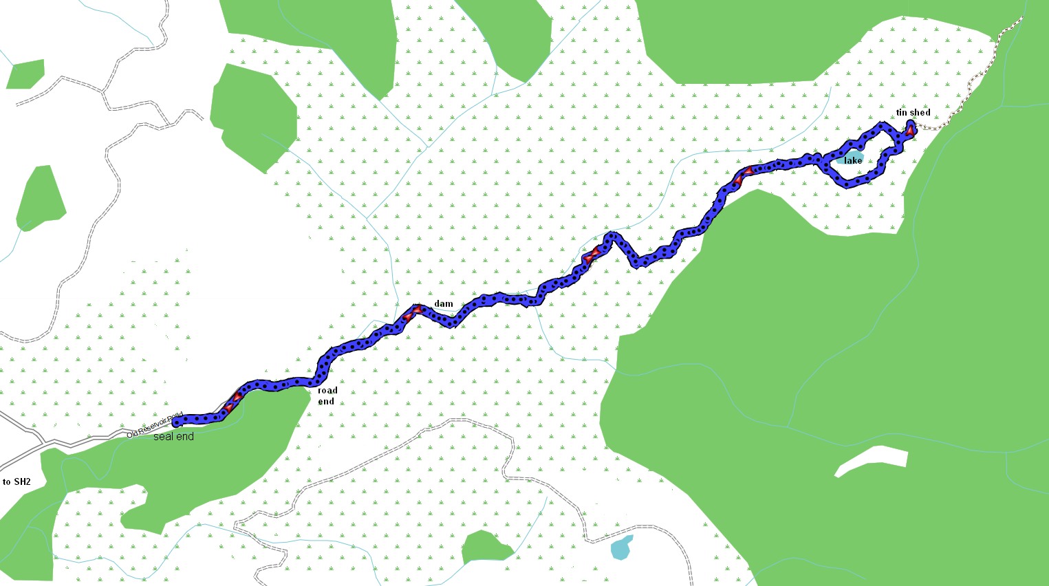
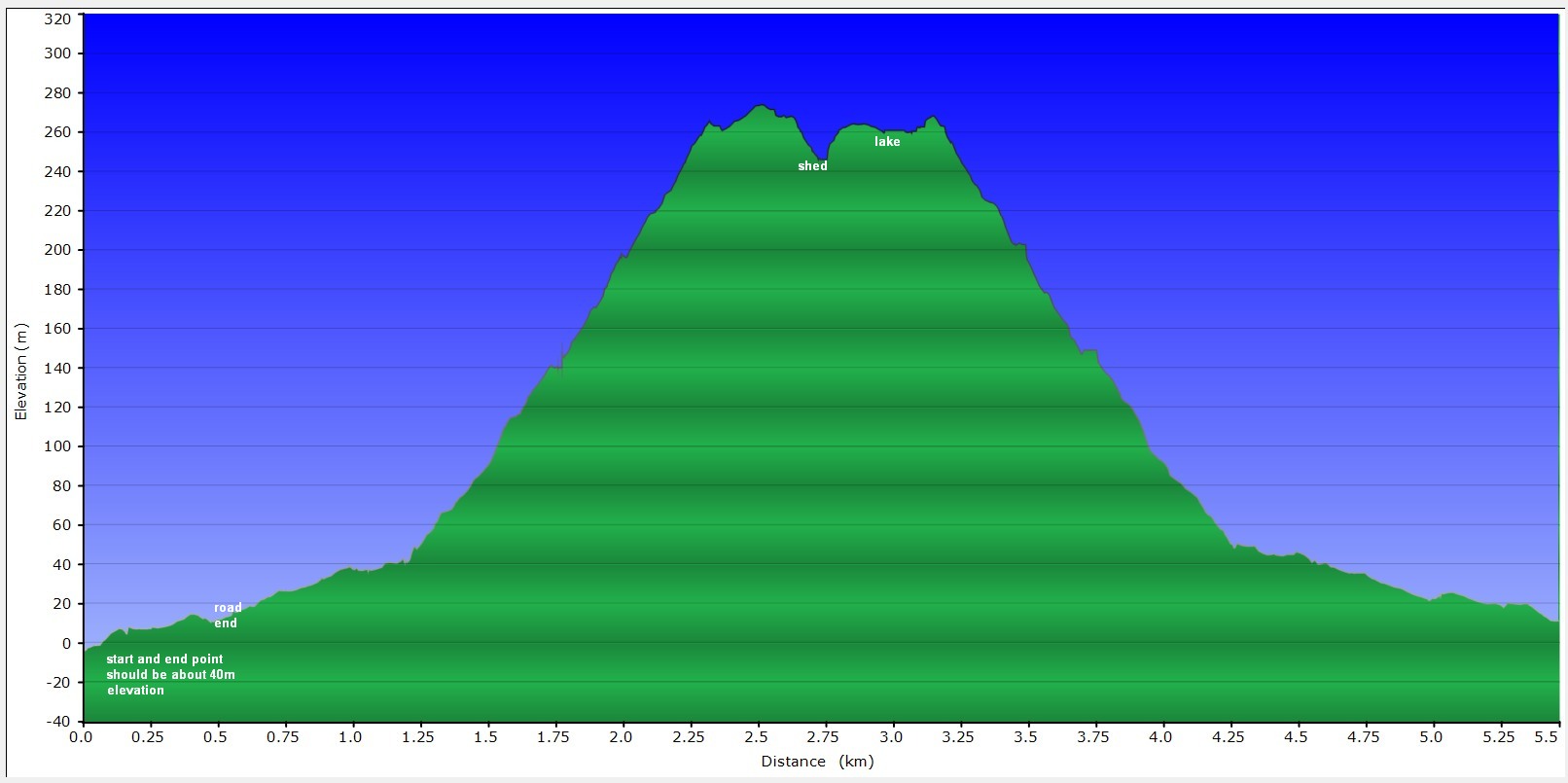
The GPS tracklog (using Open Street Map) shows the route followed. The distance from seal end to road end is about 450 metres. The distance from road end to the hut or shed is about 2.5 km, making a total distance of 5.7 km walked, in a time of 2 hours 30 minutes, using about the same time of 1 hour 15 minutes in each direction.
The elevation chart is unfortunately offset by about 40 metres due to the altimeter not being calibrated beforehand. The road is about 40 metres above sea level, and the highest point about 315 metres.
The aerial image, from Bing Maps, shows about the same area as the GPS tracklog.

The track was walked on June 5, 2021.

Hey just wondering if you had any trouble from land owners in this area?
LikeLike
No, we didn’t have any problems. It’s a very narrow road so I can imagine locals would be upset if people park inconsiderately. We parked some distance from the end of the road, and well off the road. As far as I know the road and the track is on public land.
LikeLike