Please note: This part of the Waikato River Trails has been permanently closed. Please do NOT try to access this track. Mangarewa Suspension Bridge is still accessible on a 10km long trail from the Waipapa Dam, but the trail from Waotu South Road to the bridge has been permanently closed. The cycle trail now follows a different route from Arapuni Dam to Waipapa Dam. See the Waikato River Trails web site for details.
As the web site mentions in the update dated October 1, 2020:
“The foolish minority have created a situation through ignorance and disrespect that access to parts of the Trail are now denied to the respectful and socially aware majority. The abuse of years of goodwill from the Trails farming neighbour is a sad reflection that it only takes a few people in any section of the community to unravel enjoyment for the masses.”
The Waikato River Trail stretches a total of about 100km from Lake Karapiro in the north to Atiamuri in the south. Parts of the trail are on public roads, but most of it is specially constructed walking and mountain biking track, following the Waikato River. The trail is calculated to take 3 or 4 days to cover the total length on a mountain bike, and somewhat longer by foot. Since several parts of the trail are easily accessible from public roads it is possible to walk most of it as day walks, walking each part in both directions if you don’t have other transport arranged. See the entry for the Jones Landing to Arapuni section of the trail, and also the one for the Jim Barnett Reserve section. More details of the Waikato River Trail can be found at the official trail web site.
The section from the end of Waotu South Rd to Waipapa Dam is quite long, and estimated to take about 9 hours by foot. A shorter section consists of the part from Waotu South Rd to the Mangarewa Suspension Bridge and back, about 6km each way or a total distance of about 12km. There are no toilet facilities anywhere on this part of the track, the nearest being at the Jim Barnett Reserve, about 3 km from the start.
Most of the walk is through regenerating native bush, with a shorter part along radiata pine forest, and very short stretches in open country alongside farmland. The track was not very busy, with two groups of two mountain bikers, and a family of 3 (father and two children) mountain bikers were the only others seen along the way. The family were riding the whole 100km trail over 4 days as a school holiday activity.
Waotu South Rd ends at the Rata Downs Farm, and the trail starts here, passing through farmland for a short distance before a descent to Lake Arapuni.

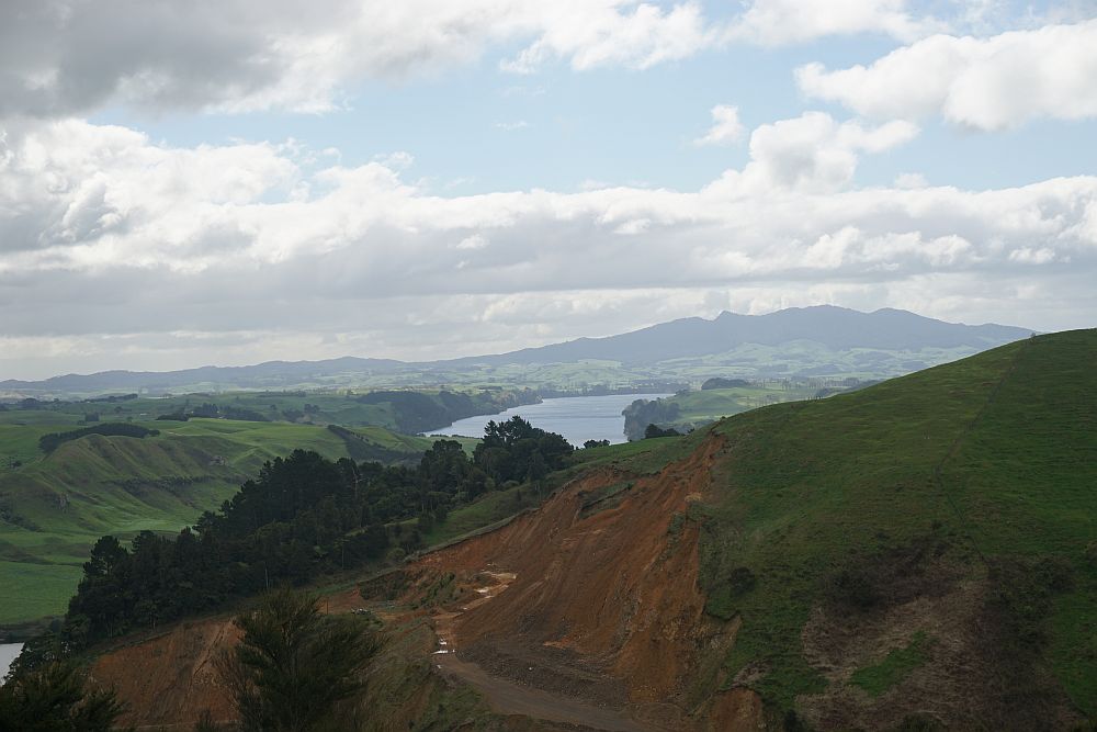
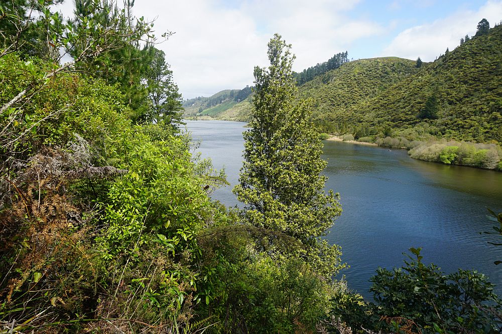
There is a height difference of about 250m between the highest point, near the start of the track, and the lowest point near the edge of Lake Arapuni. Shortly after the start the lake is visible, here with Maungatautari in the background.
 .
.
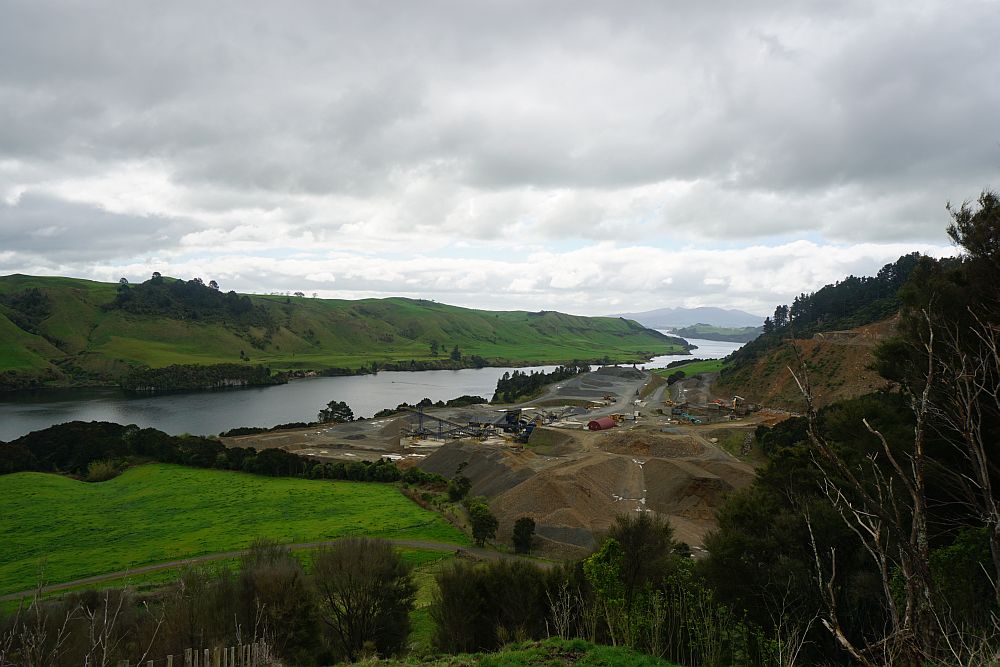
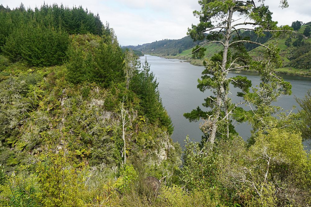
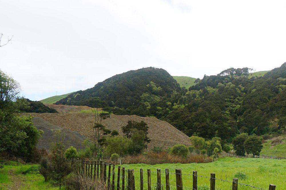
A large stone quarry next to the track is also visible for a large part of the descent at the start of the trail.
The 250m descent makes up the first part of the track, zig-zagging down the hillside on a gentle slope, suitable both for walking and mountain biking.

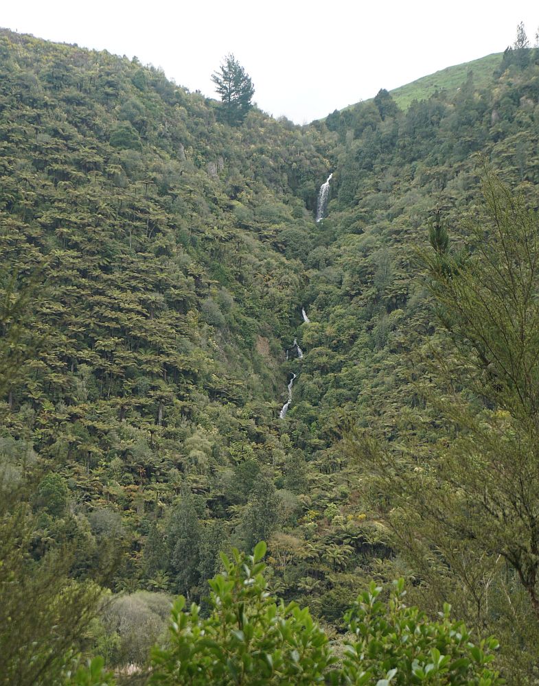
The track passes a small waterfall along the way.
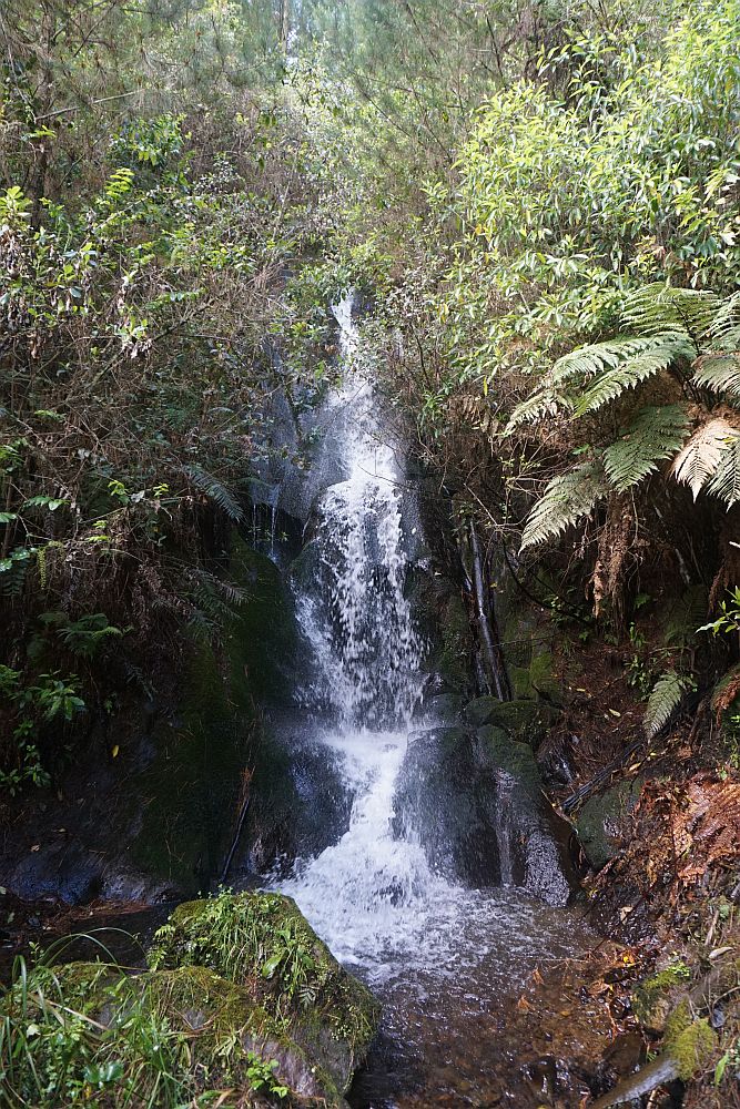
A higher waterfall, descending in several steps, is also visible on the other side of the lake.
Originally there was probably a good view from this picnic table, until the pines grew taller. Nowadays, not much view, but still a pleasant location for a break.

Nearby the lake is clearly visible.
Looking across the lower end of the gully that the suspension bridge crosses over.
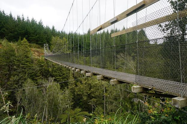
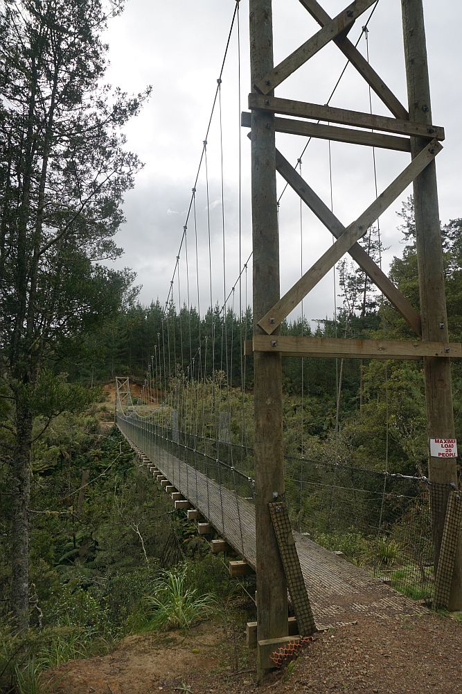
The suspension bridge crosses a deep gully. Here seen from the Arapuni end.


Looking down the gully to the lake, from the centre of the suspension bridge.

The suspension bridge seen from the Waipapa end.
The hill to be climbed on the way back is in the centre of this photo.
The track was walked on October 5, 2014. Total distance about 12km, taking about 3.5 hours in total. The GPS log doesn’t have enough detail to show all the zigs and zags on the way up and down the hill, but there are at least 30 hairpin bends on the hillside. The southern end of the log shows the location of the suspension bridge.

