The Pā Kererū Loop Walk was opened in early November 2019 after several years of work by the Mahi Boys training program, a special team who are all clients of the Bay of Plenty District Health Board mental health service. A story with details and photos can be found on the Bay of Plenty Times web site. The loop walk is located at the end of Whakamarama Road, starting from the same location as the Leyland O’Brien Tramway track and the Ngamarama Track.
The Pā Kererū track mainly follows the old Poripori and Leyland O’Brien tramlines, with very easy gradients and bridges over stream crossings. The walking time is marked as 40 minutes for the loop, starting and ending at the Bulldozer Blade Clearing at the southern end of Whakamarama Road.
The loop track was walked in both directions, first in a clockwise direction, and then anti-clockwise. In a few places there were branches in the track with no signage indicating which way to continue for the loop walk, but there were orange DoC track markers in most places. The clockwise walk took about 40 minutes, including time for photos and a couple of wrong turns. The anti-clockwise walk was 30 minutes, with a distance of 2.2 km. The photos are shown in a clockwise walk sequence.
A narrow gravel road with only one vehicle width and only a few places to meet oncoming vehicles continues on for about 1 km from the apparent end of Whakamarama Road. The road continues alongside the railing at the centre of the photo, to the left of the driveway seen heading on up the hill. A sign on the left warns of a narrow 950m long road with possible oncoming traffic.

The Bulldozer Blade clearing picnic and parking at the end of the narrow extension of Whakamarama Road.

Looking back down the road, across the picnic area, with the old bulldozer blade visible at picture centre. The entry for walking the loop track in an anti-clockwise direction is off to the left of the photo.

The entry for walking the loop in a clockwise direction is from the car park, by the sign on the left. There is a basic DoC toilet off to the right.

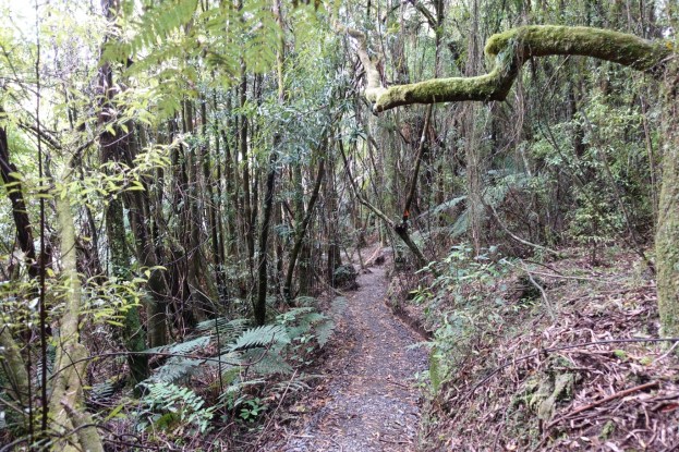
Parts of the track have a gravel or stone chip surface, but most of the track is normal forest track with earth surface, with a few muddy spots on the tramline sections.

Part of the work program by the Mahi Boys has been construction of bridges over the stream crossings.

One of the first intersections is 4-way, with one heading sharply backwards to the left, one at about a right angle to the left, and the Poripori tramline straight ahead. The sharp left one is the old track to the Leyland O’Brien tramway, joining up later with the Pā Kererū loop. The right angle left is the loop walk, and the one straight ahead leads back via the tramline to the parking area.

Looking back from the continuation along the tramline the two tracks branching off, now on the right, can be seen clearly.

The sign at the intersection only shows one direction for the loop walk. The other direction is the one shown as Leyland O’Brien Tramline Track.

The track intersection where the Leyland O’Brien tramline track branches off to the left. This intersection is clearly marked, with the sign on the left pointing back along the loop track.

The sign seen on the right in the above photo has clear directions to other tracks and to a continuation of the loop walk.

The Leyland O’Brien part of the loop walk crosses over some wet areas, with a new bridge constructed near the intersection.

The boardwalk further on is an older construction across a swampy area.

There are some small cuttings on the tramline route, where the tramline cuts through some low hills. The tracks in these cuttings can be muddy at times.

The intersection where the Ngamarama Track branches off from the loop track. From here it’s a 4 hour walk to the recently constructed hut, Te Whare Okioki, on the North-South Kaimai ridgeline track.

A bench seat provides a resting area along the loop track, with views across a small valley.

The exit point from the loop track when walking in a clockwise direction, and the entry point for anti-clockwise. This is at the picnic area in Bulldozer Blade clearing.

Another entry at the picnic area between the two entry points to the loop track follows the Poripori tramline, joining with the loop track at the 4-way intersection shown earlier.

The Pā Kererū Loop Walk is about 2.2 km long, and is signposted with a walking time of 40 minutes. The clockwise walk took about 40 minutes, including a couple of wrong turns and time for photos, with the anticlockwise walk with no stops took 30 minutes. There is only a height difference of about 20 metres between the highest and lowest points of the loop track. No kereru were seen on the walk, but one was heard flying and there was birdsong from tui and others along the way.
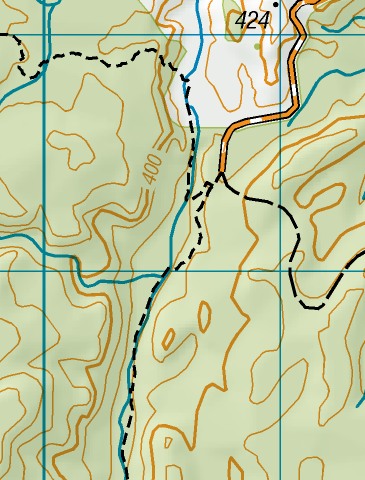
The GPS tracklog map shows the loop track route.

The aerial image, from Google Maps, and the topographic map show approximately the same area as the GPS tracklog map.

The track was walked on November 16, 2019.
