The Rotorua Walkway is a 26 km long walkway in Rotorua, broken up into 8 shorter sections. The walkways are described in the brochure Rotorua Walkways available on the Rotorua Lakes Council web site, under the Brochures heading. This walk covers the section named Utuhina in the brochure. It follows the Utuhina Stream for most of the way between Old Taupo Road near Pukuatua Street and the entry to Rotorua Tree Trust Centennial Park, on Kotuku Street, off Kiwi Street and Otonga Road. Two side tracks off the Rotorua Walkway, one of them joining Utuhina Walkway, were described in the previous post, Mangakakahi and Otamatea walkways, Rotorua.
The walkway passes through parks and reserves, with parts of it along urban streets. Some parking is available at Centennial Park at the southern end of the walkway, and on Mataatua Street at the northern end. There are no toilets by the walkway.
This walk was done starting at Centennial Park and ending at Old Taupo Road, with a bus from there back to Otonga Road next to Kiwi Street. Total walking distance, not including the wrong turns along the way, was about 6.5 km, with a total time of 1 hour 45 minutes, including about 10 minutes following wrong tracks, mostly in the Tihi Road Reserve.
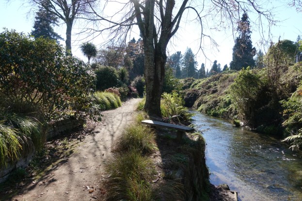
The parking area at Centennial Park. The Rotorua Walkway continues through the park from the gates at photo centre.

The entry to the short single-lane driveway to Centennial Park off Kotuku Street is partly hidden. It branches off the end of the street, running alongside the wooden fence on the far left.

The first part of the walk is along Kotuku Street, turning left onto Kiwi Street, and then crossing diagonally over Otonga Road to enter Jackson Park alongside the school. There is no marked track through the grass area, but it runs alongside the school and either left or right of the taller row of trees seen just left of centre.

The route continues down a sloping section, here to the left of the row of trees seen on the right.

There is a skateboard bowl near the lower end of the slope. Here looking back with the top of a school building just visible on the far left.

The route then crosses a small bridge at the bottom of the valley and then heads up the other side to McDowell Street.

Heading up the slope after crossing the bridge there is a marker peg showing that this is part of the walkway.

Almost directly across McDowell Street from Jackson Park the route runs along Simmonds Crescent for about 50 metres before the entry to Tihi Rd Reserve, seen between the two hedges.

There are several alternative tracks through Tihi Rd Reserve, including some wrong ones, and the reserve has several entries off Tihi Road. This walk followed some walkway signs, heading towards the southern end of the reserve, before returning and crossing over one of the tracks leading across the valley. It branches sharply to the right not far from this row of trees.

One of the entrances to Tihi Rd Reserve on Tihi Road. The route then runs north along Tihi Rd to the intersection with Springfield Road. Turn left and follow Springfield Road. Follow Springfield for about 360 metres until the bridge across Utuhina Stream.

Just before the bridge Springfield Road becomes Pukehangi Road. The walkway branches off to the right immediately on the far end of the bridge.

The walkway entry, by the bridge on Pukehangi Road over Utuhina Stream.

Coming down the steps from Pukehangi Road the walkway continues straight ahead, but there is apparently a walkway continuing under the bridge and heading south alongside the stream.

The track runs alongside Pukehangi Stream, with Springfield Golf Course on the other side of the stream, and Devon Street behind a row of houses on the left.

On the map in the walkway brochure the track takes a loop through the trees on the right, following the stream. However it loops around and comes back through the same location before exiting onto Devon Street by the trees on the far left.

The route then follows Devon Street for about 500 metres, with the stadium and Ray Boord Park sports grounds on the left before reaching the stream once again. The track then enters across the road alongside Ray Boord Park, between the trees left of centre.

The Ray Boord Park sports grounds are on the left, Mt Ngongotaha at the centre, and the walkway with Utuhina Stream on the right.

The track turns away from the park, and drops down to follow Utuhina Stream.

The walkway continues under the bridge on Malfroy Road, although it is also possible to cross over the road instead.

After crossing under or over Malfroy Road the route continues through a grass area before continuing as a formed track, as seen to the left of centre.

The walkway continues alongside the stream, across Wrigley Road Reserve. Mt Ngongotaha is again visible.

From Wrigley Road Reseve it is possible to exit onto Wing Place, but the track continues past the rocks and through a grass area before coming to Harold Crescent.

The exit onto Harold Crescent.

After only about 20 metres along Harold Cres the walkway branches off to the right alongside the hedge at the far end of the grass area.

The walkway then continues alongside Utuhina Stream, with residential housing on the left and the stream on the right. There are occasional markers showing the walkway route.


A bridge on the walkway crosses over the Otamatea Stream, a tributary of Utuhina Stream, shortly after the junction with Otamatea Walkway. For the exit at the end of Utuhina Walkway onto Old Taupo Road see the post about Otamatea and Mangakakahi walkways, Mangakakahi and Otamatea walkways, Rotorua.

The GPS tracklog shows the route followed, starting at the southern and and ending at Old Taupo Road. The total distance for the track as shown is 6.5 km, with a walking time of about 1 hour 45 minutes, including about 10 minutes following wrong tracks.

The aerial image, from Google Maps, shows the same area as the tracklog.

The track was walked on June 29, 2019.
