Lake Okaro, situated near SH5 and SH38 between Rotorua and Taupo, is the smallest of the Rotorua lakes under public management. The lake has had poor water quality due to runoff from surrounding farms, but efforts have been made in recent years to improve the water quality, so that it can now be used for recreational use. The lake is adjacent to Okaro Road, off SH38 near the intersection with SH5. There is a campground, a boat ramp, and public toilets by the lake and Okaro Road. Te Ara Ahi, the thermal cycleway, passes by the lake on Okaro Road.
There is a walkway of about 2.3 kilometres around the lake, with a nominal time of 1 hour. The walkway follows the lake edge, with only relatively easy gradients on some smaller climbs. Vertical height difference is only about 20 metres for the track. About one quarter of the track, on the north-western border, is wheelchair accessible according to the signage. There is a charge for overnight camping, payable at the Rotorua i-Site on Fenton Street.
There is a short description of the lake on the Rotorua Lakes Council web site. A more detailed description can be found on an information panel by the lake. The information panel reads, in part: “Lake Okaro is a special little lake but not that long ago it was all but dead. Sediments and nutrients from the surrounding farmland made the water unfit for most wildlife and algal blooms were common – it wasn’t a place you’d want to go walking and fishing was out of the question. But in recent years Rotorua District Council and Environment Bay of Plenty have been working hard to reverse the damage.”
The lake is now used for recreational purposes such as boating, water skiing, and fishing. There is a campground alongside the lake by Okaro Road, with parking and public toilets available. An area of wetland has been created nearby to filter some of the water running into the lake.
The walkway around the lake is about 2.3 km long, and is shown as taking one hour. This walk, in a clockwise direction from the campground, took 40 minutes.
Lake Okaro Reserve, with the campground on the left and behind the trees, and the boat ramp hidden behind the signs on the right.

The cycleway Te Ara Ahi runs along Okaro Road past the campground, lake, and toilets. The original toilets were closed, and replaced with temporary portable toilets.

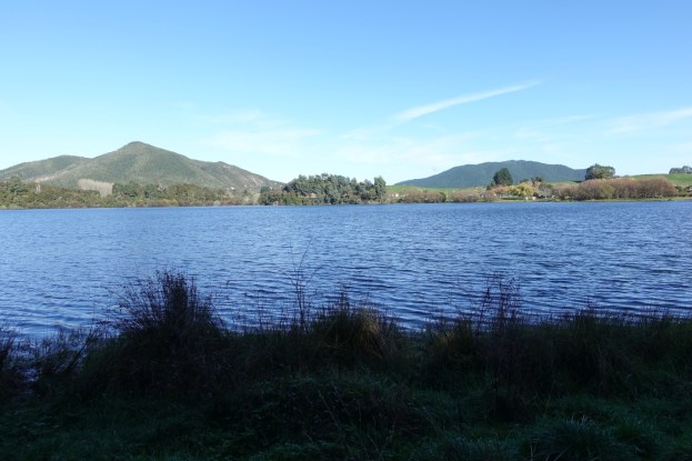
Looking from the campground past the boat ramp, with Maungakakaramea (Rainbow Mountian) to the right of centre.

A map of the lake and walkway on the information panel by the campground. Note that north is to the left, not to the top of the map.

The start of the walkway, in a clockwise direction, with a small boardwalk where water runs into the lake from the wetland area, and the information panels.

A local community group assists with restoration of the area and the wildlife. This is part of the track, on the right, accessible by wheelchair.

Looking across the lake with Maungakakaramea at 743 metres high on the left, and Maungaongaonga at 825 metres on the right.

The end of the wheelchair accessible part of the walkway. The track narrows and heads up a small rise to the first of the lookouts.

The first of the lookouts by the walkway.

The view across the lake from the lookout.

The walkway continues across an open grass area, with farmland on the left and the lake behind the vegetation on the right.

The second of the two lookouts.

The track crosses a small stream before narrowing and entering and area with regenerating native vegetation.

The track rises and falls as it passes through the taller vegetation. It is marked with clear markers, not the normal orange DoC markers.

The track exits onto Okaro Road. There is about 400 metres of track alongside the road back to the campground.

Looking back from Okaro Road, the track heads down to the left beside the tall wattle trees.

Looking across the lake towards the Waimangu thermal area at the northern end of Okaro Road. The steam from the thermal area can be seen. The campground is on the far left edge.

Returning to the campground along Okaro Rd, looking north.

The walkway has a total length of 2.3 km, and took 40 minutes for the walk, including time for photos. The GPS tracklog shows the route followed, and the lake location relative to SH38.

The aerial image, from Google Maps, shows the same area, with the lake clearly visible.

The track was walked on June 9, 2019.
