
Marawaiwai Scenic Reserve is located about 10 kms or a 10 minute drive south of Opotiki near the end of Harrison Road. A short, easy loop walk leads through native forest alongside a small stream. The reserve is at the northern end of Waikerea Forest. The track was built by Opotiki College students and is managed by DoC. The DoC web site has a short description of the track and of the reserve.
There is a small raupo wetland in the reserve. On the day this walk was done the birdsong was about the loudest and most persistent I’ve experienced, with kereru and tui as well as several other species very active in the trees.
The reserve entry is about 2km down the gravel Harrison Road, off Warrington Road. A few vehicles can be parked on the grass verge of Harrison Road, but there is a drain with a boardwalk across it between the road and the reserve entry, so some care is required. By the entry there is a grass area with a few large trees, a picnic table, and a toilet to the left hidden behind some trees.
The entry to Marawaiwai Scenic Reserve, near the end of Harrison Road. The boardwalk across the drain can be seen at the lower edge, and the entry gate to the right. The basic DoC toilet is behind the trees on the left.

The entry to the track is off the grass area, on the far right within the shade from the trees.

The entry to the track. It is marked as being a half hour walk, although it is only about 700 metres long, and an easy walk. There are no steps on the track, but there are two bridges crossing the stream with small steps on and off the bridges.

A few metres from the entry the loop track begins, with the first bridge on the left. This walk was done in an anti-clockwise direction by taking the track on the right.

The second bridge, with the small stream running through the reserve.

The track is well formed, and is marked with orange DoC triangle markers.
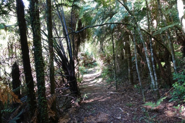
Unfortunately all the plant identification plates have been removed, leaving only the pegs where they were placed, as seen at lower left.

The GPS tracklog shows the location of the track relative to SH2, Warrington Road, and Harrison Road. The track, from reserve entry and back, is about 700 metres long, and took just under 15 minutes to walk, including time for photos. There are only very gentle inclines on the track. The most memorable feature of the walk was actually the impressive birdsong which could be heard all the way around the track.

The topographic map excerpt shows the same area as the tracklog, with the track and the Waikerea Forest shown.

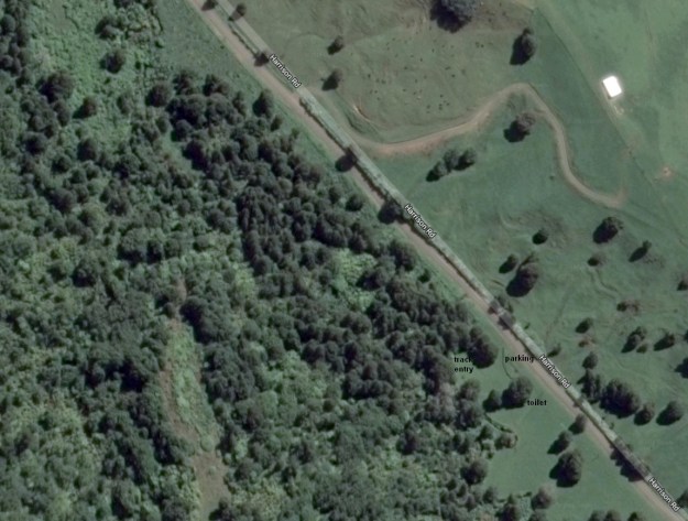
The aerial photo, from Google Maps, shows only the part of the scenic reserve with the track.
The track was walked on April 14, 2019.
