The TECT All Terrain Park is located on Whataroa Road, off SH36 (Tauranga Direct Road) between Tauranga and Rotorua. Numerous activities are catered for in the park, with the area west of SH36 covering non-motorised activities, such as horse riding, mountain biking, hiking, model aeroplanes, shooting, and dog exercise. Details of the park can be found on their web site. Various maps can be viewed or downloaded from the maps page on the site.
The Te Rerenga Trail and Lost Tank tracks in the park have been covered in a separate post. This post covers the tracks to the radio repeater site with a lookout, with extensive views of the surrounding area.
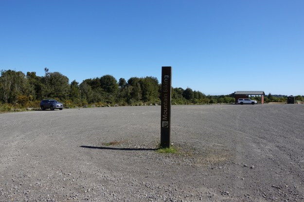
The walk starts at the mountain bike hub parking area at the end of Mangakopikopiko Road. After turning off SH36 onto Whataroa Road take the first turn left onto Weld Road, then turn right at the end of Weld Road onto Te Ara Raho Road, which continues onto Mangakopikopiko Road. At the end of the road is the carpark with a shelter and a toilet, shown on the far right. The track to the lookout starts at the far left.
In the shelter there is an map of the area with some of the tracks marked. The track to the repeater site is very clearly marked.

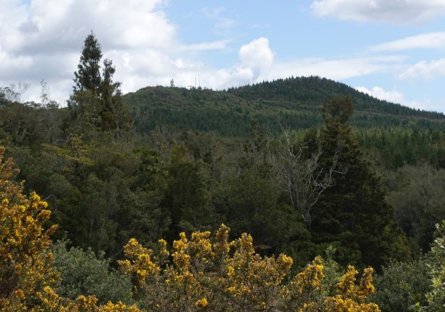
The two radio repeater masts are visible from the carpark, on the horizon just to the left of centre.
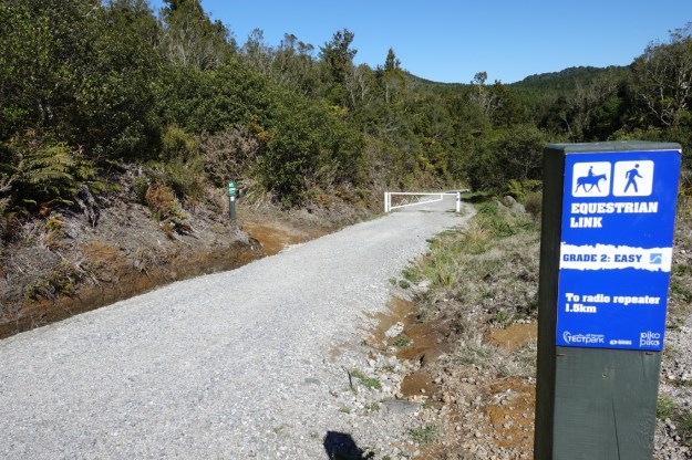
The start of the track, which is actually a forestry road, by the carpark. The Lost Tank Track branches off by the marker post to the left of centre. The Equestrian Link sign is probably in the wrong location, as the shortest route to the radio repeater from here is about 2.8 km, not 1.5.
The track winds its way downhill for about 500 metres through native forest, before reaching the lowest point and a bridge across a stream. The track is shown on park maps as the Buffalo Girl Track.

The bridge at the lowest point of the track.

The small Upokokotio Stream under the bridge.
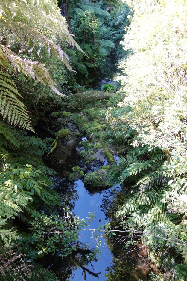
Looking back across the native bush-clad valley with the Upokokotio Stream running through it.

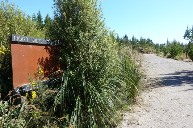
The track ascends on the other side of the valley, to reach the equestrian link track at the North West Trail Head. The right-hand track leads to the equestrian area.

The sign at the North West Trail Head is getting overgrown. Presumably the panel had some information on it at some time in the past.
The park map shows a lookout a short distance from the North West Trail Head. A recently bulldozed track branches off to the left about 20 metres from the trail head junction, in an area with recently planted and pruned pine trees.
Coming up the track the short track to the lookout is easily overlooked. It does not appear to get used very often.

There could be a good reason for the lack of use – there is no view from the lookout. Note – see the comments at the end of this post. Vegetation has been cut back, and there are now views from the lookout once again.

Continuing up the track from the trail head there is a branch of the Buffalo Girl track off to the left which is marked as not allowed for horses or hikers.
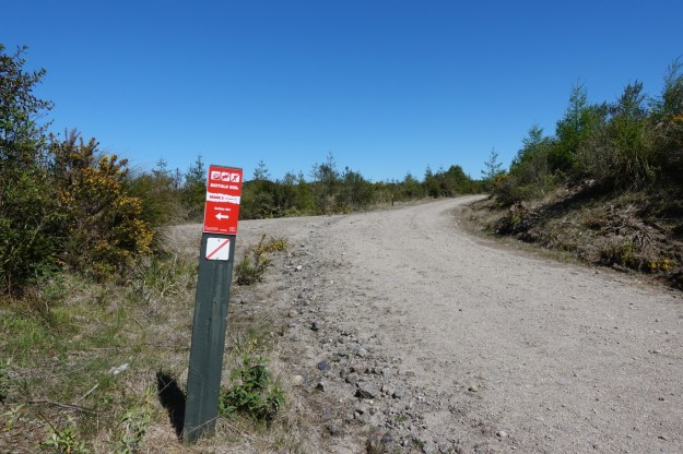
The sign on the far side of the branch track intersection, leading to the radio repeater and lookout also indicates that hikers are not allowed. Again, this is perhaps a mistake, as there is no reasonable alternative track for hikers to reach the lookout.

The next signpost allows hikers again. The Buffalo Girl Track branches off sharply to the left. The right hand track continues a short distance up to the radio repeater site and the lookout.

The radio repeater, with the track on the right continuing on to the Lookout Drop mountain bike descent track.

Adjacent to the repeater there is a small enclosure, presumably intended for horses, as it is next to the end of the Mustang equestrian track, which continues down the hill behind the enclosure. There is no signage at the repeater site except for the post with the bike trail grade information.

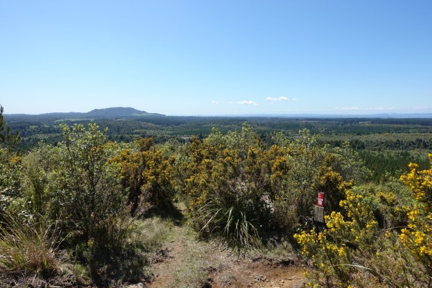
There are extensive views from the radio repeater site. The peak to the left of centre is Otanewainuku. The Lookout Drop mountain bike track starts by the signpost on the right.

In a northerly direction Mt Maunganui/Mauao can be seen clearly to the left, with a faint outline of Mayor Island/Tuhua in the distance to the right of Mauao.

A lookout on the nearby summit of Puwhenua (622 metres above sea level) is just visible from the repeater site. The repeater is at about 580 metres asl.

The same road/track was followed back to the carpark, with short walks down the two side tracks shown on some of the photos to show their locations on the GPS tracklog. After leaving the valley with native forest most of the track has no shade. At least until the recently planted pine trees grow taller.
The tracklog shows the tracks followed, starting and ending at the carpark on the far right, and with the radio repeater and lookout to the left of centre. Time was spent looking for the lookout with no views by the North West Trail Head. The times and distances (excluding the North West Trail Head lookout) were:
Carpark to radio repeater direct: 2.9 km, 42 minutes walking time.
Radio repeater to carpark, with a couple of short side tracks: 3.2 km, 41 minutes.
Not a single mountain biker, horse rider, or hiker was seen during the walk, despite being done on a Sunday with fine weather and the last day of the school holidays.

The elevation graph shows the elevation along the track, being symmetrical with the same tracks followed on the upward and downward sections.

The aerial photos of the area on Google Maps are quite old, so do not show much of the TECT All Terrain Park facilities. The location of the Mountain Bike car park and the radio repeater site are marked.

The tracks were walked on October 14, 2018.
How to get lost in the TECT All Terrain Park
The tracks within the park boundaries are not shown on current topographic maps, or on any of the other maps that I could find, apart from the ones in the park brochure and in the shelter shown near the start of this post. The track routes are quite coarse and can be slightly misleading. This is an excerpt from the map in the park brochure, which I was using as my guide.

For some reason I was convinced that I was following the track shown as Galaxy (which apparently no longer exists) to the radio repeater site. And on the map it looks as if the tracks to the left (which is actually north) and below the repeater continue on past the repeater. The track/forest road does continue past the repeater, and with no signage it seemed natural to try following it. Someone had even scratched a very prominent arrow on the road pointing in that direction. But after walking on forestry roads with no signs at all for some time it became clear that the best way of getting back to the carpark was to retrace my steps back to the repeater and then follow the original route back down. It’s a large area, with roads not very far from the boundary of the park, but with no apparent connections to the park tracks. The total walk turned out to be just over 14 km, instead of about 6 km. The extras are not shown in the tracklog.
The two tracks leading down and to the left of the repeater site on the map are actually a single track, until the leftmost one branches off as shown on the far left hand side of the tracklog. The track to and from the repeater site is the one shown just to the left and below the Galaxy text, and not the Galaxy track itself. The other track shown branching off at the lower edge of the tracklog is the one shown on the map just below the lower end of the Galaxy Track.
On the brochure map the Mustang track is shown as ending at the repeater site, but it’s not shown on the information panel map. In a couple of places the Mustang horse trail is shown as an alternative hiking track to the radio repeater site, but this would be a somewhat longer alternative. It’s shown as 3.6 km from the North West Trail Head.

As of last week in Jan 2019, there are once again views from the Look Out! All the Gorse and undergrowth have been cut back.
LikeLike
Thank you for the update. I appreciate receiving updates and corrections to any of the blog entries.
LikeLike