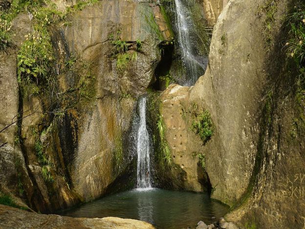
William Wright Falls is a 28m high waterfall in the Orokawa Scenic Reserve, accessible only by a tramping track from Orokawa Bay. The Orokawa Stream runs down the cliff face before plunging into a small pool partway up the face, and another fall into the stream bed. The track and falls should not be accessed during and immediately after heavy rain, as the track follows the stream bed for most of the way. It was closed for a year or more after the original track was washed away after heavy rain.
The track is a side track to the Orokawa Bay to Homunga Bay track, and can be done as part of that walk, adding betweeb an hour and 90 minutes to that walk. Or it can be combined with a walk from Waihi Beach to Orokawa Bay for a shorter time and distance.
Since the Orokawa Bay to Homunga Bay track has been described in a separate post, this one will mainly cover the walk from that track to the falls and back again. See the other walk post for details about parking and toilet facilities.
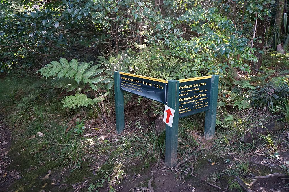
The William Wright Falls track joins up with the Orokawa Bay to Homunga Bay track at the northern end of Orokawa Bay. The sign indicates a time of 40 minutes each way.
The track now follows and uses the dry part of the stream bed for most of the way to the falls. Only short parts of the original track are still used. The track is uneven, and can at times be difficult to locate. There are about 21 stream crossings each way, but normally these can be done with dry feet by stepping across on rocks. This is the first crossing.
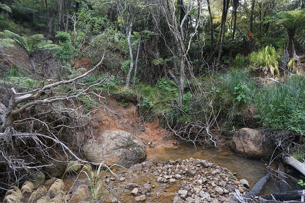
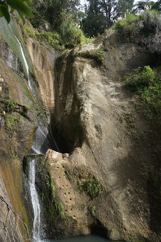
It’s obvious from rocks and debris that the small stream can become a torrent after heavy rain.


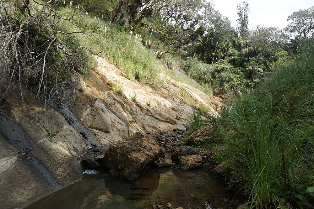
Small tributaries running down cliff faces along the main stream add to the water flow.
The falls themselves are on a branch of the main stream, appearing soon after the fork in the stream.
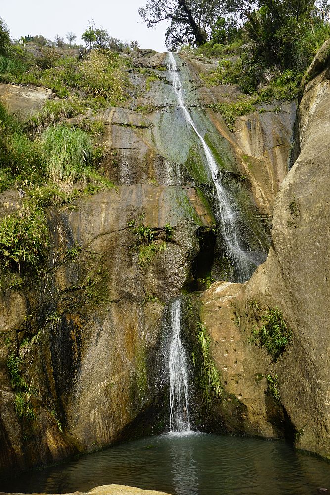
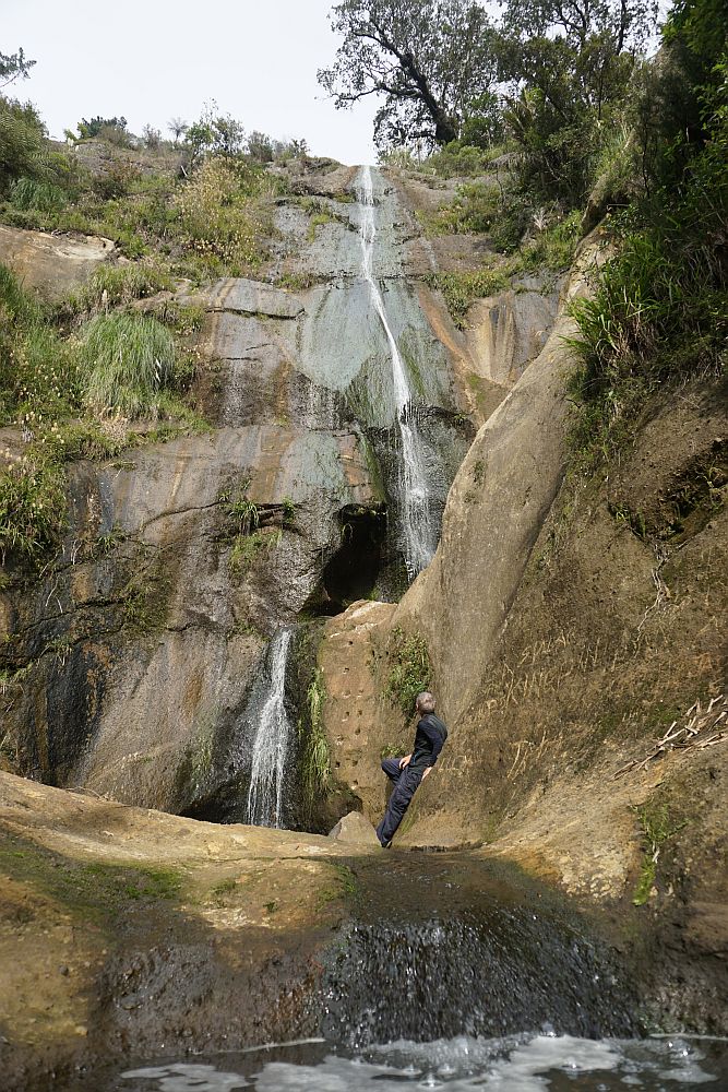
There is a small pool in the cliff where the first fall ends. It is only accessible by the steps cut into the rock. The climb to the pool does not exactly look safe.
Some of the stream crossings are well marked. In other places the track markers can be difficult to locate, and with an overgrown track it’s easy to take a wrong turn in places.

Although there are plenty of rocks and stones available, this was the only ‘rock pyramid’ seen along the track. A large part of the track is overgrown with the ‘cutty grass’ (pampas grass or toetoe) seen her. Some of it head high. It can produce some nasty cuts on exposed skin if rubbed the wrong way.

Back at Waihi Beach a fisherman stands on the rocks at the northern end of the beach.

While another comes straight out of the sea and drives in the Sealegs boat up and onto the trailer waiting at the parking area.

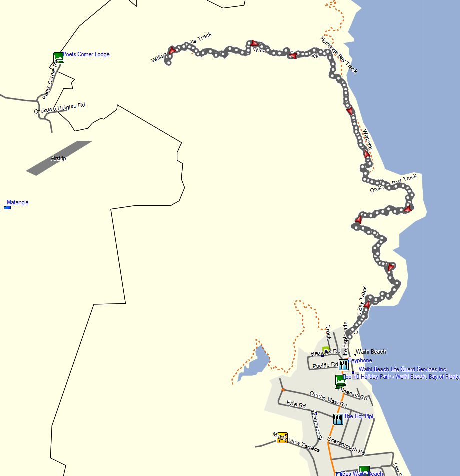
The GPS tracklog shows the walk from The Esplanade at the northern end of Waihi Beach along the Orokawa Bay track and then to the William Wright Falls and back again. Total distance about 9.6km, and total time 3 hours 20 minutes, including time for a lunch break at the falls. From the Orokawa Bay track to the falls is about 1.4km each way, and the walk up to the falls took 40 minutes, with 32 minutes being required on the return along the same track due to fewer wrong turns.
The track log is from a walk on May 5, 2015. The track was also walked on February 16, 2011, before it was partly washed away and temporarily closed.
