
Note: Please see the comments and the DoC web site, which state that the track has been closed to prevent the spread of kauri dieback disease.
Ananui Falls, in the Kaimai-Mamaku Forest Park, is a 106m high waterfall accessible from Woodland Rd, a few kms north of Katikati. Woodland Rd, previously known as Woodlands Rd since it was originally intended to be joined up with Woodlands Rd off Old Tauranga Rd south of Waihi, joins up with SH2 about 4 km north of Katikati. The parking area is at the end of Woodland Rd, with the last kilometre of the road being a narrow gravel road.
There are numerous stream crossings along the track, some of which may be difficult after heavy rainfall. Unfortunately there appear to be no good lookout points for viewing the falls, but the top of the falls are easily accessible from the track.
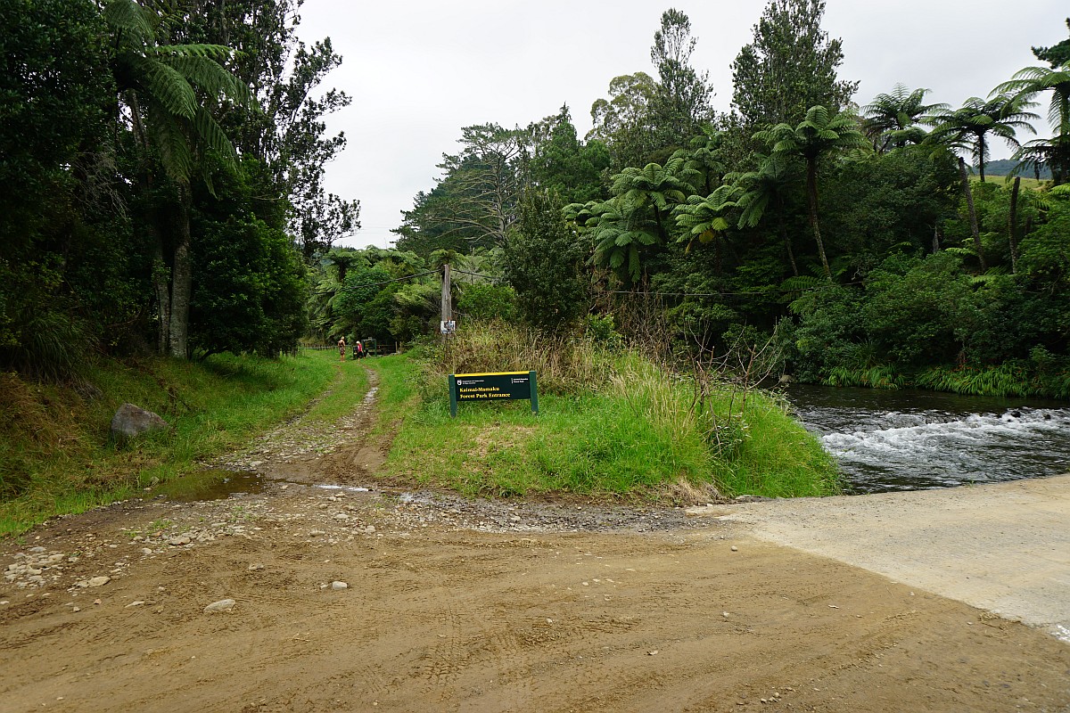
There are no facilities at the parking area, which is a large grassed area next to the junction of the Wairoa/Waitengaue Stream and Tamaki Stream. Information about the track is also available on the DoC web site.
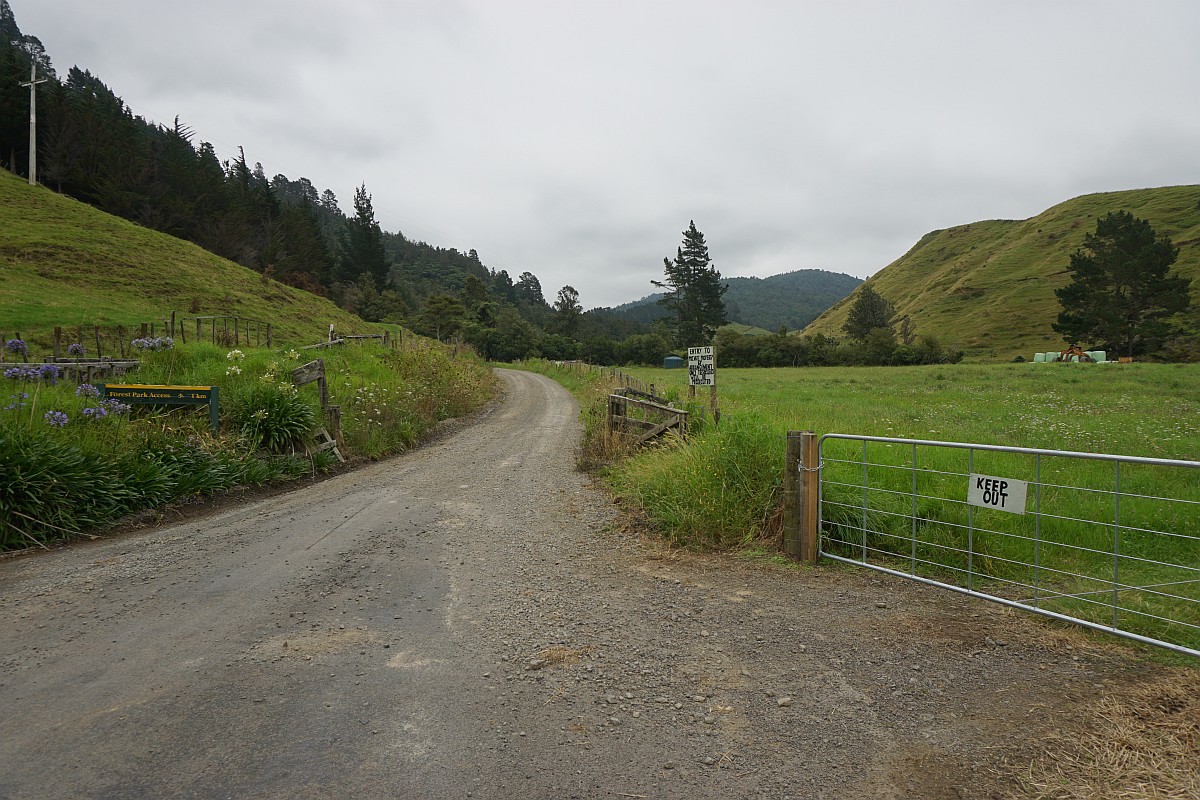
The end of the tarsealed part of Woodland Rd. The narrow gravel road continues on straight ahead through the open gateway for about 1 km to the parking area.
The parking area at the end of Woodland Rd. The track to Ananui Falls starts to the left of the car. The concrete bridge to the right of the car leads to private farmland.

The start of the track runs alongside the stream after crossing a stile, just left of centre.
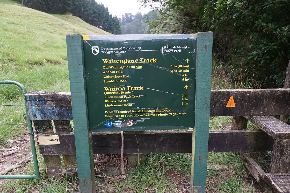
The stile, with the sign indicating a 2 hour 30 minute walking time to the Ananui Falls.
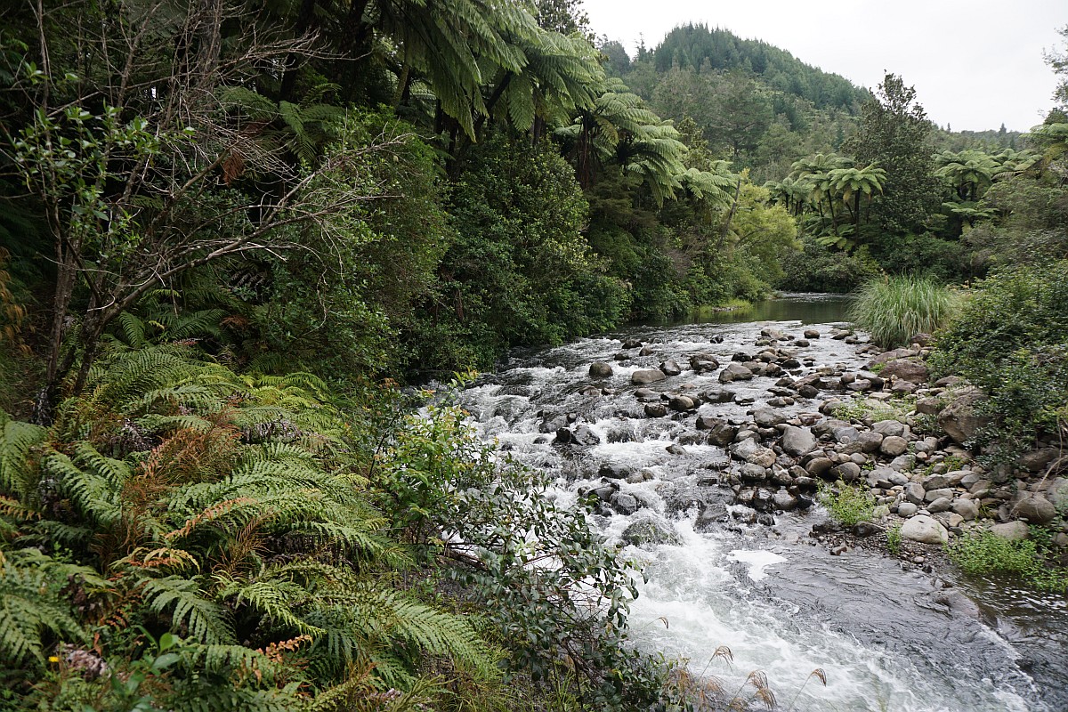
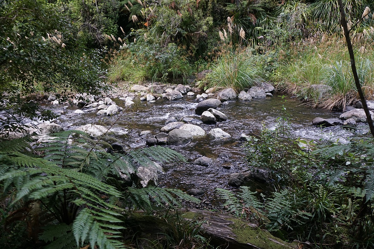
The first few hundred metres of track after crossing the stile runs alongside the Wairoa/Waitengaue Stream.
The first crossing is the Wairoa Stream, where there was a swingbridge until recently. The poles and signs from the swingbridge are still in place, but the bridge itself has been removed.
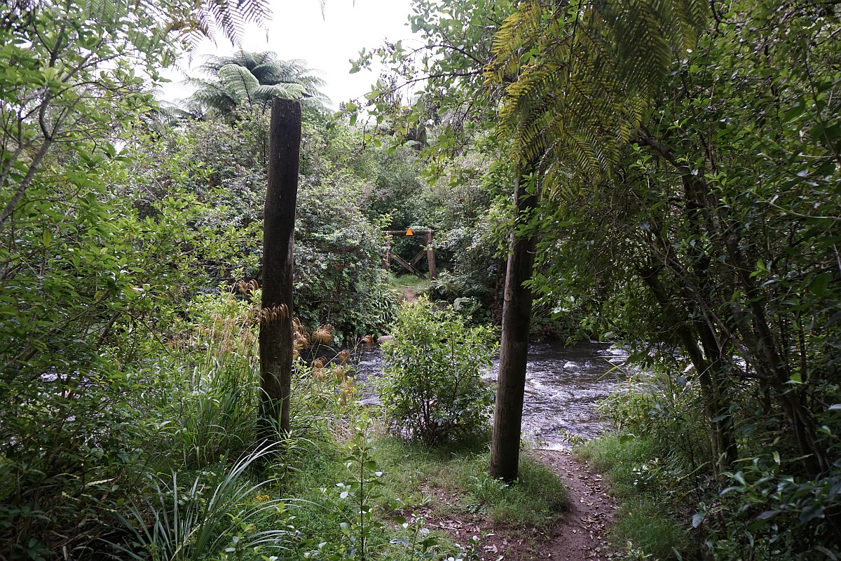
The stream can be too deep to cross without getting wet feet, but on this occasion it was just possible to cross by stepping on rocks, some of which are very slippery.

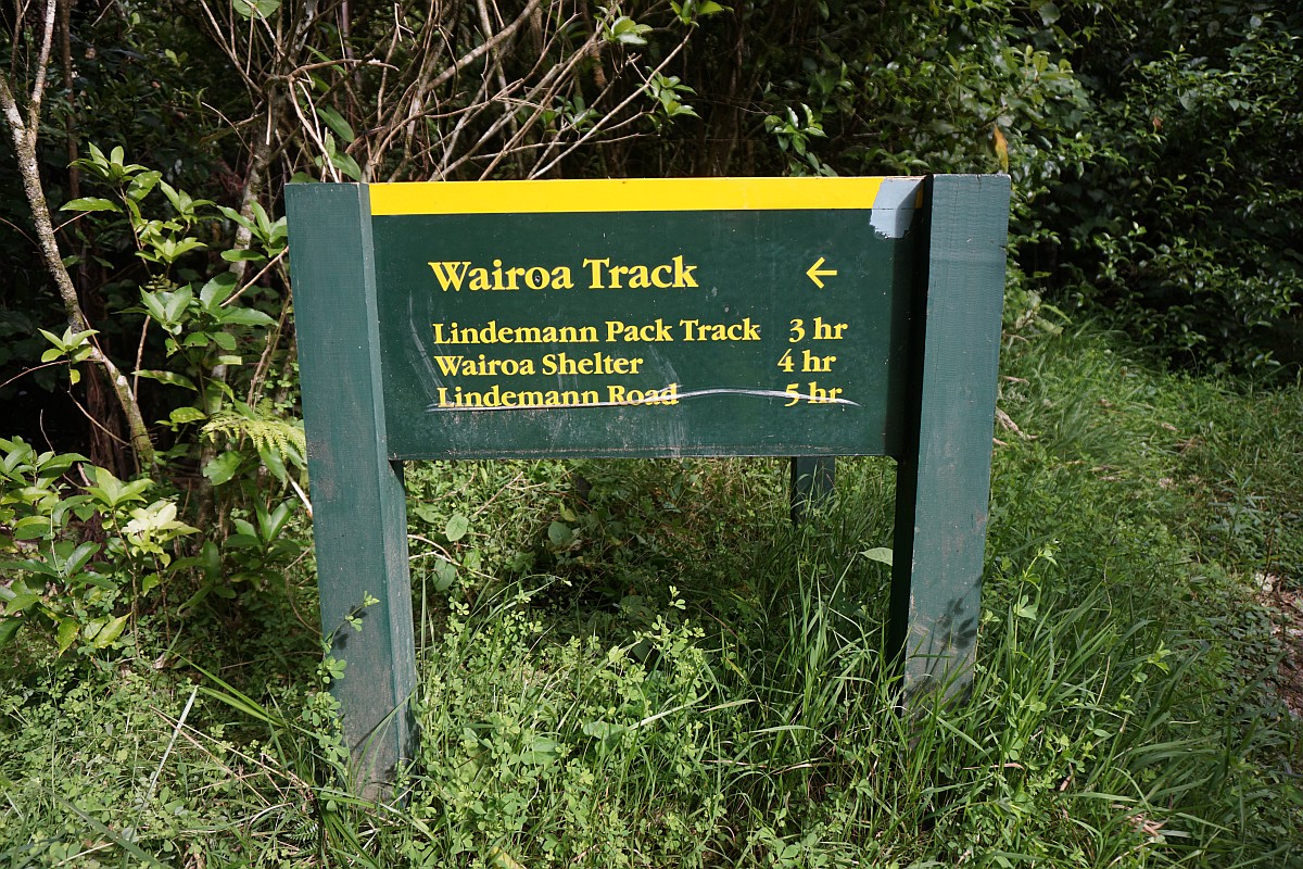
The Wairoa Track branches off to the left immediately after the Wairoa Stream crossing.
The Waitengaue Track to the Ananui Falls continues straight ahead after the crossing.

A first part of the track follows the Waitengaue Tramline, making for a gentle incline except where there have been washouts or the stream banks have eroded. The initial part has only limited tree cover and, in places, bushes almost covering the track.

The Waitengaue Stream is crossed 5 times. After heavy rain the crossings would be difficult, but with the stream at this level it was possible to keep feet dry. The rocks in the stream are very slippery.

At the second crossing of the Waitengaue Stream there is a marker post for an alternative track that bypasses the two lower crossings when the stream is running high. The track was not visible, and apparently not recently used. Presumably it was more useful when there was a bridge across the Wairoa Stream, which could also be in flood, and for which there is no alternative route.

The second crossing of the Waitengaue Stream, with the marker for alternative track at lower right.

Regenerating native bush provides cover for the track as it follows the route of the Waitengaue Tramway alongside Waitengaue Stream.

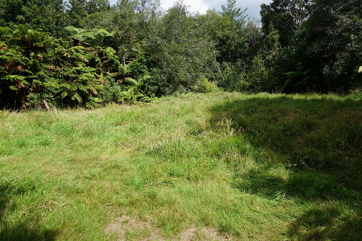
The track at the old Waitengaue Hut location. The hut clearing is on the left, with the track continuing on the right.

The clearing marks the location of the Waitengaue Hut. There are no remains from the hut itself.
Another crossing of the Waitengaue Stream a short distance past the Waitengaue Hut clearing.

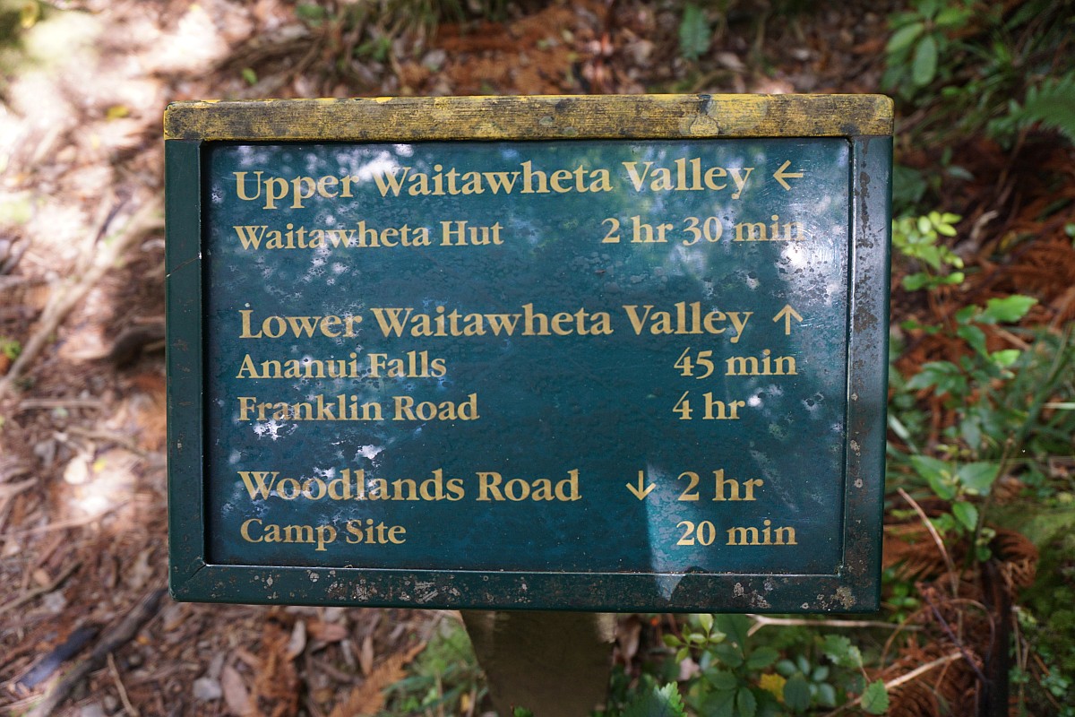
A sign marks the point where the track to the Lower Waitawheta Valley branches off from the track to the Ananui Falls.
The Lower Waitawheta Valley Track starts off with a crossing of the Waitengaue Stream.
Shortly after the track junction the track starts the steeper climb to the top of the falls. There are numerous younger kauri trees alongside the track.

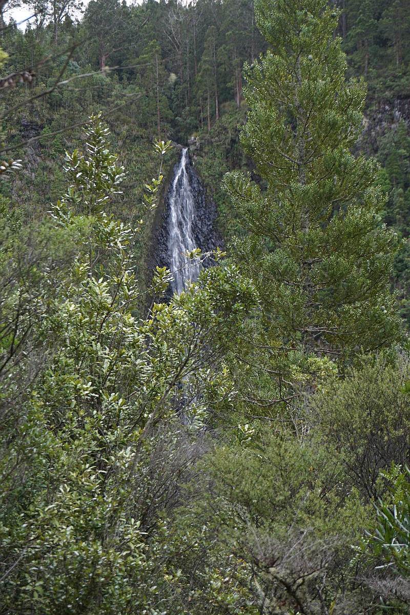
View from the only location along the track where the 106m high Ananui Falls are clearly visible. And then only through vegetation which covers part of the view.
A detail from the previous photo, showing a couple enjoying lunch on a rock ledge at the very edge of the falls.

A short side track leads to the top of the Ananui Falls.

The side track to the top of the falls leads down to the Ananui Stream, which is crossed.

The warning sign approaching the top of the Ananui Falls.

The couple on the rock ledge, by a 106m drop, at the top of the falls.

The Ananui Stream as it plunges over the edge.
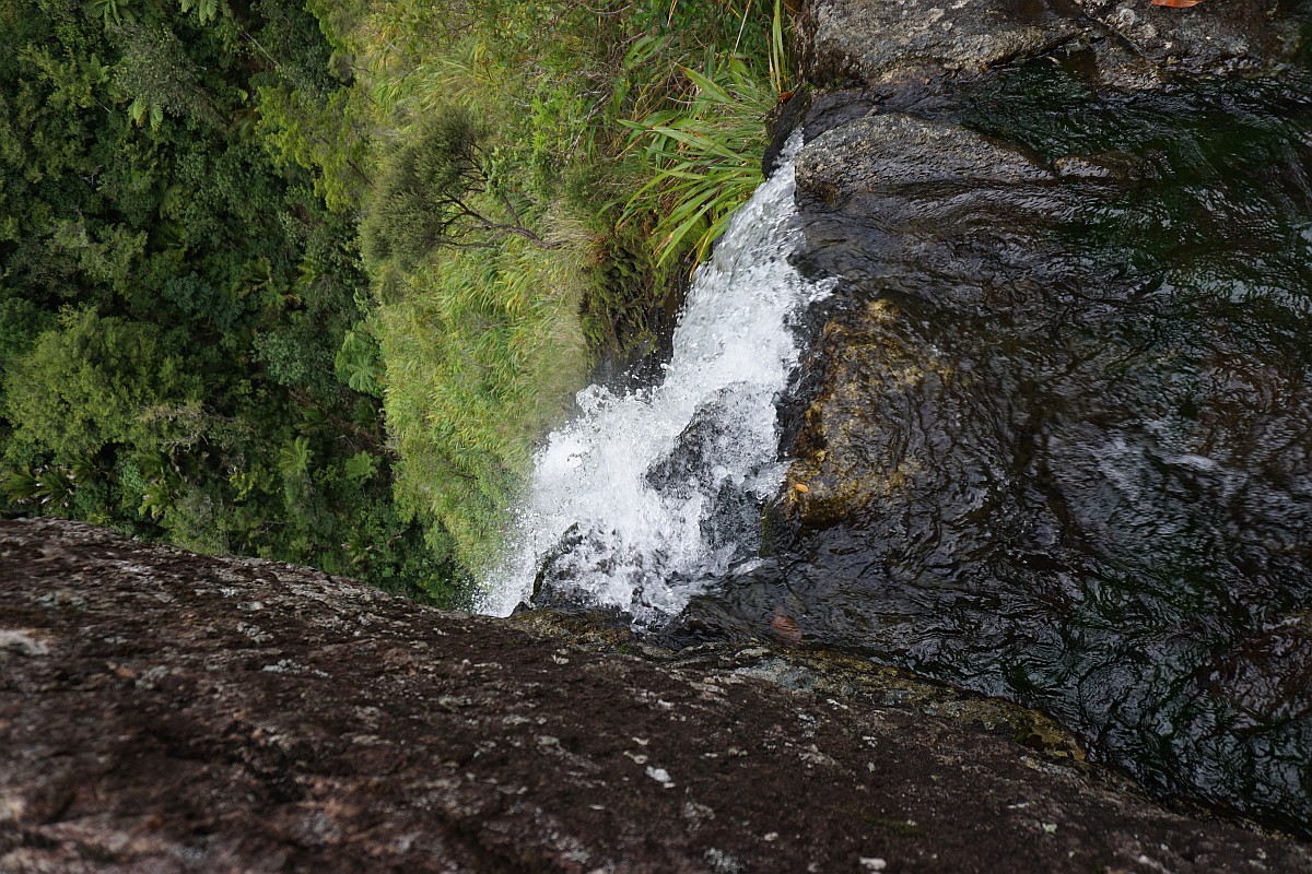
Looking down the waterfall from the rock ledge at the top of the falls.

Views from the top of the Ananui Falls.


The GPS tracklog shows the route used in both directions, as well as some locations of interest. R marks the crossing of the Wairoa Stream and the 5 crossings of the Waitengaue Stream. There are several crossings of a tributary to the Waitengaue Stream, but these are not marked on the map.
The approximate walking times and distances were as follows:
Total, including short break at top of falls: 12.1 km, 5 hours.
Woodland Rd to top of Ananui Falls: 6 km, 2 hours 35 minutes.
Top of falls to Woodland Rd: 6 km, 2 hours 5 minutes.
Woodland Rd to Upper Waitawheta Valley Track: 4.8 km, 2 hours.
Junction of Upper Waitawheta Valley Track to top of falls: 1.2 km, 35 minutes.
Lowest elevation at the parking area is about 70 m above sea level. Highest elevation near the top of the falls is about 390 m asl.

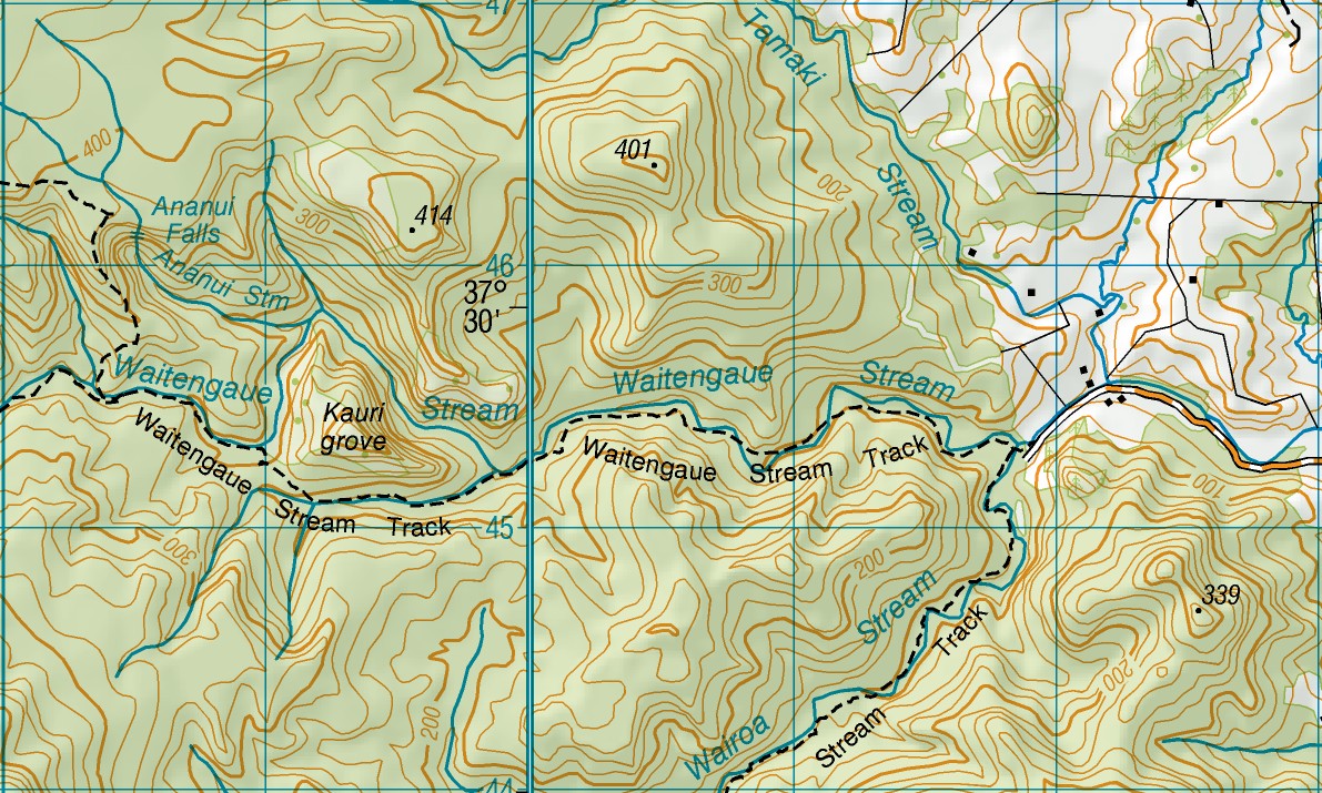
The topographic map shows the terrain and the tracks, with Woodland Rd on the far right. The parking area is at the junction with Tamaki Stream.
The track was walked on February 14, 2016.

Hi there, went there today 08 01 2020. Looks like there has been a change and there is no sign posting. the DOC sign above on picture 5 has been taped over and there is only one track. It is all new and with stairs and board walks. My family and I ventured up there 2 hours today and had lunch by the stream. Nice walk, might investigate going in through from the Old Tauranga Road. Beautiful pics. thanks for this.
LikeLike
Update on the above post, Doc says the track was closed due to Kauri Die Back. Artical found here: https://www.doc.govt.nz/parks-and-recreation/places-to-go/bay-of-plenty/places/kaimai-mamaku-conservation-park/things-to-do/tracks/ananui-falls-track/
LikeLike
Many thanks, Tony. I’ve now edited the post and noted the closure. Unfortunately that seems to be happening in more places around the district. Hopefully it will open again if there are boardwalks being constructed in the areas with kauri trees.
LikeLike
Hello mate nice posst
LikeLike