Public access to view Ōmanawa Falls opened in December 2023 after a lengthy closure. Extensive work has been done on a new parking area, toilets, information panels, access tracks, steps and viewing platforms. For information about the falls and the previous viewing access see the post Omanawa Falls. Official information about the falls, including opening times, and a downloadable map of the new tracks can be found on the Tauranga City web site.
Development work was done with the involvement of Ngāti Hangarau, for whom the falls are a sacred place, a place for reflection, interpretation and healing. There is no public access to the lake at the bottom of the falls or the underground power station. The end of the track and last lookout is almost directly above the top of the falls.
The entry to the carpark is at 1031 Ōmanawa Road, near the old entry point, just over 10 km from SH29. Ignore a sign at the intersection with Peers Road pointing up Peers Road to a waterfall. That leads to McLaren Falls, with the sign installed at a time when access to Ōmanawa Falls was discouraged or banned.
Modern toilet facilities are available by the carpark, and there is a portal leading to the tracks. Here is the entry to the carpark off Ōmanawa Road.

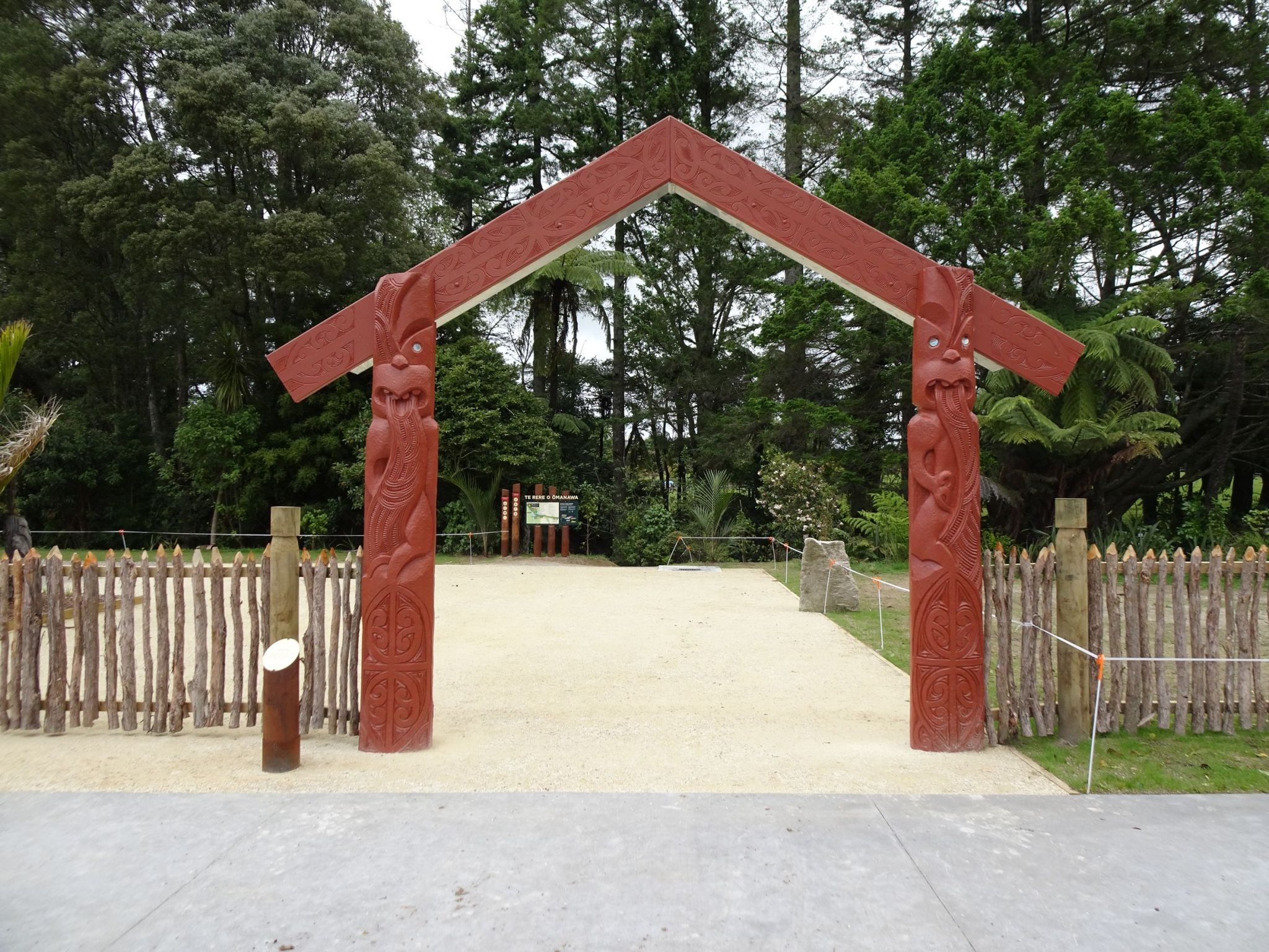
The tomokanga or entry portal leading to the tracks.
The starting point of the tracks, with an information panel showing the layout of the tracks and information about the tracks and the lookouts.

The short Kōkiri Loop branches off to the left only a few metres from the starting point. Some of the trees along the loop track have information panels on them.

The shared vehicle and walking track to the lookouts. Vehicle access is not for public use, but is used for power station and track maintenance vehicles. The Kōkiri Loop track can be seen on the left.

Tītoki Junction with the vehicle/walking track to the Te Tae Ōmanawa Lookout straight ahead and the walking track with multiple steps heading off to the right.

Carved posts or pou are located at various locations along the tracks. Here by Te Tae Ōmanawa Lookout.

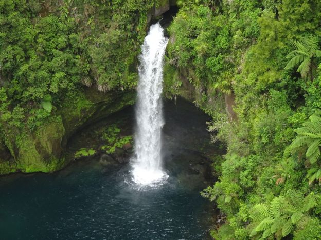
Ōmanawa Falls from Te Tae Ōmanawa Lookout. The aerial cable is used for moving items to or from the underground power station. The closed track to the power station is on the right.

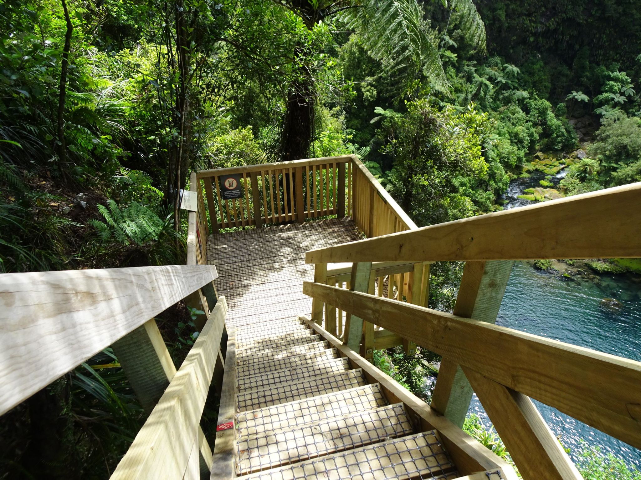
The start of the walking track leading to Wairere Tapu Lookout and to Te Harikoa Lookout at the end of the track. The map on the information panel shows a total of 96 stairs to Wairere Tapu Lookout and a further 662 stairs from there to Te Harikoa Lookout.

Wairere Tapu Lookout and Ōmanawa Falls. Te Harikoa Lookout is just below the leftmost bottom corner of the lookout, near the top of the falls.

The falls in closeup seen from Wairere Tapu Lookout. The single drop waterfall is about 35 metres high.

The start of the track from Wairere Tapu Lookout to Tānekaha Tūroa loop and to Te Harikoa Lookout, with a warning about the 662 stairs. The map shows 236 stairs up and 354 stairs down, which does not add up to 662. It does not include the shorter sections at each end with extra steps up and down.

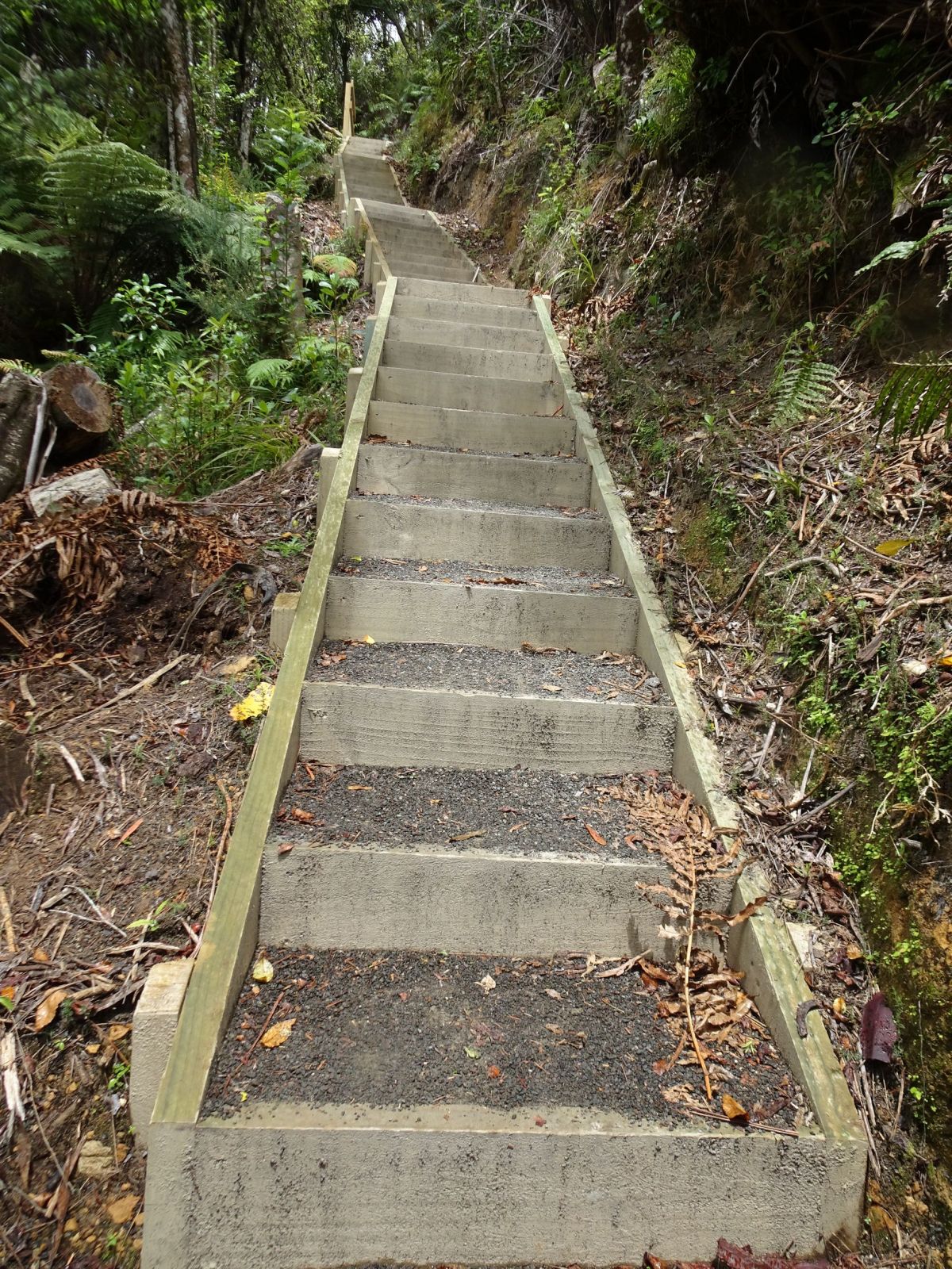
Some of the stair sections are long and not very wide, but the steps have a good spacing and rise. Some have passing bays on the way.
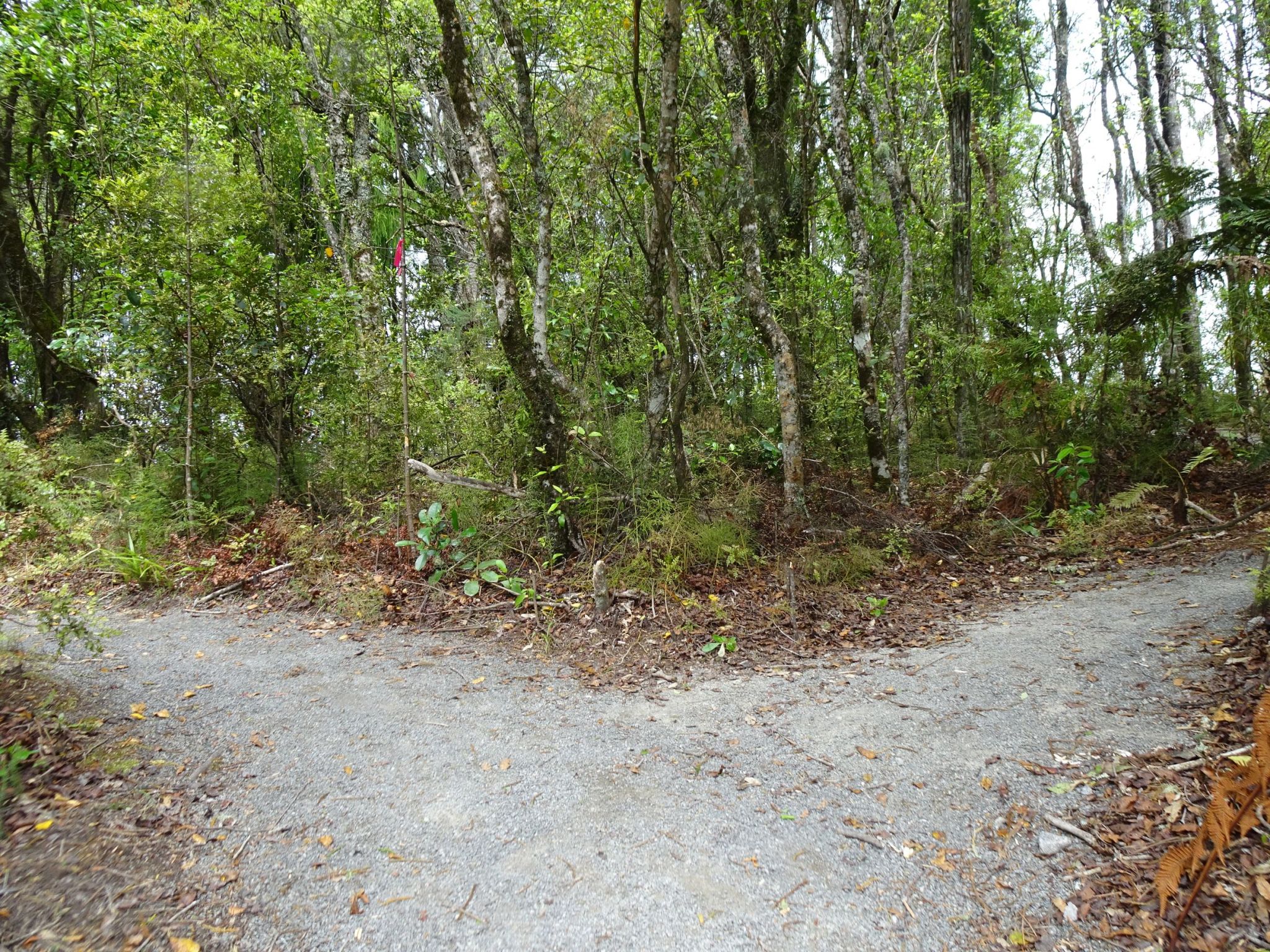
Tānekaha Tūroa is a short ecology loop track, only about 30 metres long.
And AED (defibrillator) is located by Tānekaha Tūroa, with a seat made from a single log. Similar bench seats are found at various locations alongside the track.

Near the end of the track leading to Te Harikoa Lookout. Numerous anchors have been drilled into the rocks to reduce the likelihood of rockfalls.

The end of the track and Te Harikoa Lookout.
Looking down on the top of the falls from just above Te Harikoa Lookout.

Te Harikoa Lookout information.

The pool at the bottom of the falls, and the deep valley through which the Ōmanawa River continues on from the falls.

A few steps up from the Te Harikoa Lookout there is an indication of what lies ahead on the way back to the carpark. Step count signs are found at various locations, showing either the number walked on the way towards the end of the track, or the number remaining to get back to the Tītoki Junction.

Due to the high cliff faces and vegetation cover the GPS signals along the tracks are not very reliable or accurate, especially for elevation data. The GPS tracklog shows the ‘best guess’ location of the tracks and the points of interest.
Some of the distances and times registered were:
Kōkiri Loop – 115m, 2m 30s.
Carpark to Tītoki Junction – 500m, 12 minutes.
Tītoki Junction to Te Tae Ōmanawa Lookout – 70m, 2 minutes.
Tītoki Junction to Wairere Tapu Lookout – 115m, 4 minutes.
Wairere Tapu Lookout to Tānekaha Tūroa – 120m, 7 minutes.
Wairere Tapu Lookout to Te Harikoa Lookout – 420m, 20 minutes.
Total time from carpark to end of track, including all lookouts and time for photos was 42 minutes for a distance of about 1.2 km. On the return, bypassing Te Tae Ōmanawa Lookout was 36 minutes and 1.0 km.
The elevation changes from the GPS are not reliable, but the elevations shown on the information panels are approximately:
Carpark about 280m above sea level.
Tītoki Junction 235m.
Wairere Tapu Lookout 250m.
Tānekaha Tūroa 280m.
Te Harikoa Lookout/track end 205m.
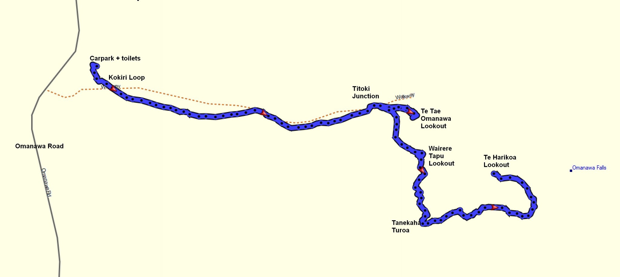
The downloadable map from the Tauranga City web site, and as shown on various information panels.

The tracks were walked on December 13, 2023.
