
Taupiri Mountain (Taupiri Maunga), at the southern end of the Taupiri Range, is located adjacent to State Highway 1 between Huntly and Ngaruawahia. Taupiri Mountain is sacred to the Waikato people and its lower flanks are used as burial grounds. Amongst others Maori royalty are buried there. A loop track leads to the summit from an access road near Mangawara Stream.
The loop track was reopened in 1995 after work on the track was done by local residents and members of Taupiri Young Farmers Club. The summit of Taupiri Mountain has a trig station at an elevation of 288 metres.
Please see the comments. Access is now from Watts Grove, off Orini Road. The access road off SH1 is now closed.
Some of the history of Taupiri mountain can be found on Te Ara Encyclopedia and on Wikipedia.
The loop track can be divided into 3 parts. Starting from the southernmost entrance to the track the first part leads up a 900 metre long steep climb to the summit. The northernmost second part leads down a steep 930 metre long steep track to an extension of the access road. The last leg is an easy walk of about 770 metres along the access road extension to the parking area near SH1 and the railway line. Total distance about 2.6 km, with a climb of about 270 metres.
A new single-lane bridge has been constructed across Mangawara Stream from Watts Grove to the parking area for the urupa at the base of Taupiri Mountain. The bridge is also used for access to the walkway to the summit. Watts Grove is a few metres along Orini Road from the roundabout on SH1B/Gordonton Road.

Looking from the access road and parking area to the summit of Taupiri Mountain with an urupa on the left and another off-picture to the right.

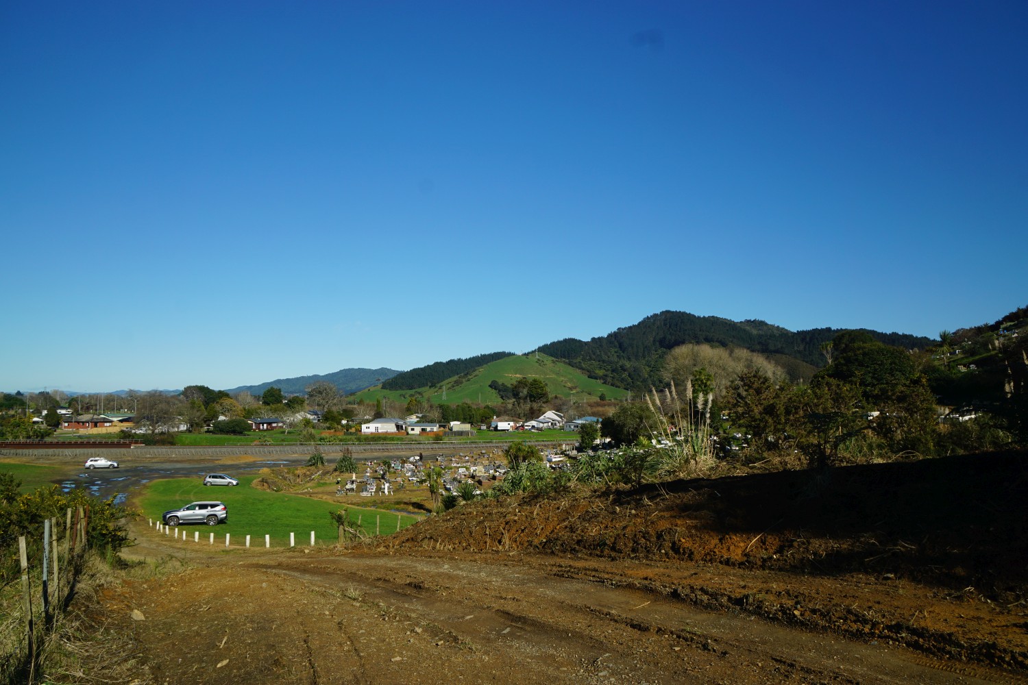
The view from the parking area in November 2020.

Looking from near the southern track entrance to the parking areas, the railway line, SH1, and the Hakarimata Range on the far side of the Waikato River.
The track entrance directly off the access road extension.
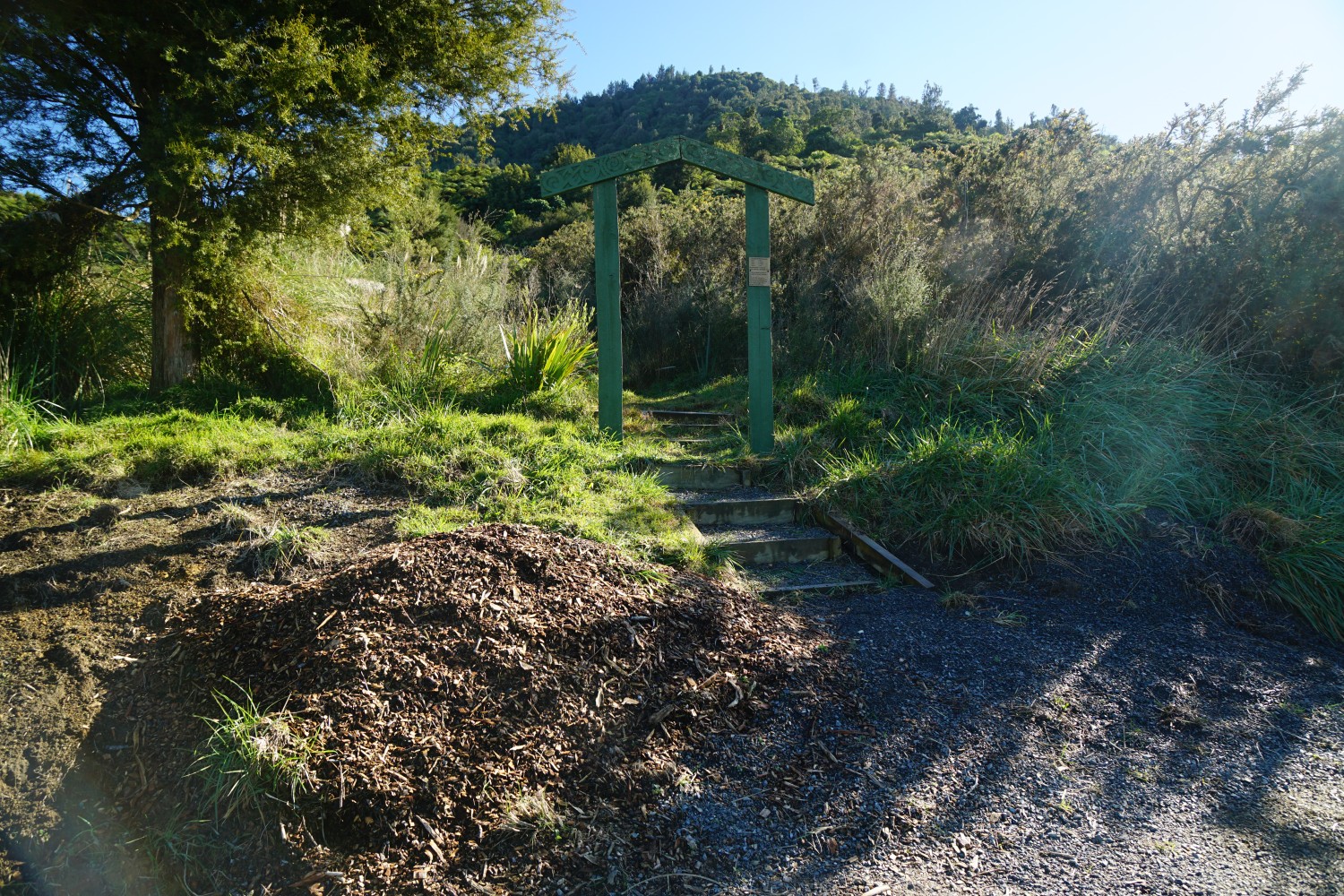
The plaque on one of the posts of the entrance archway.

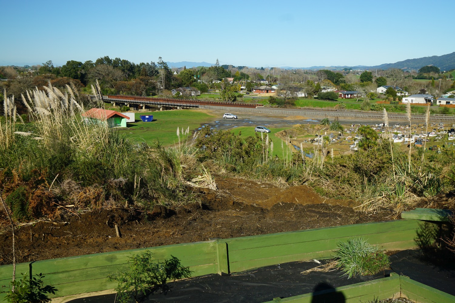
A small rest area with a seat and a view has been built near the track entrance.

The view from the seat, with the parking areas and the railway bridge over Mangawara Stream visible. The small township of Taupiri is on the right.
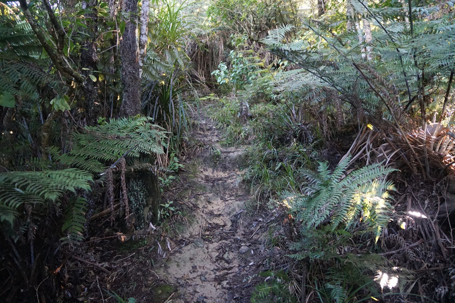
There are a number of steps, some of them very high, on the first part of the track.

Views to the south are visible from a few locations on the track to the summit. Mangawara Stream and the Waikato River are visible, as is Mount Pirongia in the distance.

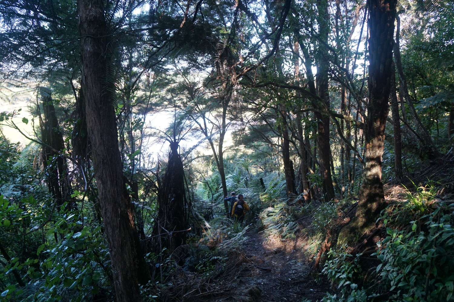
The onward track is steep and very slippery when wet. There are no track markers, but the track is easy to follow, as it appears to be used regularly.
View to the north from the summit. Lake Waikare is on the right.

Looking to the south from the summit. Mount Pirongia is on the right, with Kakepuku to the left of it, and Maungatautari further to the left. The Waikato River is clearly visible running past the township of Taupiri.

Looking towards the north-east from the summit.

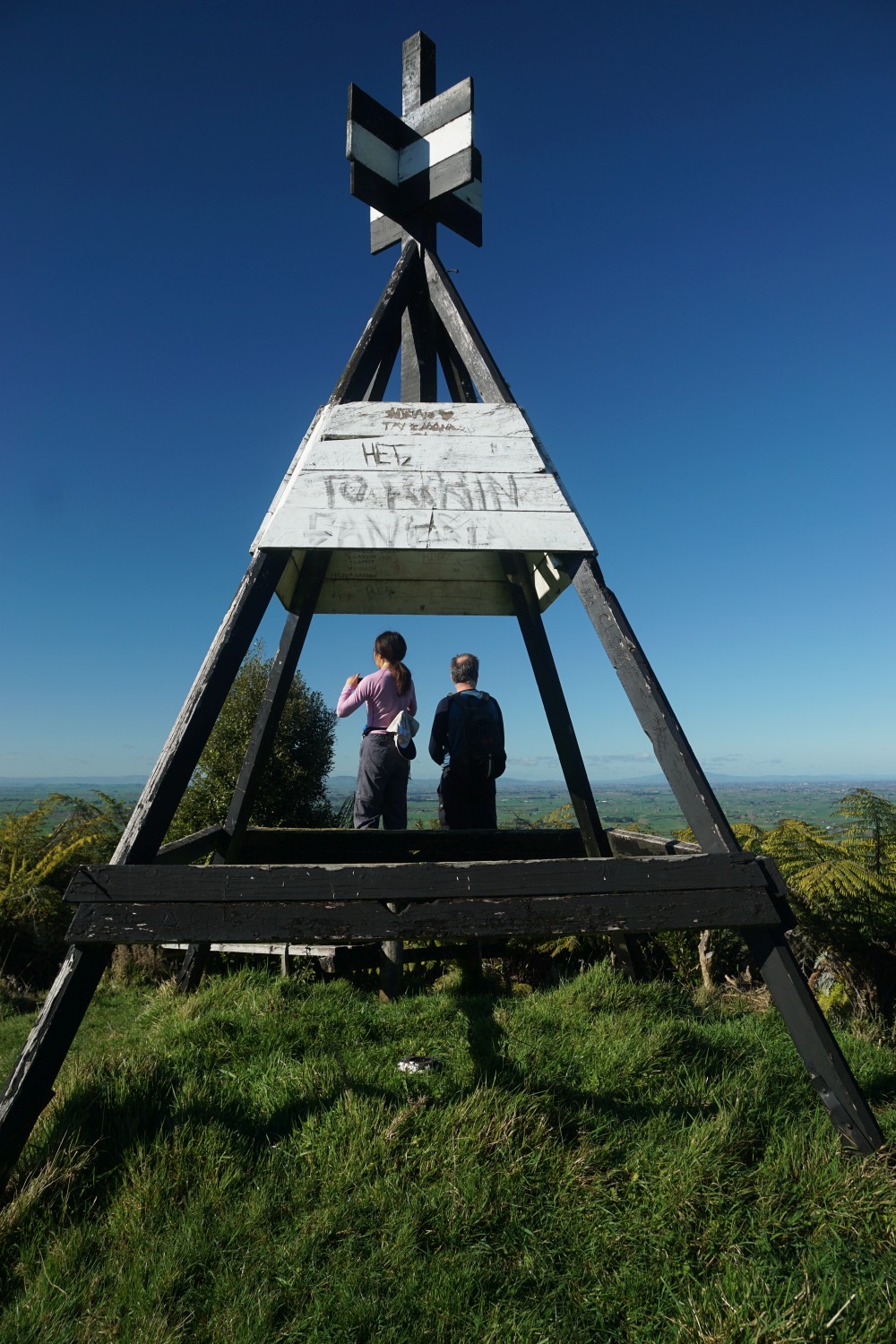
The trig station on the summit, at an elevation of 288 metres above sea level.
Returning along the same track, the northern leg of the loop track branches off to the left after about 50 metres from the summit. This track is also steep in parts and very slippery when wet. There are no steps on this part of the track.

As on the upward leg there are a few openings in the vegetation allowing for views to the south-east.

The northernmost entry/exit from the loop track, directly off the access road extension.

There are no good parking areas near the northern entry, and no good turning areas. Heading back along the road extension to the southern entry and the parking area.

A view of Taupiri Mountain from Orini Road to the south-east.

The GPS tracklog shows the route which was followed, with the loop track walked in a clockwise direction. Total walking distance was 2.6 km, with a total time of 2 hours, including a 20 minutes break at the summit. The upward leg was 900 metres, and took 40 minutes. The downward leg, including the walk along the access road, was 1.7 km and took 1 hour. 930 metres and 45 minutes of this was the downhill walk through the native bush, with the remainder the walk along the access road.
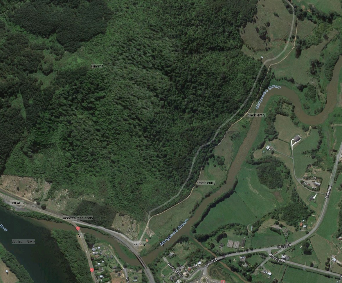
On the map Mangawara Stream is incorrectly shown as Waikato River. The Waikato River is the wider part in the lower left corner only.

The aerial image from Google Maps shows the same area as the GPS tracklog. Points of interest are marked on the image. Note: Watts Grove, the new access point, is at the lower centre of the photo, just to the right of the railway bridge over Mangawara Stream.
The topo map excerpt shows the topography of the area, but unfortunately the walking tracks are not shown in the map.

The track was walked on July 29, 2017.
The post was updated November 15, 2020 to add the new access from Watts Grove, off Orini Road. The new bridge is not yet visible on Google’s aerial photos.

Great advice and directions. Walked it today. Heavy rain last night didn’t leave the track too bad. Slippery coming down the loop though. Amazing views
LikeLike
Thank you for the comment. Glad to hear that the post has been useful.
LikeLike
Thanks for the info. Walked it this morning. Track was dry. I think it might be tricky if wet.
LikeLike
Hi there. The SH1 entry is now closed to vehicles – the entry is via Watts Grove off Orini Rd. Track is in ok condition Nov 2020. Still steep!!!
LikeLike
Many thanks, Stefan. I have changed the description and will try to get back some time for photos and details of the new access point.
LikeLike
Kia ora, is this all native bush and if so is there a list of species? Is it appropriate for walking alone?
ngā mihi, Chrissen
LikeLike
The vegetation is mainly regenerating native bush but with some introduced species as well, such as the gorse which was found in several places. From memory also some pine trees. I don’t recall any mature native trees. There was no list of species. I haven’t used it, but there is a native plants app developed by AUT which can be used for identifying native trees and plants. It’s available in both Android and Apple versions. Search for NZ trees in the app stores. Most of my walks are done alone, and I can’t think of any reason not to do this one alone. Enjoy your walk, and please leave a message with your thoughts on the native plants app if you do try it. Ngā mihi.
LikeLike
Kia ora for that!
LikeLike